Shelton Ne Topo Map Nebraska
To zoom in, hover over the map of Shelton Ne
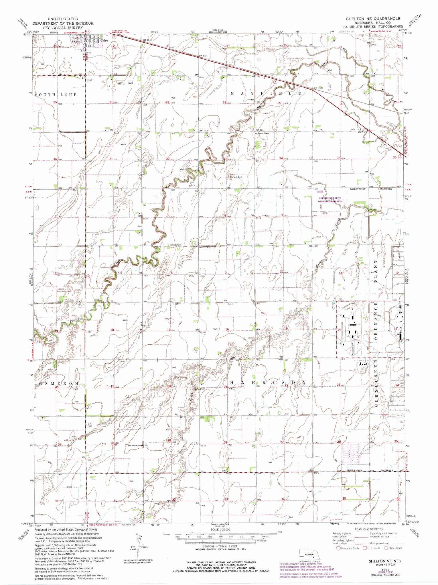
USGS Topo Quad 40098h5 - 1:24,000 scale
| Topo Map Name: | Shelton Ne |
| USGS Topo Quad ID: | 40098h5 |
| Print Size: | ca. 21 1/4" wide x 27" high |
| Southeast Coordinates: | 40.875° N latitude / 98.5° W longitude |
| Map Center Coordinates: | 40.9375° N latitude / 98.5625° W longitude |
| U.S. State: | NE |
| Filename: | O40098h5.jpg |
| Download Map JPG Image: | Shelton Ne topo map 1:24,000 scale |
| Map Type: | Topographic |
| Topo Series: | 7.5´ |
| Map Scale: | 1:24,000 |
| Source of Map Images: | United States Geological Survey (USGS) |
| Alternate Map Versions: |
Shelton NE NE 1962, updated 1964 Download PDF Buy paper map Shelton NE NE 1962, updated 1990 Download PDF Buy paper map Shelton NE NE 1962, updated 1993 Download PDF Buy paper map Shelton NE NE 2011 Download PDF Buy paper map Shelton NE NE 2014 Download PDF Buy paper map |
1:24,000 Topo Quads surrounding Shelton Ne
Ashton |
Farwell |
Nysted |
Saint Paul |
Palmer |
Rockville |
Boelus |
Dannebrog |
Saint Paul Sw |
Saint Lebory |
Poole Ne |
Cameron |
Shelton Ne |
Abbott |
Grand Island |
Gibbon North |
Shelton |
Wood River |
Alda |
Doniphan |
Gibbon South |
Denman |
Prosser |
Hastings Nw |
Trumbull |
> Back to 40098e1 at 1:100,000 scale
> Back to 40098a1 at 1:250,000 scale
> Back to U.S. Topo Maps home
Shelton Ne topo map: Gazetteer
Shelton Ne: Parks
Cornhusker State Wildlife Management Area elevation 579m 1899′Shelton Ne: Streams
Dry Creek elevation 577m 1893′Shelton Ne digital topo map on disk
Buy this Shelton Ne topo map showing relief, roads, GPS coordinates and other geographical features, as a high-resolution digital map file on DVD: