Elm Creek West Topo Map Nebraska
To zoom in, hover over the map of Elm Creek West
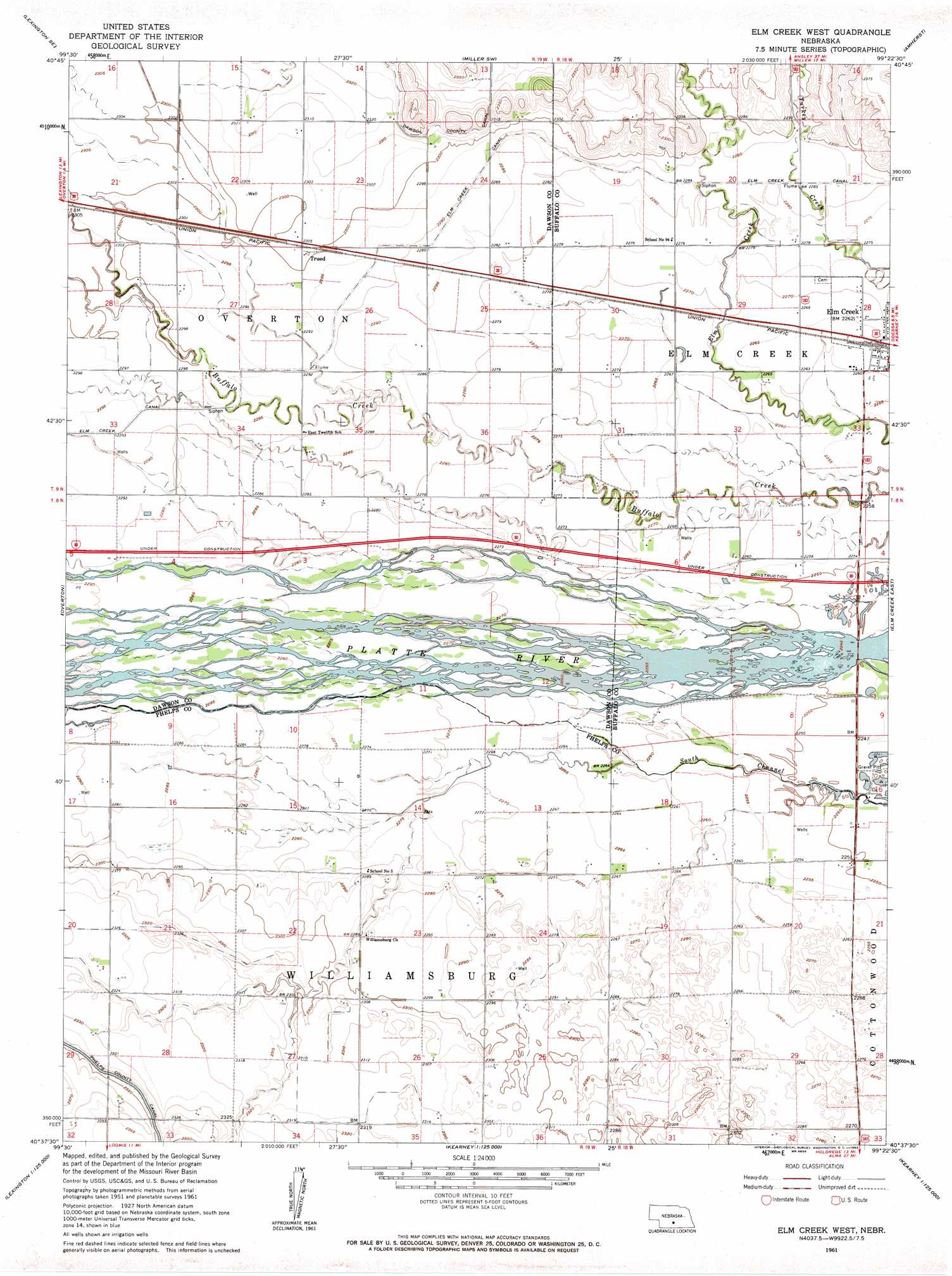
USGS Topo Quad 40099f4 - 1:24,000 scale
| Topo Map Name: | Elm Creek West |
| USGS Topo Quad ID: | 40099f4 |
| Print Size: | ca. 21 1/4" wide x 27" high |
| Southeast Coordinates: | 40.625° N latitude / 99.375° W longitude |
| Map Center Coordinates: | 40.6875° N latitude / 99.4375° W longitude |
| U.S. State: | NE |
| Filename: | O40099f4.jpg |
| Download Map JPG Image: | Elm Creek West topo map 1:24,000 scale |
| Map Type: | Topographic |
| Topo Series: | 7.5´ |
| Map Scale: | 1:24,000 |
| Source of Map Images: | United States Geological Survey (USGS) |
| Alternate Map Versions: |
Elm Creek West NE 1961, updated 1963 Download PDF Buy paper map Elm Creek West NE 2011 Download PDF Buy paper map Elm Creek West NE 2014 Download PDF Buy paper map |
1:24,000 Topo Quads surrounding Elm Creek West
Lexington Nw |
Sumner |
Miller |
Miller Ne |
Pleasanton Nw |
Lexington East |
Lexington Se |
Miller Sw |
Amherst |
Riverdale |
Bertrand Nw |
Overton |
Elm Creek West |
Elm Creek East |
Alfalfa Center |
Bertrand |
Bertrand Se |
Elm Creek Sw |
Elm Creek Se |
Kearney Sw |
Oxford Nw |
Loomis |
Holdrege West |
Holdrege East |
Axtell West |
> Back to 40099e1 at 1:100,000 scale
> Back to 40098a1 at 1:250,000 scale
> Back to U.S. Topo Maps home
Elm Creek West topo map: Gazetteer
Elm Creek West: Bridges
Platte River Bridge elevation 683m 2240′Elm Creek West: Canals
Elm Creek Canal elevation 697m 2286′Elm Creek West: Crossings
Interchange 257 elevation 686m 2250′Elm Creek West: Parks
Historic Platte Valley Historical Marker elevation 686m 2250′Elm Creek West: Populated Places
Trued elevation 702m 2303′Elm Creek West: Post Offices
Williamsburg Post Office (historical) elevation 699m 2293′Elm Creek West: Reservoirs
Blue Hole West Lake elevation 688m 2257′Elm Creek West digital topo map on disk
Buy this Elm Creek West topo map showing relief, roads, GPS coordinates and other geographical features, as a high-resolution digital map file on DVD: