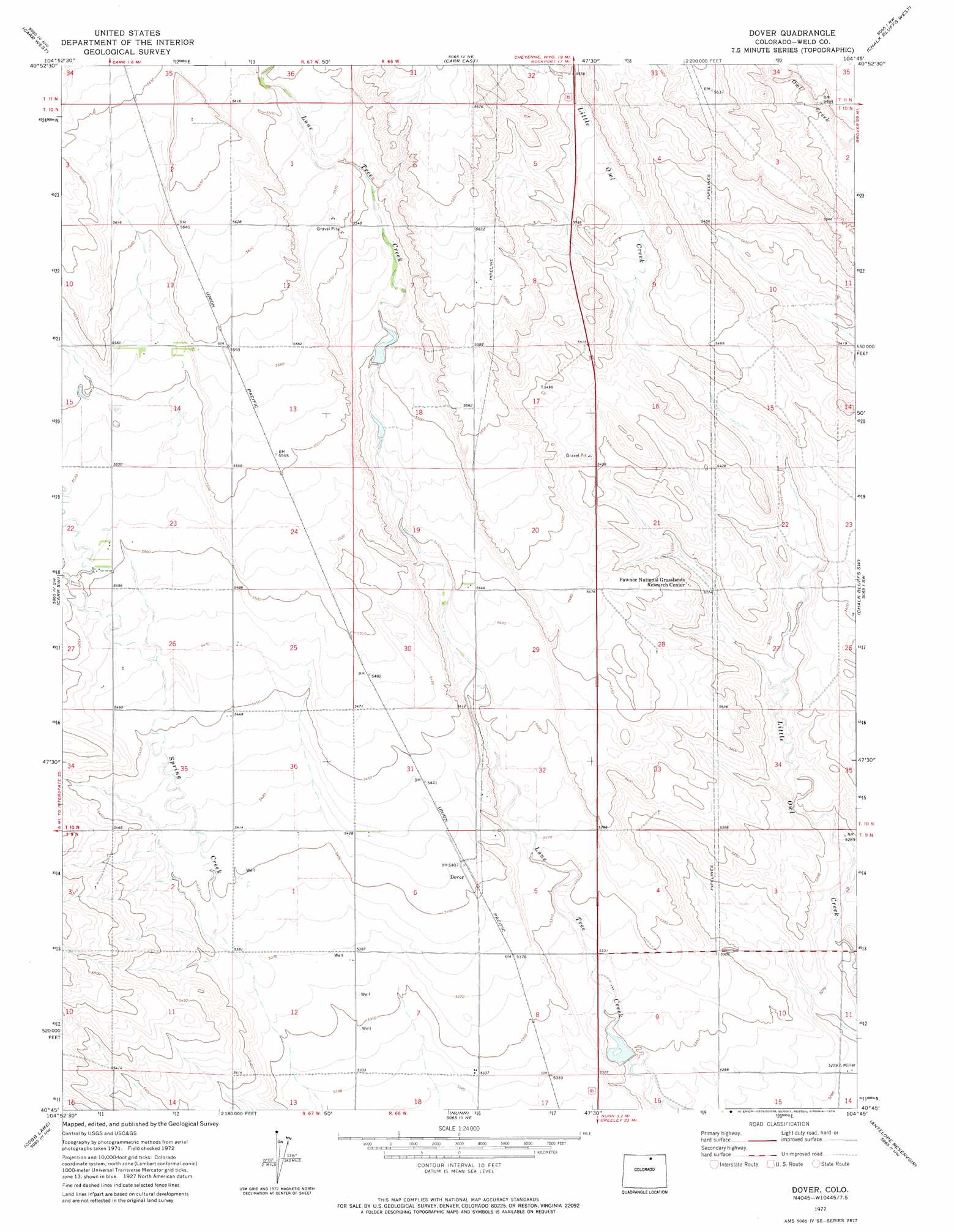
Dover Topo Map Colorado
To zoom in, hover over the map of Dover
USGS Topo Quad 40104g7 - 1:24,000 scale
| Topo Map Name: | Dover |
| USGS Topo Quad ID: | 40104g7 |
| Print Size: | ca. 21 1/4" wide x 27" high |
| Southeast Coordinates: | 40.75° N latitude / 104.75° W longitude |
| Map Center Coordinates: | 40.8125° N latitude / 104.8125° W longitude |
| U.S. State: | CO |
| Filename: | o40104g7.jpg |
| Download Map JPG Image: | Dover topo map 1:24,000 scale |
| Map Type: | Topographic |
| Topo Series: | 7.5´ |
| Map Scale: | 1:24,000 |
| Source of Map Images: | United States Geological Survey (USGS) |
| Alternate Map Versions: |
Dover CO 1972, updated 1974 Download PDF Buy paper map Dover CO 1972, updated 1974 Download PDF Buy paper map Dover CO 1997, updated 2000 Download PDF Buy paper map Dover CO 2011 Download PDF Buy paper map Dover CO 2013 Download PDF Buy paper map Dover CO 2016 Download PDF Buy paper map |
| FStopo: | US Forest Service topo Dover is available: Download FStopo PDF Download FStopo TIF |
1:24,000 Topo Quads surrounding Dover
Emkay |
Borie |
Cheyenne South |
Altvan |
Campstool |
Round Butte |
Carr West |
Carr East |
Eastman Creek North |
Squaw Rock |
Buckeye |
Carr Sw |
Dover |
Eastman Creek South |
Eastman Creek Se |
Wellington |
Cobb Lake |
Nunn |
Antelope Reservoir |
Purcell |
Fort Collins |
Timnath |
Severance |
Eaton |
Galeton |
> Back to 40104e1 at 1:100,000 scale
> Back to 40104a1 at 1:250,000 scale
> Back to U.S. Topo Maps home
Dover topo map: Gazetteer
Dover: Dams
Dover Dam elevation 1615m 5298′Giffon Number 1 Dam elevation 1673m 5488′
Giffon Number 2 Dam elevation 1675m 5495′
Dover: Populated Places
Dover elevation 1650m 5413′Dover: Reservoirs
Dover Reservoir elevation 1615m 5298′Giffon Number 1 Reservoir elevation 1673m 5488′
Giffon Number 2 Reservoir elevation 1675m 5495′
Dover digital topo map on disk
Buy this Dover topo map showing relief, roads, GPS coordinates and other geographical features, as a high-resolution digital map file on DVD: