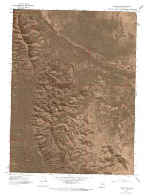
Craner Peak Topo Map Utah
To zoom in, hover over the map of Craner Peak
USGS Topo Quad 40112h7 - 1:24,000 scale
| Topo Map Name: | Craner Peak |
| USGS Topo Quad ID: | 40112h7 |
| Print Size: | ca. 21 1/4" wide x 27" high |
| Southeast Coordinates: | 40.875° N latitude / 112.75° W longitude |
| Map Center Coordinates: | 40.9375° N latitude / 112.8125° W longitude |
| U.S. State: | UT |
| Filename: | p40112h7.jpg |
| Download Map JPG Image: | Craner Peak topo map 1:24,000 scale |
| Map Type: | Orthophoto |
| Topo Series: | 7.5´ |
| Map Scale: | 1:24,000 |
| Source of Map Images: | United States Geological Survey (USGS) |
| Alternate Map Versions: |
Craner Peak UT 1968, updated 1973 Download PDF Buy paper map Craner Peak UT 1968, updated 1973 Download PDF Buy paper map Craner Peak UT 2011 Download PDF Buy paper map Craner Peak UT 2014 Download PDF Buy paper map |
1:24,000 Topo Quads surrounding Craner Peak
> Back to 40112e1 at 1:100,000 scale
> Back to 40112a1 at 1:250,000 scale
> Back to U.S. Topo Maps home
Craner Peak topo map: Gazetteer
Craner Peak: Basins
Lakeside Valley elevation 1289m 4229′Craner Peak: Flats
Craner Flat elevation 1290m 4232′Craner Peak: Gaps
Well Pass elevation 1502m 4927′Craner Peak: Mines
Marblehead Quarry elevation 1564m 5131′Monarch Mine elevation 1563m 5127′
Craner Peak: Springs
Craner Spring elevation 1609m 5278′Craner Peak: Summits
Black Mountain elevation 1990m 6528′Craner Peak elevation 2018m 6620′
Indian Knoll elevation 1328m 4356′
Jedediah Mountain elevation 1777m 5830′
Table Mountain elevation 1575m 5167′
Craner Peak: Valleys
Beards Hollow elevation 1447m 4747′Craner Canyon elevation 1310m 4297′
Monarch Canyon elevation 1318m 4324′
Mountain Sheep Canyon elevation 1305m 4281′
Peepstone Canyon elevation 1299m 4261′
Right Fork Carter Canyon elevation 1316m 4317′
Vindicator Canyon elevation 1427m 4681′
Craner Peak: Wells
Johnson Well elevation 1305m 4281′Monarch Well elevation 1305m 4281′
Old Wrathall Well elevation 1286m 4219′
Craner Peak digital topo map on disk
Buy this Craner Peak topo map showing relief, roads, GPS coordinates and other geographical features, as a high-resolution digital map file on DVD:


