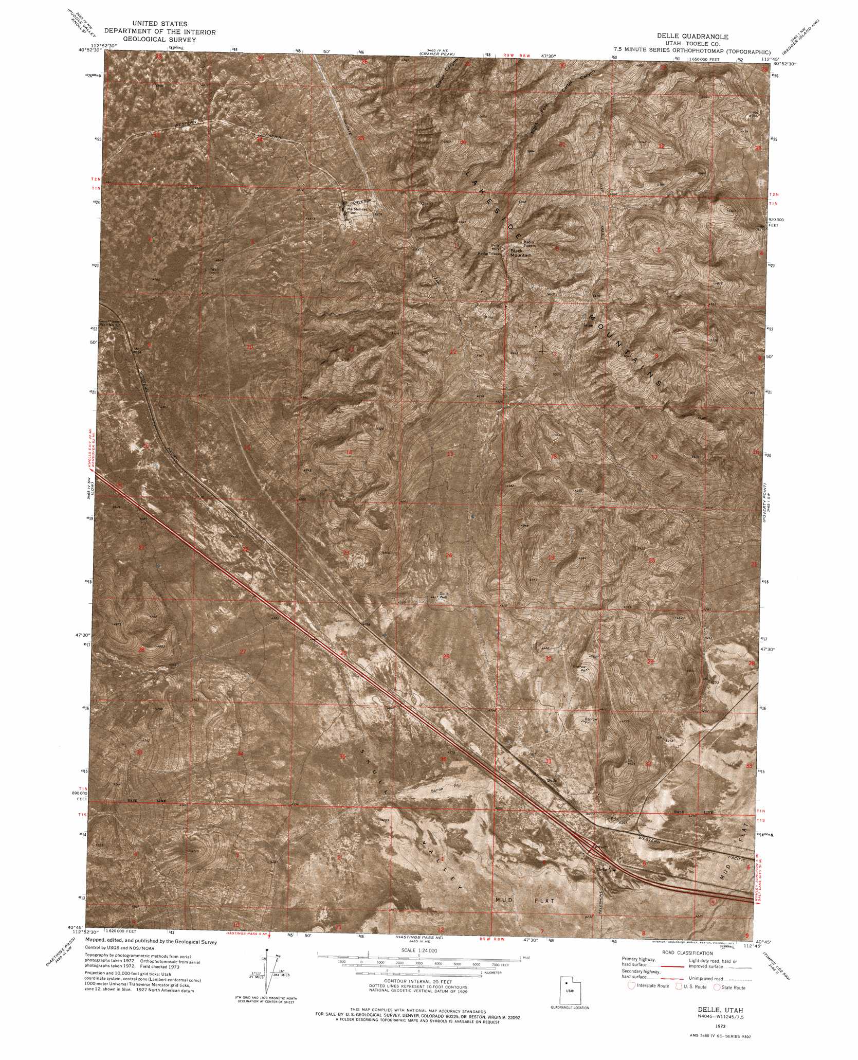
Delle Topo Map Utah
To zoom in, hover over the map of Delle
USGS Topo Quad 40112g7 - 1:24,000 scale
| Topo Map Name: | Delle |
| USGS Topo Quad ID: | 40112g7 |
| Print Size: | ca. 21 1/4" wide x 27" high |
| Southeast Coordinates: | 40.75° N latitude / 112.75° W longitude |
| Map Center Coordinates: | 40.8125° N latitude / 112.8125° W longitude |
| U.S. State: | UT |
| Filename: | p40112g7.jpg |
| Download Map JPG Image: | Delle topo map 1:24,000 scale |
| Map Type: | Orthophoto |
| Topo Series: | 7.5´ |
| Map Scale: | 1:24,000 |
| Source of Map Images: | United States Geological Survey (USGS) |
| Alternate Map Versions: |
Delle UT 1973, updated 1977 Download PDF Buy paper map Delle UT 2011 Download PDF Buy paper map Delle UT 2014 Download PDF Buy paper map |
1:24,000 Topo Quads surrounding Delle
Round Mountain |
Sally Mountain |
Deardens Knoll |
Carrington Island Sw |
Carrington Island |
Grassy Mountains |
Puddle Valley Knolls |
Craner Peak |
Badger Island Nw |
Badger Island |
Ripple Valley |
Low |
Delle |
Poverty Point |
Corral Canyon |
Aragonite |
Hastings Pass |
Hastings Pass Ne |
Timpie |
Flux |
Aragonite Se |
Quincy Spring |
Hastings Pass Se |
Salt Mountain |
North Willow Canyon |
> Back to 40112e1 at 1:100,000 scale
> Back to 40112a1 at 1:250,000 scale
> Back to U.S. Topo Maps home
Delle topo map: Gazetteer
Delle: Populated Places
Delle elevation 1298m 4258′Delle: Summits
Black Mountain elevation 1979m 6492′Delle: Wells
Delle Well elevation 1347m 4419′Government Well Number 82 elevation 1380m 4527′
Delle digital topo map on disk
Buy this Delle topo map showing relief, roads, GPS coordinates and other geographical features, as a high-resolution digital map file on DVD: