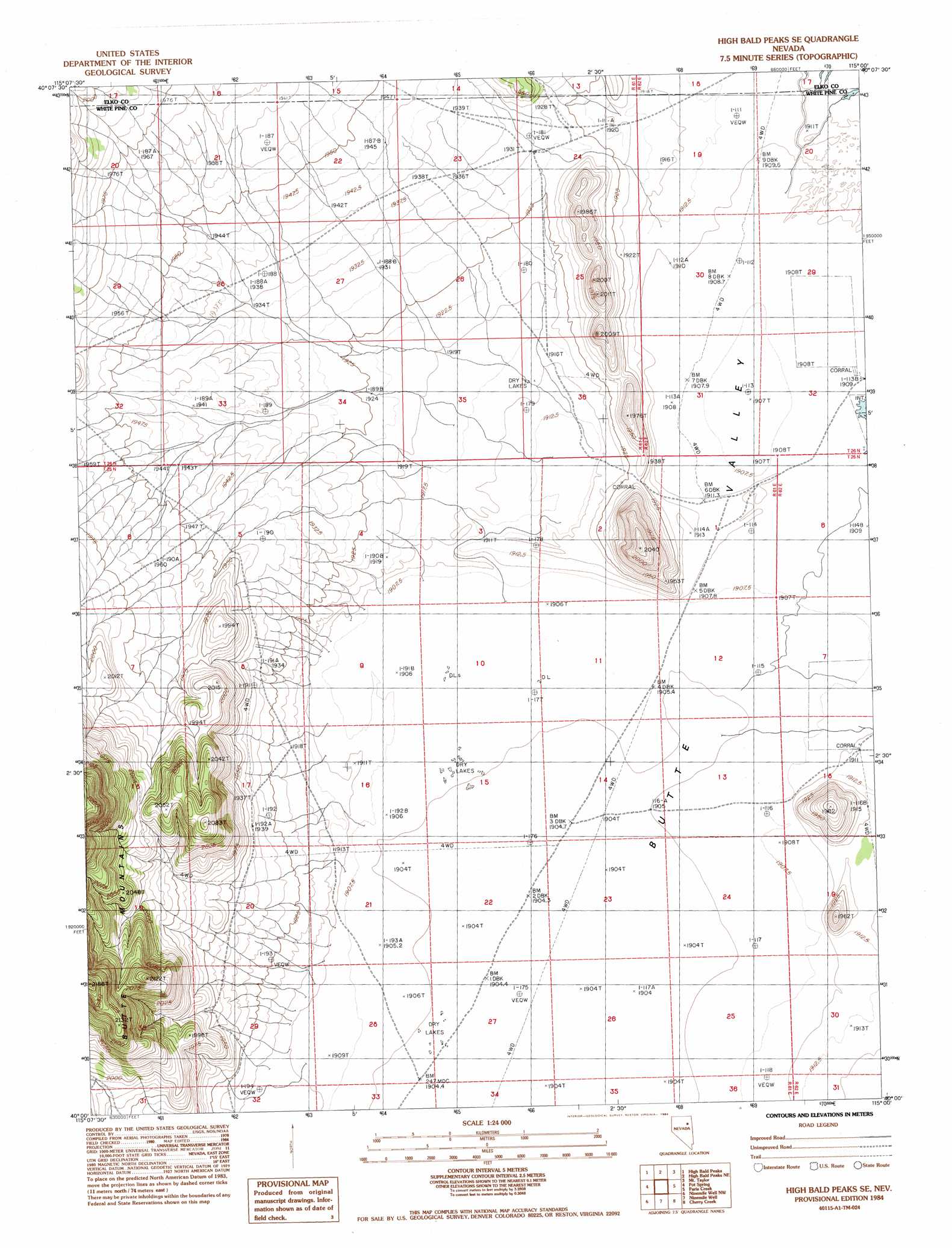
High Bald Peaks Se Topo Map Nevada
To zoom in, hover over the map of High Bald Peaks Se
USGS Topo Quad 40115a1 - 1:24,000 scale
| Topo Map Name: | High Bald Peaks Se |
| USGS Topo Quad ID: | 40115a1 |
| Print Size: | ca. 21 1/4" wide x 27" high |
| Southeast Coordinates: | 40° N latitude / 115° W longitude |
| Map Center Coordinates: | 40.0625° N latitude / 115.0625° W longitude |
| U.S. State: | NV |
| Filename: | o40115a1.jpg |
| Download Map JPG Image: | High Bald Peaks Se topo map 1:24,000 scale |
| Map Type: | Topographic |
| Topo Series: | 7.5´ |
| Map Scale: | 1:24,000 |
| Source of Map Images: | United States Geological Survey (USGS) |
| Alternate Map Versions: |
High Bald Peaks SE NV 1984, updated 1984 Download PDF Buy paper map High Bald Peaks SE NV 2012 Download PDF Buy paper map High Bald Peaks SE NV 2014 Download PDF Buy paper map |
1:24,000 Topo Quads surrounding High Bald Peaks Se
Franklin Lake Se |
Medicine Spring |
Odgers Ranch |
Silo Canyon |
Currie Gardens |
Ruby Lake Ne |
High Bald Peaks |
High Bald Peaks Ne |
Mount Taylor |
Mcdermid Ranch |
Ruby Lake Se |
Pot Spring |
High Bald Peaks Se |
Paris Creek |
Goshute Creek |
Junction Well |
Ninemile Well Nw |
Ninemile Well |
Cherry Creek |
Cherry Creek Station |
Cabin Spring |
Cow Camp |
Franks Well |
Egan Canyon |
Borchert Spring |
> Back to 40115a1 at 1:100,000 scale
> Back to 40114a1 at 1:250,000 scale
> Back to U.S. Topo Maps home
High Bald Peaks Se topo map: Gazetteer
High Bald Peaks Se: Streams
Paris Creek elevation 1910m 6266′High Bald Peaks Se digital topo map on disk
Buy this High Bald Peaks Se topo map showing relief, roads, GPS coordinates and other geographical features, as a high-resolution digital map file on DVD: