Bartomes Spring Topo Map Nevada
To zoom in, hover over the map of Bartomes Spring
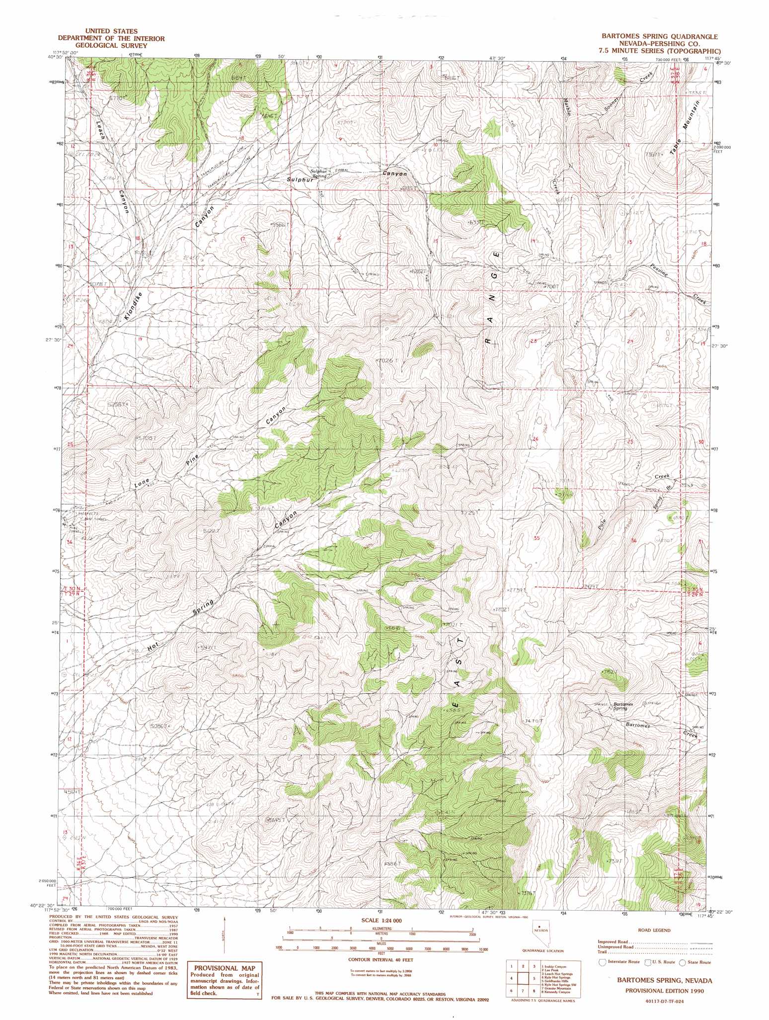
USGS Topo Quad 40117d7 - 1:24,000 scale
| Topo Map Name: | Bartomes Spring |
| USGS Topo Quad ID: | 40117d7 |
| Print Size: | ca. 21 1/4" wide x 27" high |
| Southeast Coordinates: | 40.375° N latitude / 117.75° W longitude |
| Map Center Coordinates: | 40.4375° N latitude / 117.8125° W longitude |
| U.S. State: | NV |
| Filename: | o40117d7.jpg |
| Download Map JPG Image: | Bartomes Spring topo map 1:24,000 scale |
| Map Type: | Topographic |
| Topo Series: | 7.5´ |
| Map Scale: | 1:24,000 |
| Source of Map Images: | United States Geological Survey (USGS) |
| Alternate Map Versions: |
Bartomes Spring NV 1990, updated 1990 Download PDF Buy paper map Bartomes Spring NV 2011 Download PDF Buy paper map Bartomes Spring NV 2014 Download PDF Buy paper map |
1:24,000 Topo Quads surrounding Bartomes Spring
Mill City |
Dun Glen |
Natchez Pass |
Clear Creek Ranch |
Sheep Ranch Canyon |
Star Creek Ranch |
Inskip Canyon |
Lee Peak |
Leach Hot Springs |
Panther Canyon |
Unionville |
Kyle Hot Springs |
Bartomes Spring |
Goldbanks Hills |
Mount Tobin |
Fitting |
Kyle Hot Springs Sw |
Granite Mountain |
Kennedy Canyon |
Needle Peak |
Fisher Canyon |
West Of Mckinney Pass |
Mckinney Pass |
Sou Hills |
Home Station Ranch |
> Back to 40117a1 at 1:100,000 scale
> Back to 40116a1 at 1:250,000 scale
> Back to U.S. Topo Maps home
Bartomes Spring topo map: Gazetteer
Bartomes Spring: Springs
Bartomes Spring elevation 1917m 6289′Sulphur Spring elevation 1671m 5482′
Bartomes Spring: Streams
Sooner Creek elevation 1834m 6017′Spring Branch elevation 1951m 6400′
Bartomes Spring: Valleys
Hot Spring Canyon elevation 1467m 4812′Leach Canyon elevation 1519m 4983′
Lone Pine Canyon elevation 1491m 4891′
Sulphur Canyon elevation 1559m 5114′
Bartomes Spring digital topo map on disk
Buy this Bartomes Spring topo map showing relief, roads, GPS coordinates and other geographical features, as a high-resolution digital map file on DVD: