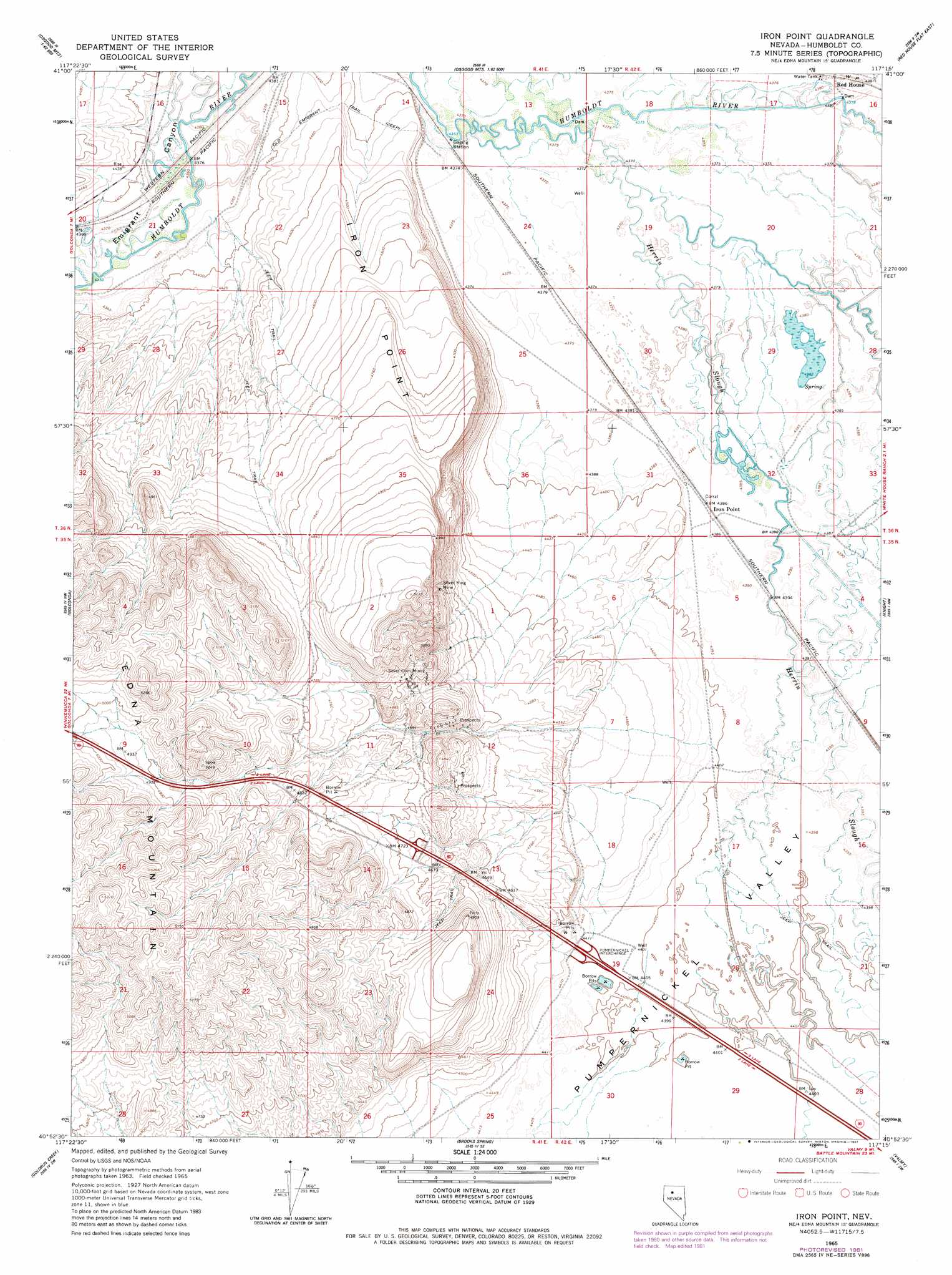
Iron Point Topo Map Nevada
To zoom in, hover over the map of Iron Point
USGS Topo Quad 40117h3 - 1:24,000 scale
| Topo Map Name: | Iron Point |
| USGS Topo Quad ID: | 40117h3 |
| Print Size: | ca. 21 1/4" wide x 27" high |
| Southeast Coordinates: | 40.875° N latitude / 117.25° W longitude |
| Map Center Coordinates: | 40.9375° N latitude / 117.3125° W longitude |
| U.S. State: | NV |
| Filename: | o40117h3.jpg |
| Download Map JPG Image: | Iron Point topo map 1:24,000 scale |
| Map Type: | Topographic |
| Topo Series: | 7.5´ |
| Map Scale: | 1:24,000 |
| Source of Map Images: | United States Geological Survey (USGS) |
| Alternate Map Versions: |
Iron Point NV 1965, updated 1967 Download PDF Buy paper map Iron Point NV 1965, updated 1981 Download PDF Buy paper map Iron Point NV 1965, updated 1981 Download PDF Buy paper map Iron Point NV 2011 Download PDF Buy paper map Iron Point NV 2014 Download PDF Buy paper map |
1:24,000 Topo Quads surrounding Iron Point
Gumboot Lake |
Delvada Spring |
Adam Peak |
Dry Hills South |
The Knolls |
Golconda Butte |
Anderson Gardens |
Red House Flat West |
Red House Flat East |
Elevenmile Well |
Pole Creek |
Golconda |
Iron Point |
Knight |
Hot Pot |
Adelaide |
Goldrun Creek |
Brooks Spring |
Valmy |
Ellison |
Sheep Ranch Canyon |
Smelser Pass |
China Mountain Ne |
North Peak |
Snow Gulch |
> Back to 40117e1 at 1:100,000 scale
> Back to 40116a1 at 1:250,000 scale
> Back to U.S. Topo Maps home
Iron Point topo map: Gazetteer
Iron Point: Capes
Iron Point elevation 1431m 4694′Iron Point: Crossings
Pumpernickel Interchange elevation 1347m 4419′Iron Point: Mines
Silver Coin Mine elevation 1472m 4829′Silver King Mine elevation 1483m 4865′
Iron Point: Populated Places
Iron Point (historical) elevation 1339m 4393′Iron Point: Post Offices
Iron Point Post Office (historical) elevation 1339m 4393′Iron Point: Streams
Herrin Slough elevation 1333m 4373′Iron Point: Valleys
Pumpernickel Valley elevation 1334m 4376′Iron Point digital topo map on disk
Buy this Iron Point topo map showing relief, roads, GPS coordinates and other geographical features, as a high-resolution digital map file on DVD: