Trinity Pass Nw Topo Map Nevada
To zoom in, hover over the map of Trinity Pass Nw
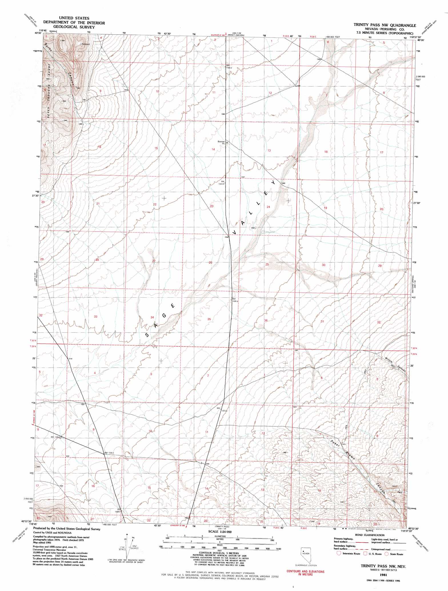
USGS Topo Quad 40118d6 - 1:24,000 scale
| Topo Map Name: | Trinity Pass Nw |
| USGS Topo Quad ID: | 40118d6 |
| Print Size: | ca. 21 1/4" wide x 27" high |
| Southeast Coordinates: | 40.375° N latitude / 118.625° W longitude |
| Map Center Coordinates: | 40.4375° N latitude / 118.6875° W longitude |
| U.S. State: | NV |
| Filename: | o40118d6.jpg |
| Download Map JPG Image: | Trinity Pass Nw topo map 1:24,000 scale |
| Map Type: | Topographic |
| Topo Series: | 7.5´ |
| Map Scale: | 1:24,000 |
| Source of Map Images: | United States Geological Survey (USGS) |
| Alternate Map Versions: |
Trinity Pass NW NV 1981, updated 1982 Download PDF Buy paper map Trinity Pass NW NV 2011 Download PDF Buy paper map Trinity Pass NW NV 2014 Download PDF Buy paper map |
1:24,000 Topo Quads surrounding Trinity Pass Nw
Sheep Spring |
Dead Horse Canyon Ne |
Placerites |
Scossa |
Majuba Mountain |
Dead Horse Canyon |
Juniper Canyon |
Rocky Canyon |
Poker Brown Gap |
Poker Brown |
Seven Troughs Nw |
Seven Troughs |
Trinity Pass Nw |
Natchez Spring |
Oreana Nw |
Blue Wing Flat North |
Seven Troughs Se |
Trinity Pass |
Poker Brown Spring |
Arabia |
Blue Wing Flat South |
Lowry Well |
Trinity Peak |
West Of Lovelock |
Lovelock |
> Back to 40118a1 at 1:100,000 scale
> Back to 40118a1 at 1:250,000 scale
> Back to U.S. Topo Maps home
Trinity Pass Nw topo map: Gazetteer
Trinity Pass Nw: Basins
Sage Valley elevation 1328m 4356′Trinity Pass Nw: Valleys
Burnt Canyon elevation 1467m 4812′Poker Brown Canyon elevation 1338m 4389′
Willow Canyon elevation 1336m 4383′
Trinity Pass Nw digital topo map on disk
Buy this Trinity Pass Nw topo map showing relief, roads, GPS coordinates and other geographical features, as a high-resolution digital map file on DVD: