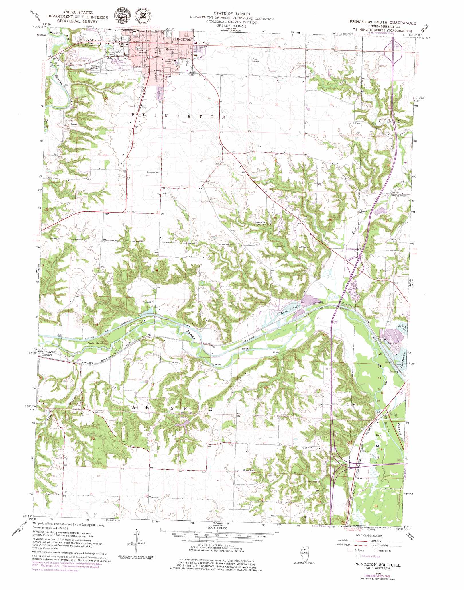
Princeton South Topo Map Illinois
To zoom in, hover over the map of Princeton South
USGS Topo Quad 41089c4 - 1:24,000 scale
| Topo Map Name: | Princeton South |
| USGS Topo Quad ID: | 41089c4 |
| Print Size: | ca. 21 1/4" wide x 27" high |
| Southeast Coordinates: | 41.25° N latitude / 89.375° W longitude |
| Map Center Coordinates: | 41.3125° N latitude / 89.4375° W longitude |
| U.S. State: | IL |
| Filename: | o41089c4.jpg |
| Download Map JPG Image: | Princeton South topo map 1:24,000 scale |
| Map Type: | Topographic |
| Topo Series: | 7.5´ |
| Map Scale: | 1:24,000 |
| Source of Map Images: | United States Geological Survey (USGS) |
| Alternate Map Versions: |
Princeton South IL 1966, updated 1968 Download PDF Buy paper map Princeton South IL 1966, updated 1979 Download PDF Buy paper map Princeton South IL 2012 Download PDF Buy paper map Princeton South IL 2015 Download PDF Buy paper map |
1:24,000 Topo Quads surrounding Princeton South
New Bedford |
Walnut |
Ohio |
Lamoille |
Mendota West |
Manlius |
Buoane |
Princeton North |
Malden |
Ladd |
Buda |
Wyanet |
Princeton South |
Depue |
Spring Valley |
Bradford |
Whitefield |
Putnam |
Florid |
Mcnabb |
Castleton |
La Prairie Center |
Lacon |
Henry |
Varna |
> Back to 41089a1 at 1:100,000 scale
> Back to 41088a1 at 1:250,000 scale
> Back to U.S. Topo Maps home
Princeton South topo map: Gazetteer
Princeton South: Airports
Perry Memorial Hospital Heliport elevation 216m 708′Piper Airport elevation 207m 679′
Princeton South: Dams
Lake Arispie Dam elevation 144m 472′Princeton South: Parks
Alexander Park elevation 208m 682′Bureau County Fair Grounds elevation 207m 679′
City Hall Park elevation 213m 698′
Soldier and Sailors Park elevation 219m 718′
West Side Ball Park elevation 214m 702′
Zearing Park elevation 213m 698′
Princeton South: Populated Places
Princeton elevation 219m 718′Princeton South: Post Offices
Princeton Post Office elevation 216m 708′Princeton South: Reservoirs
Lake Arispie elevation 144m 472′Princeton South: Streams
Brush Creek elevation 152m 498′East Bureau Creek elevation 143m 469′
Epperson Run elevation 173m 567′
Princeton South: Summits
Owls Head elevation 182m 597′Princeton South: Valleys
Plow Hollow elevation 156m 511′Princeton South digital topo map on disk
Buy this Princeton South topo map showing relief, roads, GPS coordinates and other geographical features, as a high-resolution digital map file on DVD:
Northern Illinois, Northern Indiana & Southwestern Michigan
Buy digital topo maps: Northern Illinois, Northern Indiana & Southwestern Michigan