Malden Topo Map Illinois
To zoom in, hover over the map of Malden
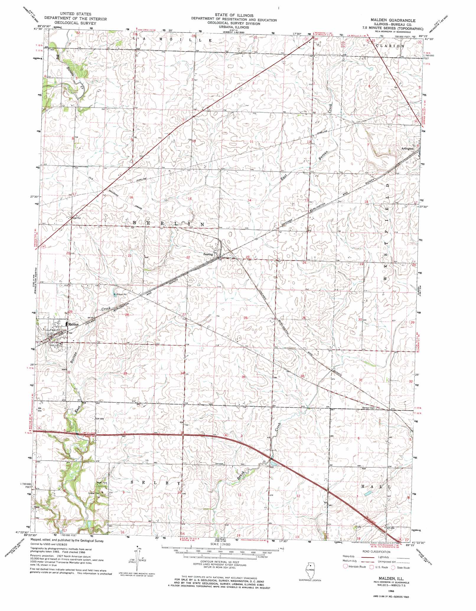
USGS Topo Quad 41089d3 - 1:24,000 scale
| Topo Map Name: | Malden |
| USGS Topo Quad ID: | 41089d3 |
| Print Size: | ca. 21 1/4" wide x 27" high |
| Southeast Coordinates: | 41.375° N latitude / 89.25° W longitude |
| Map Center Coordinates: | 41.4375° N latitude / 89.3125° W longitude |
| U.S. State: | IL |
| Filename: | o41089d3.jpg |
| Download Map JPG Image: | Malden topo map 1:24,000 scale |
| Map Type: | Topographic |
| Topo Series: | 7.5´ |
| Map Scale: | 1:24,000 |
| Source of Map Images: | United States Geological Survey (USGS) |
| Alternate Map Versions: |
Malden IL 1966, updated 1967 Download PDF Buy paper map Malden IL 1966, updated 1967 Download PDF Buy paper map Malden IL 2012 Download PDF Buy paper map Malden IL 2015 Download PDF Buy paper map |
1:24,000 Topo Quads surrounding Malden
Harmon |
Walton |
Amboy |
Sublette |
Compton |
Walnut |
Ohio |
Lamoille |
Mendota West |
Mendota East |
Buoane |
Princeton North |
Malden |
Ladd |
Troy Grove |
Wyanet |
Princeton South |
Depue |
Spring Valley |
La Salle |
Whitefield |
Putnam |
Florid |
Mcnabb |
Tonica |
> Back to 41089a1 at 1:100,000 scale
> Back to 41088a1 at 1:250,000 scale
> Back to U.S. Topo Maps home
Malden topo map: Gazetteer
Malden: Dams
Beaver Glenn Lake Dam elevation 193m 633′Malden: Parks
Myer Park elevation 202m 662′Malden: Populated Places
Malden elevation 214m 702′Zearing elevation 225m 738′
Malden: Post Offices
Zearing Post Office (historical) elevation 223m 731′Malden: Reservoirs
Beaver Glenn Lake elevation 193m 633′Malden digital topo map on disk
Buy this Malden topo map showing relief, roads, GPS coordinates and other geographical features, as a high-resolution digital map file on DVD:
Northern Illinois, Northern Indiana & Southwestern Michigan
Buy digital topo maps: Northern Illinois, Northern Indiana & Southwestern Michigan