Yorktown Topo Map Illinois
To zoom in, hover over the map of Yorktown
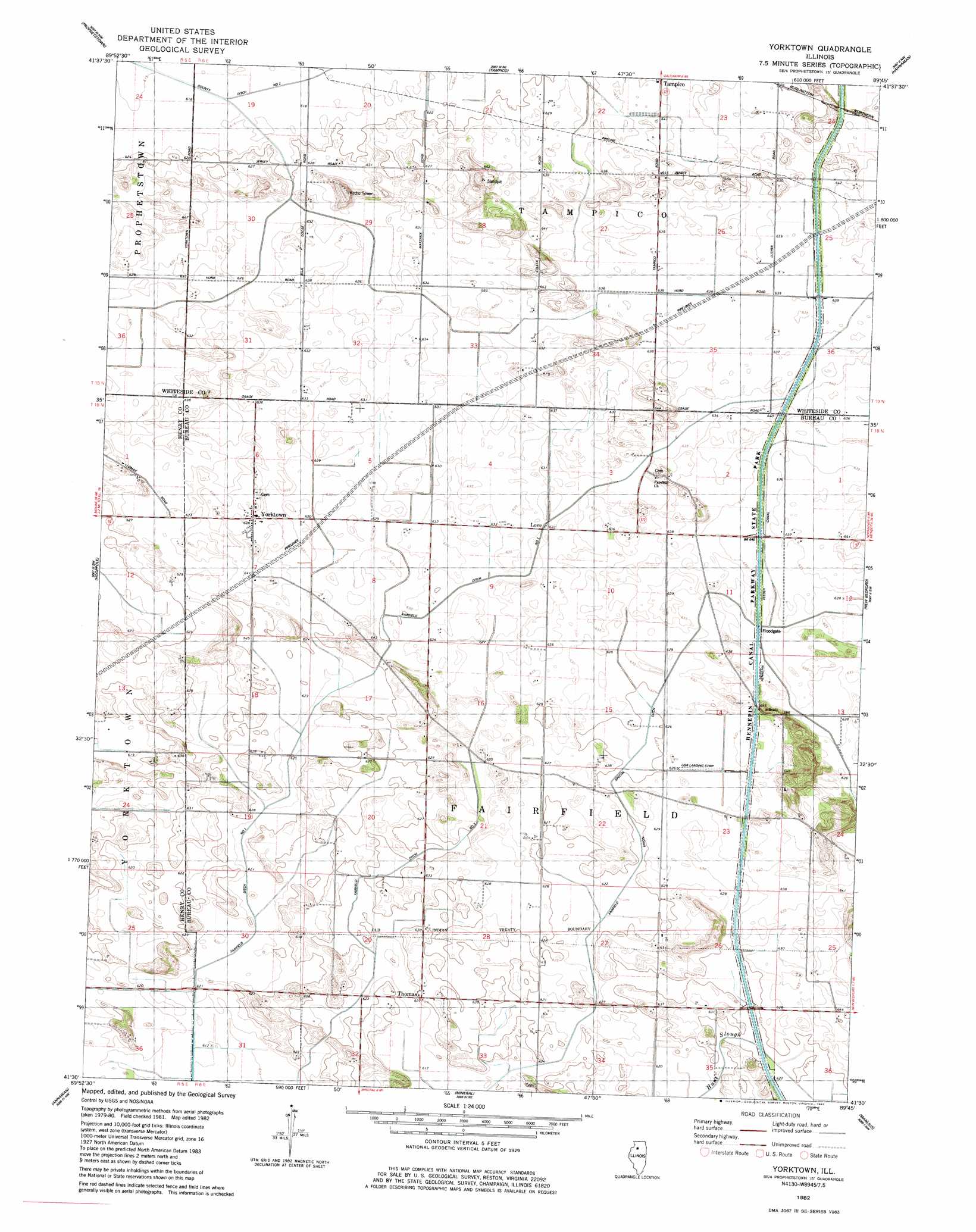
USGS Topo Quad 41089e7 - 1:24,000 scale
| Topo Map Name: | Yorktown |
| USGS Topo Quad ID: | 41089e7 |
| Print Size: | ca. 21 1/4" wide x 27" high |
| Southeast Coordinates: | 41.5° N latitude / 89.75° W longitude |
| Map Center Coordinates: | 41.5625° N latitude / 89.8125° W longitude |
| U.S. State: | IL |
| Filename: | o41089e7.jpg |
| Download Map JPG Image: | Yorktown topo map 1:24,000 scale |
| Map Type: | Topographic |
| Topo Series: | 7.5´ |
| Map Scale: | 1:24,000 |
| Source of Map Images: | United States Geological Survey (USGS) |
| Alternate Map Versions: |
York Town IL 1982, updated 1982 Download PDF Buy paper map Yorktown IL 2012 Download PDF Buy paper map Yorktown IL 2015 Download PDF Buy paper map |
1:24,000 Topo Quads surrounding Yorktown
Union Grove |
Morrison |
Como |
Sterling |
Dixon West |
Erie |
Prophetstown |
Tampico |
Hahnaman |
Harmon |
Spring Hill |
Hooppole |
Yorktown |
New Bedford |
Walnut |
Atkinson |
Annawan |
Mineral |
Manlius |
Buoane |
German Corner |
Kewanee North |
Neponset |
Buda |
Wyanet |
> Back to 41089e1 at 1:100,000 scale
> Back to 41088a1 at 1:250,000 scale
> Back to U.S. Topo Maps home
Yorktown topo map: Gazetteer
Yorktown: Airports
Harms Airstrip elevation 193m 633′Lisa Landing Strip elevation 190m 623′
Yorktown: Canals
County Ditch Number 2 elevation 186m 610′Fairfield Ditch Number 1 elevation 188m 616′
Fairfield Union Special Ditch elevation 191m 626′
Hennepin Feeder Canal elevation 194m 636′
Yorktown: Populated Places
Love elevation 193m 633′Thomas elevation 191m 626′
Yorktown elevation 195m 639′
Yorktown digital topo map on disk
Buy this Yorktown topo map showing relief, roads, GPS coordinates and other geographical features, as a high-resolution digital map file on DVD:
Northern Illinois, Northern Indiana & Southwestern Michigan
Buy digital topo maps: Northern Illinois, Northern Indiana & Southwestern Michigan