Tipton East Topo Map Iowa
To zoom in, hover over the map of Tipton East
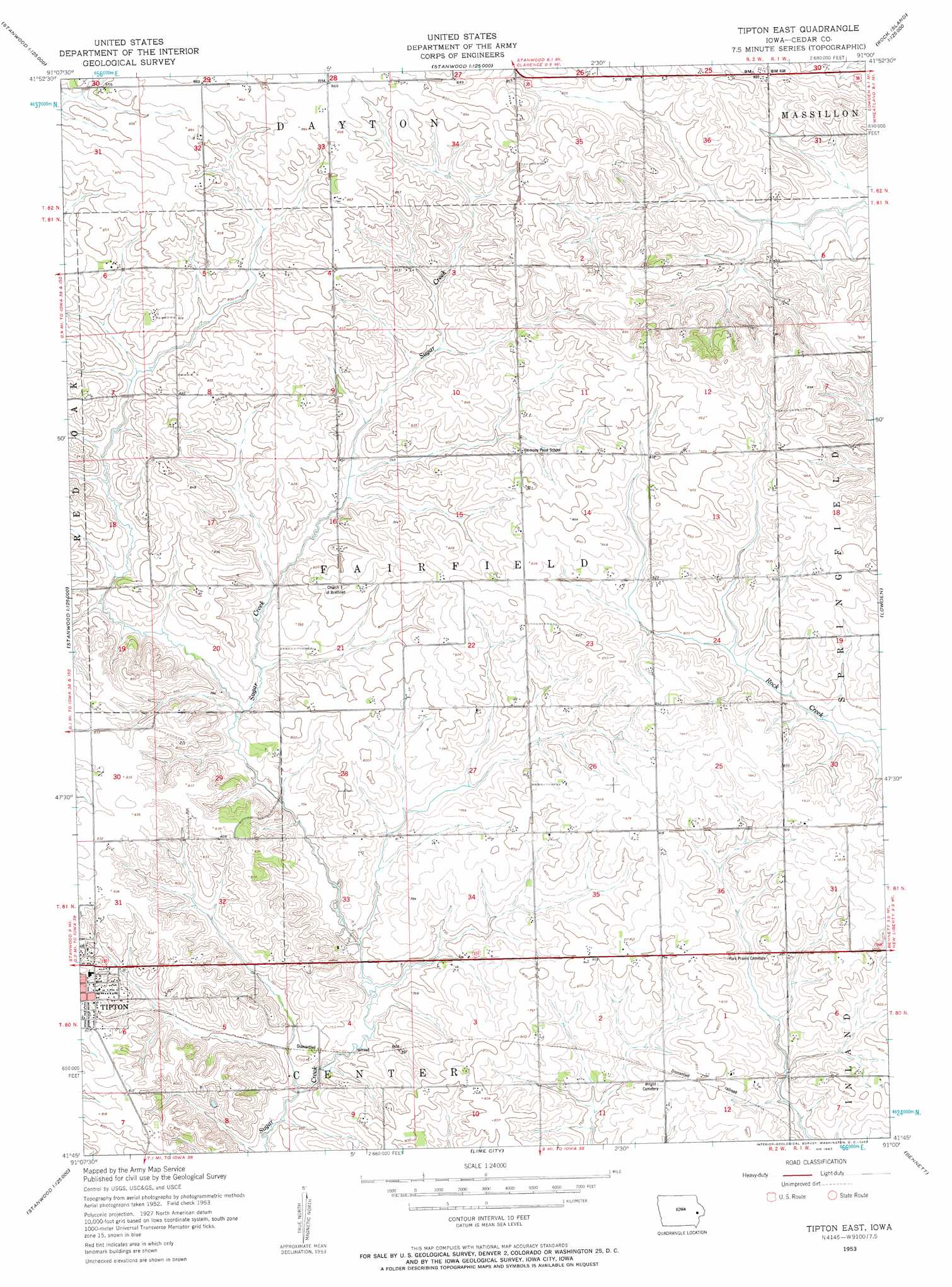
USGS Topo Quad 41091g1 - 1:24,000 scale
| Topo Map Name: | Tipton East |
| USGS Topo Quad ID: | 41091g1 |
| Print Size: | ca. 21 1/4" wide x 27" high |
| Southeast Coordinates: | 41.75° N latitude / 91° W longitude |
| Map Center Coordinates: | 41.8125° N latitude / 91.0625° W longitude |
| U.S. State: | IA |
| Filename: | o41091g1.jpg |
| Download Map JPG Image: | Tipton East topo map 1:24,000 scale |
| Map Type: | Topographic |
| Topo Series: | 7.5´ |
| Map Scale: | 1:24,000 |
| Source of Map Images: | United States Geological Survey (USGS) |
| Alternate Map Versions: |
Tipton East IA 1953, updated 1958 Download PDF Buy paper map Tipton East IA 2010 Download PDF Buy paper map Tipton East IA 2013 Download PDF Buy paper map Tipton East IA 2015 Download PDF Buy paper map |
1:24,000 Topo Quads surrounding Tipton East
Anamosa |
Morley |
Wyoming West |
Wyoming East |
Baldwin |
Mechanicsville |
Stanwood |
Clarence |
Oxford Junction |
Lost Nation |
Cedar Bluff |
Tipton West |
Tipton East |
Lowden |
Wheatland |
West Branch |
Rochester |
Lime City |
Bennett |
Dixon |
West Liberty |
Atalissa |
Wilton Junction |
Durant |
Walcott |
> Back to 41091e1 at 1:100,000 scale
> Back to 41090a1 at 1:250,000 scale
> Back to U.S. Topo Maps home
Tipton East topo map: Gazetteer
Tipton East: Parks
Tipton City Park elevation 241m 790′Tipton East: Post Offices
Cessford Post Office (historical) elevation 250m 820′Woodbridge Post Office (historical) elevation 237m 777′
York Prairie Post Office (historical) elevation 241m 790′
Tipton East digital topo map on disk
Buy this Tipton East topo map showing relief, roads, GPS coordinates and other geographical features, as a high-resolution digital map file on DVD: