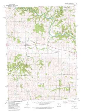
Baldwin Topo Map Iowa
To zoom in, hover over the map of Baldwin
USGS Topo Quad 42090a7 - 1:24,000 scale
| Topo Map Name: | Baldwin |
| USGS Topo Quad ID: | 42090a7 |
| Print Size: | ca. 21 1/4" wide x 27" high |
| Southeast Coordinates: | 42° N latitude / 90.75° W longitude |
| Map Center Coordinates: | 42.0625° N latitude / 90.8125° W longitude |
| U.S. State: | IA |
| Filename: | o42090a7.jpg |
| Download Map JPG Image: | Baldwin topo map 1:24,000 scale |
| Map Type: | Topographic |
| Topo Series: | 7.5´ |
| Map Scale: | 1:24,000 |
| Source of Map Images: | United States Geological Survey (USGS) |
| Alternate Map Versions: |
Baldwin IA 1980, updated 1981 Download PDF Buy paper map Baldwin IA 2010 Download PDF Buy paper map Baldwin IA 2013 Download PDF Buy paper map Baldwin IA 2015 Download PDF Buy paper map |
1:24,000 Topo Quads surrounding Baldwin
> Back to 42090a1 at 1:100,000 scale
> Back to 42090a1 at 1:250,000 scale
> Back to U.S. Topo Maps home
Baldwin topo map: Gazetteer
Baldwin: Arches
Maquoketa Caves Natural Bridge elevation 242m 793′Baldwin: Parks
Eden Valley County Refuge elevation 217m 711′Joinerville County Park elevation 223m 731′
Lost Nation Public Hunting Area elevation 261m 856′
Maquoketa Caves State Park elevation 249m 816′
Mill Rock School County Park elevation 220m 721′
Baldwin: Populated Places
Baldwin elevation 223m 731′Buckhorn elevation 224m 734′
Millrock elevation 239m 784′
Nashville elevation 220m 721′
Baldwin: Post Offices
Baldwin Post Office elevation 222m 728′Burgess Post Office (historical) elevation 245m 803′
Nashville Post Office (historical) elevation 220m 721′
Waterford Post Office (historical) elevation 214m 702′
Baldwin: Streams
Bear Creek elevation 205m 672′Beers Creek elevation 212m 695′
Raccoon Creek elevation 214m 702′
Rat Run elevation 219m 718′
Baldwin digital topo map on disk
Buy this Baldwin topo map showing relief, roads, GPS coordinates and other geographical features, as a high-resolution digital map file on DVD:


