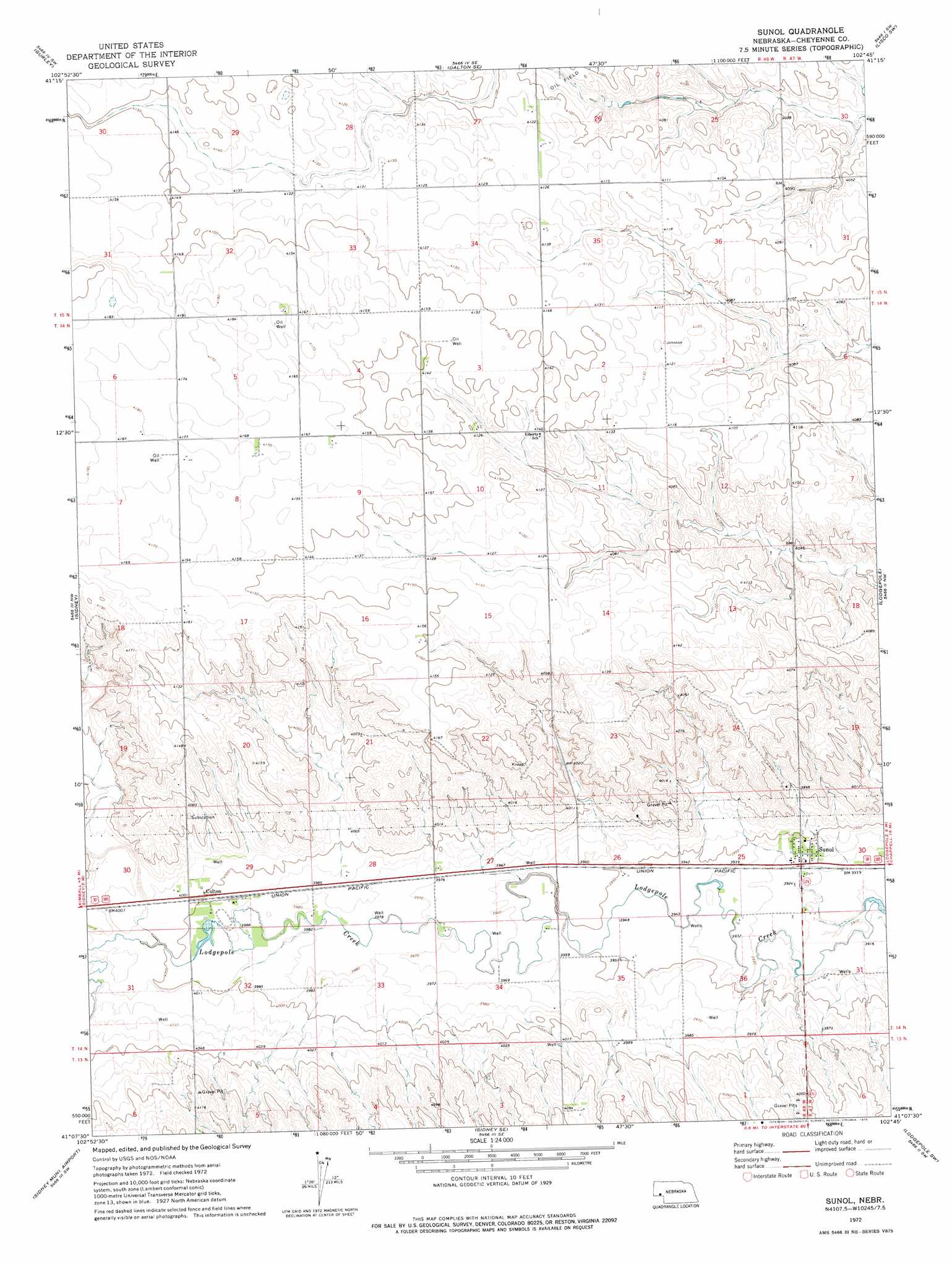
Sunol Topo Map Nebraska
To zoom in, hover over the map of Sunol
USGS Topo Quad 41102b7 - 1:24,000 scale
| Topo Map Name: | Sunol |
| USGS Topo Quad ID: | 41102b7 |
| Print Size: | ca. 21 1/4" wide x 27" high |
| Southeast Coordinates: | 41.125° N latitude / 102.75° W longitude |
| Map Center Coordinates: | 41.1875° N latitude / 102.8125° W longitude |
| U.S. State: | NE |
| Filename: | O41102B7.jpg |
| Download Map JPG Image: | Sunol topo map 1:24,000 scale |
| Map Type: | Topographic |
| Topo Series: | 7.5´ |
| Map Scale: | 1:24,000 |
| Source of Map Images: | United States Geological Survey (USGS) |
| Alternate Map Versions: |
Sunol NE 1972, updated 1975 Download PDF Buy paper map Sunol NE 2011 Download PDF Buy paper map Sunol NE 2014 Download PDF Buy paper map |
1:24,000 Topo Quads surrounding Sunol
Mud Springs |
Dalton |
Fairchild Ranch |
Lisco Nw |
Lisco |
Mud Springs Se |
Gurley |
Dalton Se |
Lisco Sw |
Lisco Se |
Brownson |
Sidney |
Sunol |
Lodgepole |
Mount Vernon |
Lorenzo |
Sidney Municipal Airport |
Sidney Se |
Lodgepole Sw |
Lodgepole Se |
Peetz |
Haystack Butte |
Twin Buttes |
Julesburg Reservoir |
Sedgwick |
> Back to 41102a1 at 1:100,000 scale
> Back to 41102a1 at 1:250,000 scale
> Back to U.S. Topo Maps home
Sunol topo map: Gazetteer
Sunol: Dams
Odaniel Dam elevation 1217m 3992′Sunol: Populated Places
Colton elevation 1220m 4002′Sunol elevation 1198m 3930′
Sunol: Post Offices
Colton Post Office (historical) elevation 1220m 4002′Sunol Post Office (historical) elevation 1198m 3930′
Sunol: Reservoirs
Odaniel Reservoir elevation 1217m 3992′Sunol digital topo map on disk
Buy this Sunol topo map showing relief, roads, GPS coordinates and other geographical features, as a high-resolution digital map file on DVD:
Eastern Wyoming & Western South Dakota
Buy digital topo maps: Eastern Wyoming & Western South Dakota