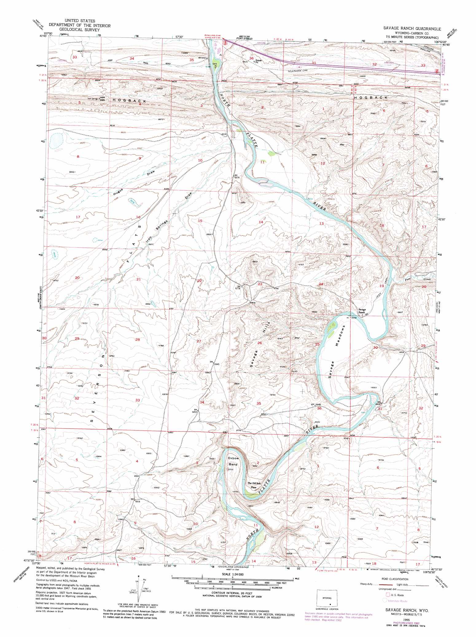
Savage Ranch Topo Map Wyoming
To zoom in, hover over the map of Savage Ranch
USGS Topo Quad 41106f8 - 1:24,000 scale
| Topo Map Name: | Savage Ranch |
| USGS Topo Quad ID: | 41106f8 |
| Print Size: | ca. 21 1/4" wide x 27" high |
| Southeast Coordinates: | 41.625° N latitude / 106.875° W longitude |
| Map Center Coordinates: | 41.6875° N latitude / 106.9375° W longitude |
| U.S. State: | WY |
| Filename: | o41106f8.jpg |
| Download Map JPG Image: | Savage Ranch topo map 1:24,000 scale |
| Map Type: | Topographic |
| Topo Series: | 7.5´ |
| Map Scale: | 1:24,000 |
| Source of Map Images: | United States Geological Survey (USGS) |
| Alternate Map Versions: |
Savage Ranch WY 1955, updated 1957 Download PDF Buy paper map Savage Ranch WY 1955, updated 1975 Download PDF Buy paper map Savage Ranch WY 1955, updated 1983 Download PDF Buy paper map Savage Ranch WY 2012 Download PDF Buy paper map Savage Ranch WY 2015 Download PDF Buy paper map |
1:24,000 Topo Quads surrounding Savage Ranch
Rawlins Nw |
Lone Haystack Mountain |
Ferris Lake |
Pats Bottom |
Tenmile Spring |
Rawlins |
Sinclair |
Fort Steele |
Walcott |
Dana |
Smith Draw West |
Smith Draw East |
Savage Ranch |
Meads |
Coal Bank Basin |
La Marsh Creek East |
Kindt Reservoir |
Overland Crossing |
Overland |
Oberg Ranch |
Middlewood Hill |
Jack Creek Reservoir |
Walck Ranch |
Saratoga |
Finley Reservoir |
> Back to 41106e1 at 1:100,000 scale
> Back to 41106a1 at 1:250,000 scale
> Back to U.S. Topo Maps home
Savage Ranch topo map: Gazetteer
Savage Ranch: Bends
Oxbow Bend elevation 2018m 6620′Savage Ranch: Flats
Savage Meadows elevation 1992m 6535′Savage Ranch: Ranges
Savage Hills elevation 2059m 6755′Savage Ranch: Ridges
Hogback elevation 2074m 6804′Savage Ranch: Streams
Pass Creek elevation 1989m 6525′Savage Ranch: Valleys
Hugus Draw elevation 1984m 6509′Iron Springs Draw elevation 1987m 6519′
Savage Ranch digital topo map on disk
Buy this Savage Ranch topo map showing relief, roads, GPS coordinates and other geographical features, as a high-resolution digital map file on DVD:
Eastern Wyoming & Western South Dakota
Buy digital topo maps: Eastern Wyoming & Western South Dakota