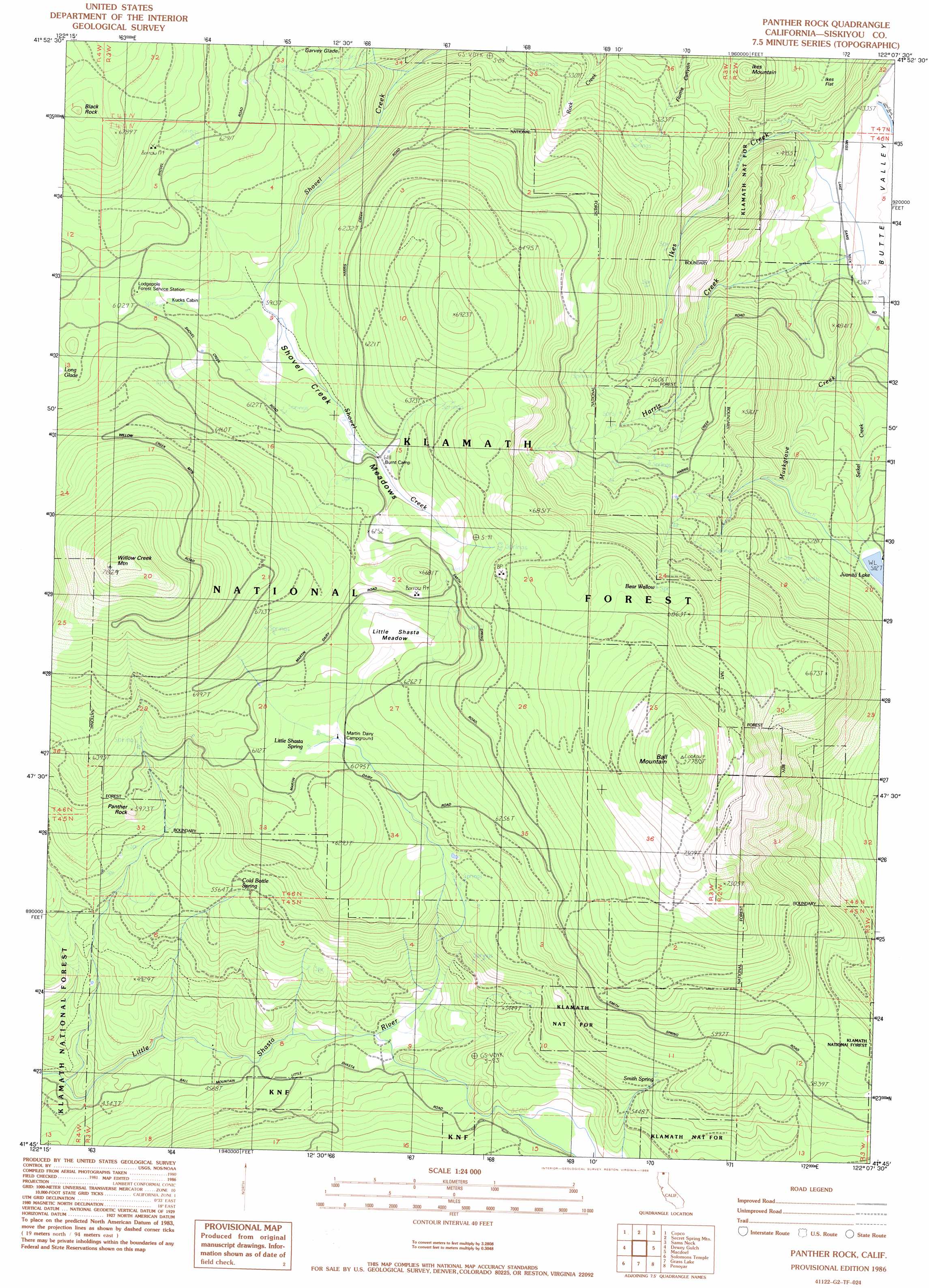
Panther Rock Topo Map California
To zoom in, hover over the map of Panther Rock
USGS Topo Quad 41122g2 - 1:24,000 scale
| Topo Map Name: | Panther Rock |
| USGS Topo Quad ID: | 41122g2 |
| Print Size: | ca. 21 1/4" wide x 27" high |
| Southeast Coordinates: | 41.75° N latitude / 122.125° W longitude |
| Map Center Coordinates: | 41.8125° N latitude / 122.1875° W longitude |
| U.S. State: | CA |
| Filename: | o41122g2.jpg |
| Download Map JPG Image: | Panther Rock topo map 1:24,000 scale |
| Map Type: | Topographic |
| Topo Series: | 7.5´ |
| Map Scale: | 1:24,000 |
| Source of Map Images: | United States Geological Survey (USGS) |
| Alternate Map Versions: |
Panther Rock CA 1986, updated 1986 Download PDF Buy paper map Panther Rock CA 2001, updated 2004 Download PDF Buy paper map Panther Rock CA 2012 Download PDF Buy paper map Panther Rock CA 2015 Download PDF Buy paper map |
| FStopo: | US Forest Service topo Panther Rock is available: Download FStopo PDF Download FStopo TIF |
1:24,000 Topo Quads surrounding Panther Rock
Soda Mountain |
Parker Mountain |
Mule Hill |
Chicken Hills |
Hamaker Mountain |
Iron Gate Reservoir |
Copco |
Secret Spring Mountain |
Sams Neck |
Dorris |
Bogus Mountain |
Dewey Gulch |
Panther Rock |
Macdoel |
Sheep Mountain |
Little Shasta |
Solomons Temple |
Grass Lake |
Penoyar |
Bray |
Lake Shastina |
Juniper Flat |
The Whaleback |
West Haight Mountain |
Tennant |
> Back to 41122e1 at 1:100,000 scale
> Back to 41122a1 at 1:250,000 scale
> Back to U.S. Topo Maps home
Panther Rock topo map: Gazetteer
Panther Rock: Flats
Garvey Glade elevation 1840m 6036′Ikes Flat elevation 1500m 4921′
Little Shasta Meadow elevation 1881m 6171′
Shovel Creek Meadows elevation 1808m 5931′
Panther Rock: Pillars
Black Rock elevation 2071m 6794′Panther Rock elevation 1807m 5928′
Panther Rock: Springs
Bear Wallow elevation 2038m 6686′Cold Bottle Spring elevation 1686m 5531′
Little Shasta Spring elevation 1846m 6056′
Smith Spring elevation 1760m 5774′
Panther Rock: Streams
Harris Creek elevation 1316m 4317′Ikes Creek elevation 1316m 4317′
Muskgrave Creek elevation 1309m 4294′
Panther Creek elevation 1275m 4183′
Seikel Creek elevation 1372m 4501′
Panther Rock: Summits
Ball Mountain elevation 2373m 7785′Butte Mountain elevation 2103m 6899′
Ikes Mountain elevation 1672m 5485′
Willow Creek Mountain elevation 2384m 7821′
Panther Rock: Trails
Burnt Camp Trail elevation 2031m 6663′Willow Creek Mountain Trail elevation 2019m 6624′
Panther Rock digital topo map on disk
Buy this Panther Rock topo map showing relief, roads, GPS coordinates and other geographical features, as a high-resolution digital map file on DVD: