Balltown Topo Map Wisconsin
To zoom in, hover over the map of Balltown
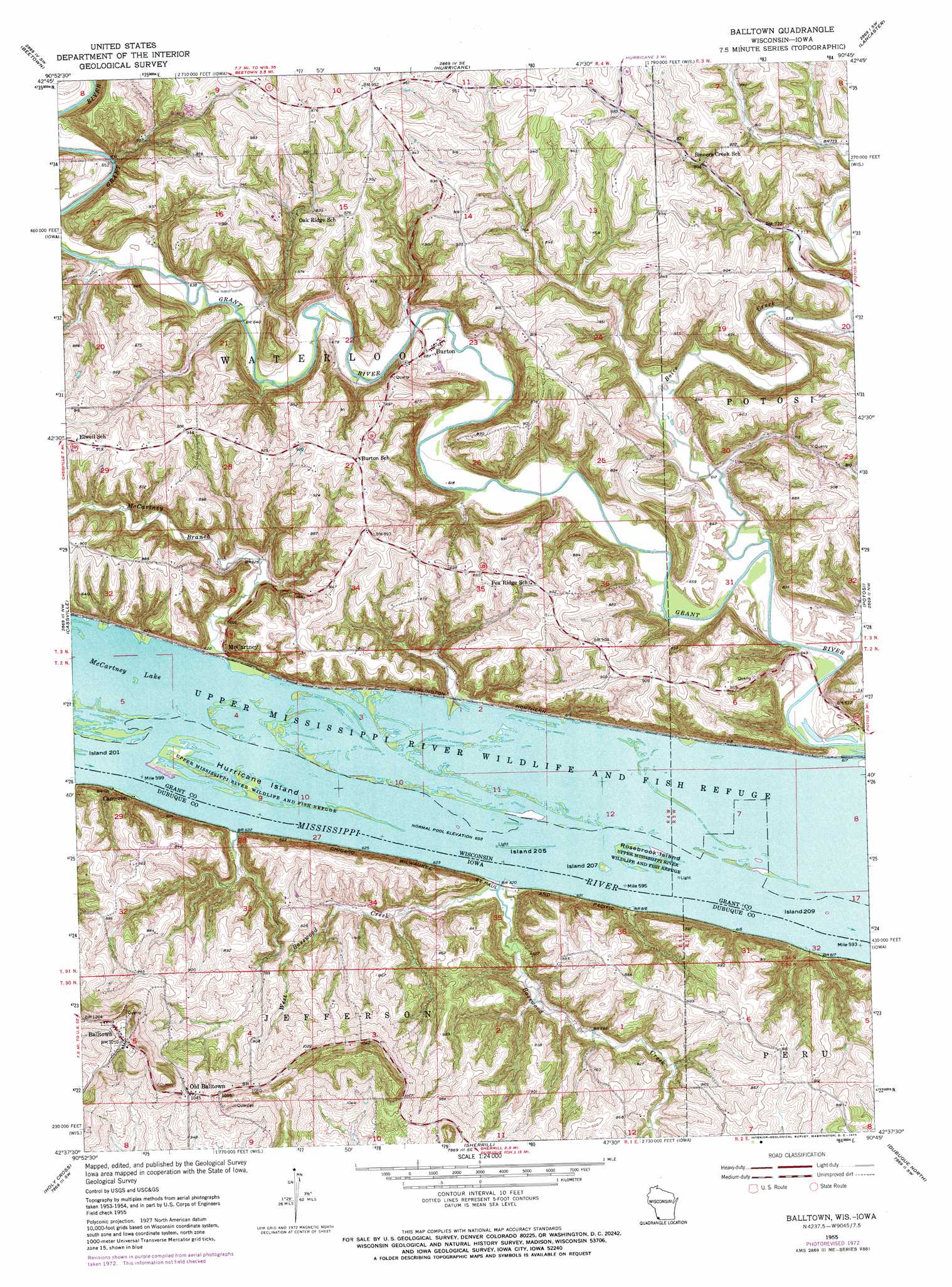
USGS Topo Quad 42090f7 - 1:24,000 scale
| Topo Map Name: | Balltown |
| USGS Topo Quad ID: | 42090f7 |
| Print Size: | ca. 21 1/4" wide x 27" high |
| Southeast Coordinates: | 42.625° N latitude / 90.75° W longitude |
| Map Center Coordinates: | 42.6875° N latitude / 90.8125° W longitude |
| U.S. States: | WI, IA |
| Filename: | o42090f7.jpg |
| Download Map JPG Image: | Balltown topo map 1:24,000 scale |
| Map Type: | Topographic |
| Topo Series: | 7.5´ |
| Map Scale: | 1:24,000 |
| Source of Map Images: | United States Geological Survey (USGS) |
| Alternate Map Versions: |
Balltown IA 1955, updated 1957 Download PDF Buy paper map Balltown IA 1955, updated 1973 Download PDF Buy paper map Balltown IA 2010 Download PDF Buy paper map Balltown IA 2013 Download PDF Buy paper map Balltown IA 2015 Download PDF Buy paper map |
1:24,000 Topo Quads surrounding Balltown
Bagley |
Bloomington |
Mount Hope |
Fennimore |
Stitzer |
Guttenberg |
Beetown |
Hurricane |
Lancaster |
Ellenboro |
Turkey River |
Cassville |
Balltown |
Potosi |
Dickeyville |
New Vienna |
Holy Cross |
Sherrill |
Dubuque North |
Kieler |
Dyersville East |
Epworth |
Peosta |
Dubuque South |
Menominee |
> Back to 42090e1 at 1:100,000 scale
> Back to 42090a1 at 1:250,000 scale
> Back to U.S. Topo Maps home
Balltown topo map: Gazetteer
Balltown: Bridges
Burton Bridge elevation 187m 613′Chaffie Hollow Bridge elevation 191m 626′
Masseyville Bridge elevation 186m 610′
Balltown: Guts
Snyder Slough elevation 184m 603′Balltown: Islands
Hurricane Island elevation 185m 606′Island Number Two Hundred Five elevation 184m 603′
Island Number Two Hundred Nine elevation 184m 603′
Island Number Two Hundred Seven elevation 186m 610′
Rosebrook Island elevation 185m 606′
Balltown: Parks
Finleys Landing Park elevation 253m 830′Balltown: Populated Places
Balltown elevation 367m 1204′Burton elevation 204m 669′
Cameron elevation 189m 620′
McCartney elevation 188m 616′
Old Balltown elevation 318m 1043′
Balltown: Post Offices
Aspinwall Post Office (historical) elevation 332m 1089′Balltown Post Office (historical) elevation 367m 1204′
Balltown: Streams
Arrow Branch elevation 216m 708′Basswood Creek elevation 184m 603′
Boice Creek elevation 185m 606′
McCartney Branch elevation 185m 606′
West Basswood Creek elevation 184m 603′
Balltown: Valleys
Graham Hollow elevation 207m 679′Rigsby Hollow elevation 190m 623′
Balltown digital topo map on disk
Buy this Balltown topo map showing relief, roads, GPS coordinates and other geographical features, as a high-resolution digital map file on DVD: