Hampton North Topo Map Iowa
To zoom in, hover over the map of Hampton North
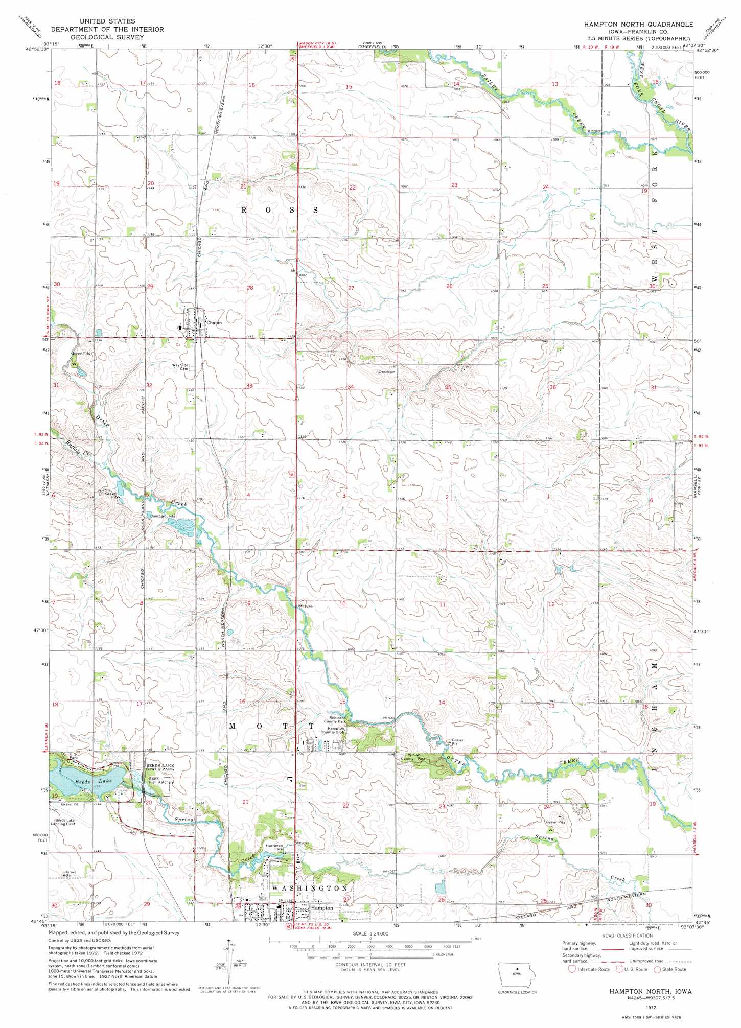
USGS Topo Quad 42093g2 - 1:24,000 scale
| Topo Map Name: | Hampton North |
| USGS Topo Quad ID: | 42093g2 |
| Print Size: | ca. 21 1/4" wide x 27" high |
| Southeast Coordinates: | 42.75° N latitude / 93.125° W longitude |
| Map Center Coordinates: | 42.8125° N latitude / 93.1875° W longitude |
| U.S. State: | IA |
| Filename: | o42093g2.jpg |
| Download Map JPG Image: | Hampton North topo map 1:24,000 scale |
| Map Type: | Topographic |
| Topo Series: | 7.5´ |
| Map Scale: | 1:24,000 |
| Source of Map Images: | United States Geological Survey (USGS) |
| Alternate Map Versions: |
Hampton North IA 1972, updated 1975 Download PDF Buy paper map Hampton North IA 2010 Download PDF Buy paper map Hampton North IA 2013 Download PDF Buy paper map Hampton North IA 2015 Download PDF Buy paper map |
1:24,000 Topo Quads surrounding Hampton North
Ventura Heights |
Burchinal |
Hanford |
Mason City Se |
Rockford |
Thornton |
Swaledale |
Sheffield |
Dougherty |
Aureola |
Alexander |
Latimer |
Hampton North |
Hansell |
Dumont North |
Dows East |
Coulter |
Hampton South |
Ackley Ne |
Dumont South |
Popejoy |
Iowa Falls West |
Iowa Falls East |
Ackley |
Aplington |
> Back to 42093e1 at 1:100,000 scale
> Back to 42092a1 at 1:250,000 scale
> Back to U.S. Topo Maps home
Hampton North topo map: Gazetteer
Hampton North: Airports
Beeds Lake Airport elevation 348m 1141′Hampton North: Parks
Beeds Lake State Park elevation 345m 1131′Harriman Park elevation 330m 1082′
Robinson County Park elevation 334m 1095′
W-K-W County Park elevation 334m 1095′
Hampton North: Populated Places
Chapin elevation 352m 1154′Hampton North: Post Offices
Chapin Post Office elevation 352m 1154′Elida Post Office (historical) elevation 322m 1056′
Washburn Post Office (historical) elevation 323m 1059′
Hampton North: Reservoirs
Beeds Lake elevation 340m 1115′Hampton North: Streams
Bailey Creek elevation 311m 1020′Buffalo Creek elevation 331m 1085′
Hampton North digital topo map on disk
Buy this Hampton North topo map showing relief, roads, GPS coordinates and other geographical features, as a high-resolution digital map file on DVD: