Monument Ridge Topo Map Wyoming
To zoom in, hover over the map of Monument Ridge
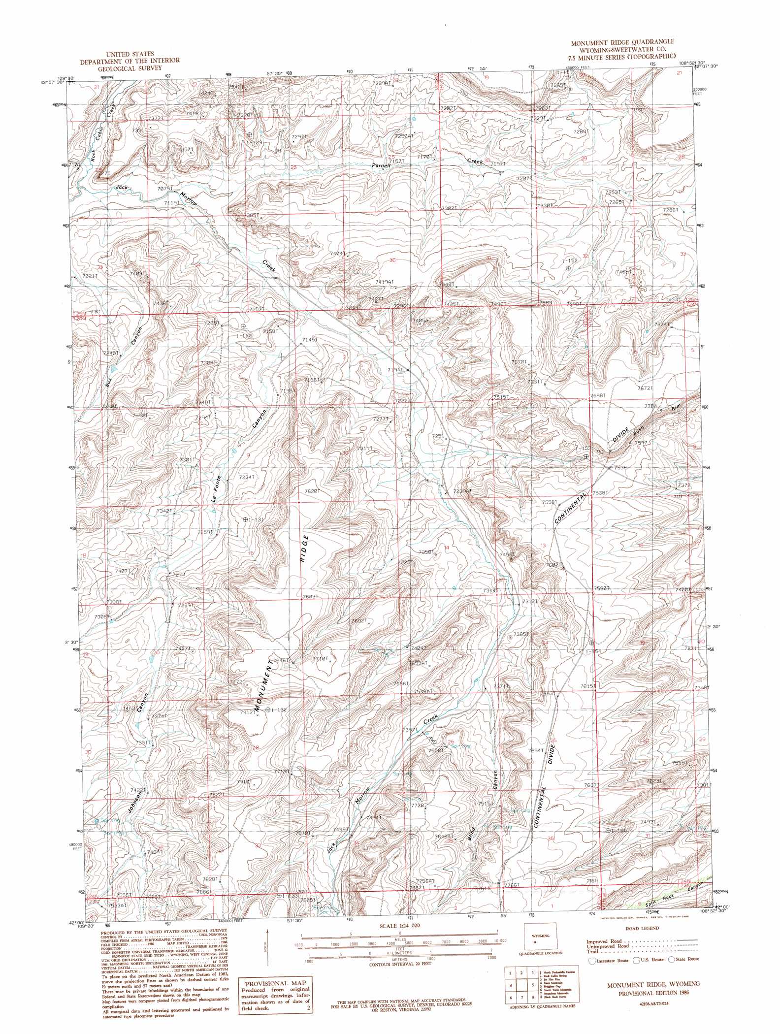
USGS Topo Quad 42108a8 - 1:24,000 scale
| Topo Map Name: | Monument Ridge |
| USGS Topo Quad ID: | 42108a8 |
| Print Size: | ca. 21 1/4" wide x 27" high |
| Southeast Coordinates: | 42° N latitude / 108.875° W longitude |
| Map Center Coordinates: | 42.0625° N latitude / 108.9375° W longitude |
| U.S. State: | WY |
| Filename: | o42108a8.jpg |
| Download Map JPG Image: | Monument Ridge topo map 1:24,000 scale |
| Map Type: | Topographic |
| Topo Series: | 7.5´ |
| Map Scale: | 1:24,000 |
| Source of Map Images: | United States Geological Survey (USGS) |
| Alternate Map Versions: |
Monument Ridge WY 1986, updated 1986 Download PDF Buy paper map Monument Ridge WY 2012 Download PDF Buy paper map Monument Ridge WY 2015 Download PDF Buy paper map |
1:24,000 Topo Quads surrounding Monument Ridge
Parting Of The Ways |
Hay Meadow Reservoir |
Pacific Springs |
Dickie Springs |
Continental Peak |
Tule Butte |
North Packsaddle Canyon |
Rock Cabin Spring |
Joe Hay Rim |
Bob Jack Well |
Ox Yoke Springs |
Essex Mountain |
Monument Ridge |
Freighter Gap |
The Pinnacles |
Boars Tusk |
North Table Mountain |
Steamboat Mountain |
Black Rock North |
Black Rock Flat West |
Boars Tusk Sw |
Deer Butte |
South Superior |
Black Rock South |
Tenmile Rim |
> Back to 42108a1 at 1:100,000 scale
> Back to 42108a1 at 1:250,000 scale
> Back to U.S. Topo Maps home
Monument Ridge topo map: Gazetteer
Monument Ridge: Gaps
Freighter Gap elevation 2275m 7463′Monument Ridge: Ridges
Monument Ridge elevation 2367m 7765′Monument Ridge: Springs
Minnie Spring elevation 2309m 7575′Monument Ridge: Streams
Jack Parnell Creek elevation 2160m 7086′Rock Cabin Creek elevation 2154m 7066′
Monument Ridge: Valleys
Blind Canyon elevation 2247m 7372′Johnson Canyon elevation 2220m 7283′
LaFonte Canyon elevation 2179m 7148′
Monument Ridge digital topo map on disk
Buy this Monument Ridge topo map showing relief, roads, GPS coordinates and other geographical features, as a high-resolution digital map file on DVD: