Boars Tusk Sw Topo Map Wyoming
To zoom in, hover over the map of Boars Tusk Sw
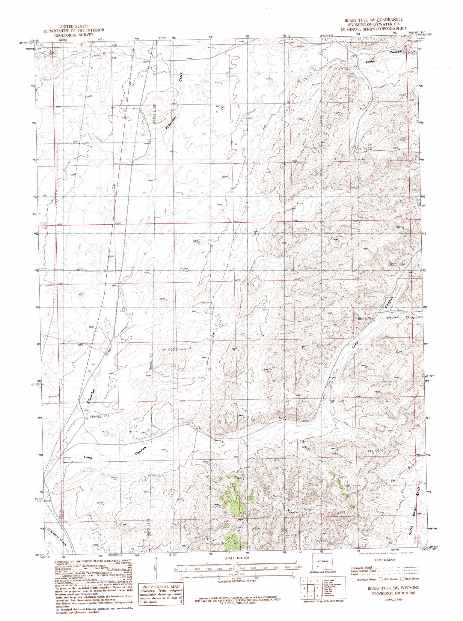
USGS Topo Quad 41109g2 - 1:24,000 scale
| Topo Map Name: | Boars Tusk Sw |
| USGS Topo Quad ID: | 41109g2 |
| Print Size: | ca. 21 1/4" wide x 27" high |
| Southeast Coordinates: | 41.75° N latitude / 109.125° W longitude |
| Map Center Coordinates: | 41.8125° N latitude / 109.1875° W longitude |
| U.S. State: | WY |
| Filename: | o41109g2.jpg |
| Download Map JPG Image: | Boars Tusk Sw topo map 1:24,000 scale |
| Map Type: | Topographic |
| Topo Series: | 7.5´ |
| Map Scale: | 1:24,000 |
| Source of Map Images: | United States Geological Survey (USGS) |
| Alternate Map Versions: |
Boars Tusk SW WY 1986, updated 1986 Download PDF Buy paper map Boars Tusk SW WY 2012 Download PDF Buy paper map Boars Tusk SW WY 2015 Download PDF Buy paper map |
1:24,000 Topo Quads surrounding Boars Tusk Sw
Farson |
Fifteenmile Spring |
Ox Yoke Springs |
Essex Mountain |
Monument Ridge |
Clay Buttes |
White Rocks |
Boars Tusk |
North Table Mountain |
Steamboat Mountain |
Clay Buttes Sw |
Clay Buttes Se |
Boars Tusk Sw |
Deer Butte |
South Superior |
Scott Spring |
Pilot Butte |
Reliance |
North Baxter |
Thayer Junction |
Green River |
Kanda |
Rock Springs |
Baxter |
Point Of Rocks Sw |
> Back to 41109e1 at 1:100,000 scale
> Back to 41108a1 at 1:250,000 scale
> Back to U.S. Topo Maps home
Boars Tusk Sw topo map: Gazetteer
Boars Tusk Sw: Valleys
Cedar Canyon elevation 1994m 6541′Crooked Canyon elevation 2070m 6791′
Boars Tusk Sw digital topo map on disk
Buy this Boars Tusk Sw topo map showing relief, roads, GPS coordinates and other geographical features, as a high-resolution digital map file on DVD: