Schoettlin Mountain Topo Map Wyoming
To zoom in, hover over the map of Schoettlin Mountain
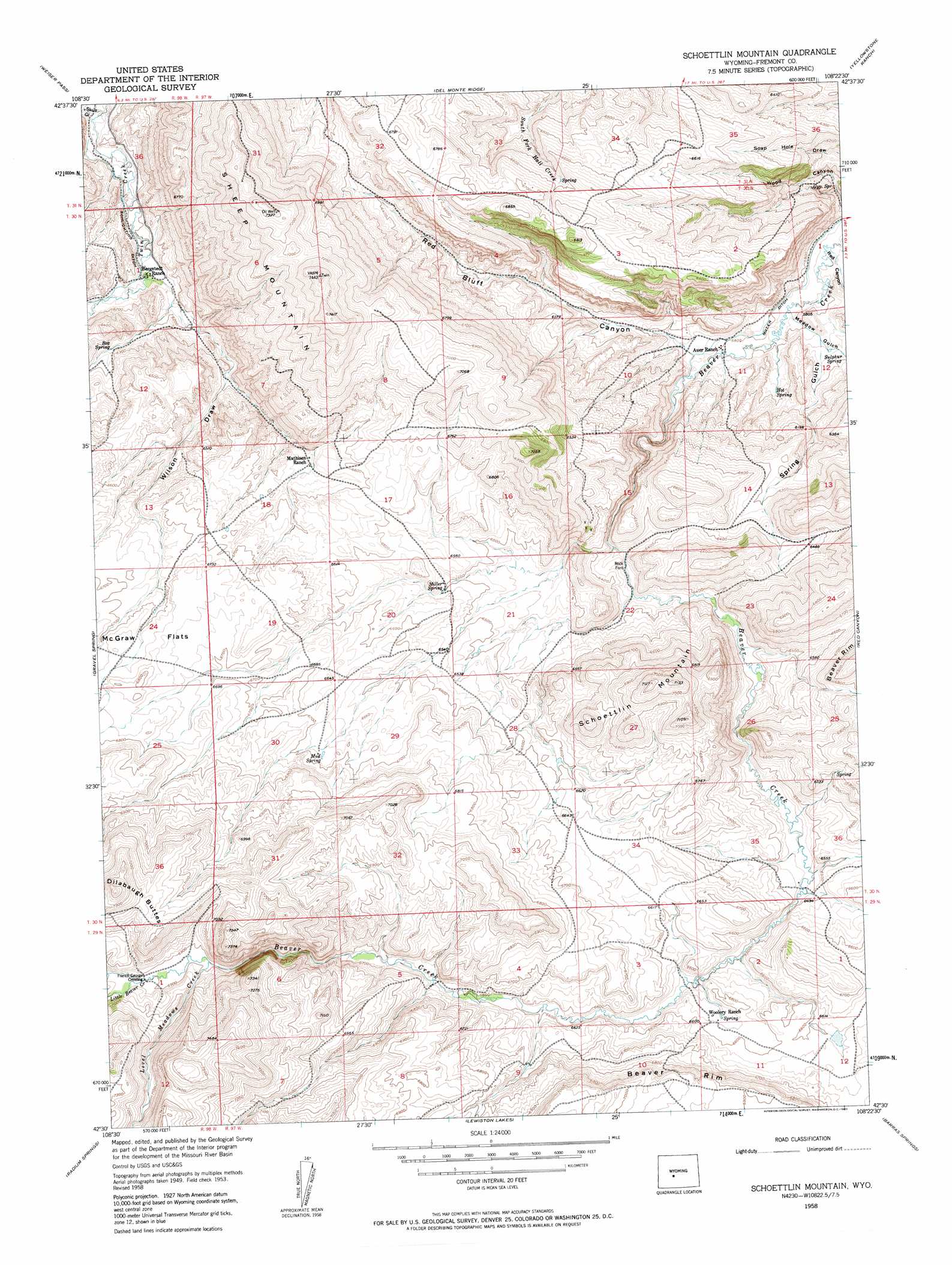
USGS Topo Quad 42108e4 - 1:24,000 scale
| Topo Map Name: | Schoettlin Mountain |
| USGS Topo Quad ID: | 42108e4 |
| Print Size: | ca. 21 1/4" wide x 27" high |
| Southeast Coordinates: | 42.5° N latitude / 108.375° W longitude |
| Map Center Coordinates: | 42.5625° N latitude / 108.4375° W longitude |
| U.S. State: | WY |
| Filename: | o42108e4.jpg |
| Download Map JPG Image: | Schoettlin Mountain topo map 1:24,000 scale |
| Map Type: | Topographic |
| Topo Series: | 7.5´ |
| Map Scale: | 1:24,000 |
| Source of Map Images: | United States Geological Survey (USGS) |
| Alternate Map Versions: |
Schlichting Mountain WY 1953, updated 1955 Download PDF Buy paper map Schoettlin Mountain WY 1958, updated 1960 Download PDF Buy paper map Schoettlin Mountain WY 1958, updated 1960 Download PDF Buy paper map Schoettlin Mountain WY 2012 Download PDF Buy paper map Schoettlin Mountain WY 2015 Download PDF Buy paper map |
1:24,000 Topo Quads surrounding Schoettlin Mountain
Lander |
Lander Se |
Ninemile Hill |
Bringolf Ranch |
Sand Draw |
Wolf Point |
Weiser Pass |
Del Monte Ridge |
Yellowstone Ranch |
Dishpan Butte |
Miners Delight |
Gravel Spring |
Schoettlin Mountain |
Red Canyon |
Sweetwater Station |
Atlantic City |
Radium Springs |
Lewiston Lakes |
Barras Springs |
Happy Spring |
Continental Peak |
Circle Bar Lake |
Picket Lake |
Sulphur Bar Spring |
Olson Springs |
> Back to 42108e1 at 1:100,000 scale
> Back to 42108a1 at 1:250,000 scale
> Back to U.S. Topo Maps home
Schoettlin Mountain topo map: Gazetteer
Schoettlin Mountain: Canals
Miller Ditch elevation 1769m 5803′Schoettlin Mountain: Crossings
French George Crossing elevation 2103m 6899′Schoettlin Mountain: Flats
McGraw Flats elevation 2053m 6735′Schoettlin Mountain: Springs
Box Spring elevation 1905m 6250′Gyp Spring elevation 1805m 5921′
Hot Spring elevation 1792m 5879′
Miller Spring elevation 1984m 6509′
Mud Spring elevation 2035m 6676′
Sulphur Spring elevation 1793m 5882′
Woolery Ranch Spring elevation 2004m 6574′
Schoettlin Mountain: Streams
Level Meadows Creek elevation 2102m 6896′Little Beaver Creek elevation 2103m 6899′
Schoettlin Mountain: Summits
Schoettlin Mountain elevation 2171m 7122′Schoettlin Mountain: Valleys
Meadow Gulch elevation 1760m 5774′Red Bluff Canyon elevation 1787m 5862′
Red Canyon elevation 1751m 5744′
Skull Gulch elevation 1838m 6030′
Spring Gulch elevation 1779m 5836′
Wilson Draw elevation 1867m 6125′
Schoettlin Mountain digital topo map on disk
Buy this Schoettlin Mountain topo map showing relief, roads, GPS coordinates and other geographical features, as a high-resolution digital map file on DVD: