Lookout Mountain Topo Map Wyoming
To zoom in, hover over the map of Lookout Mountain
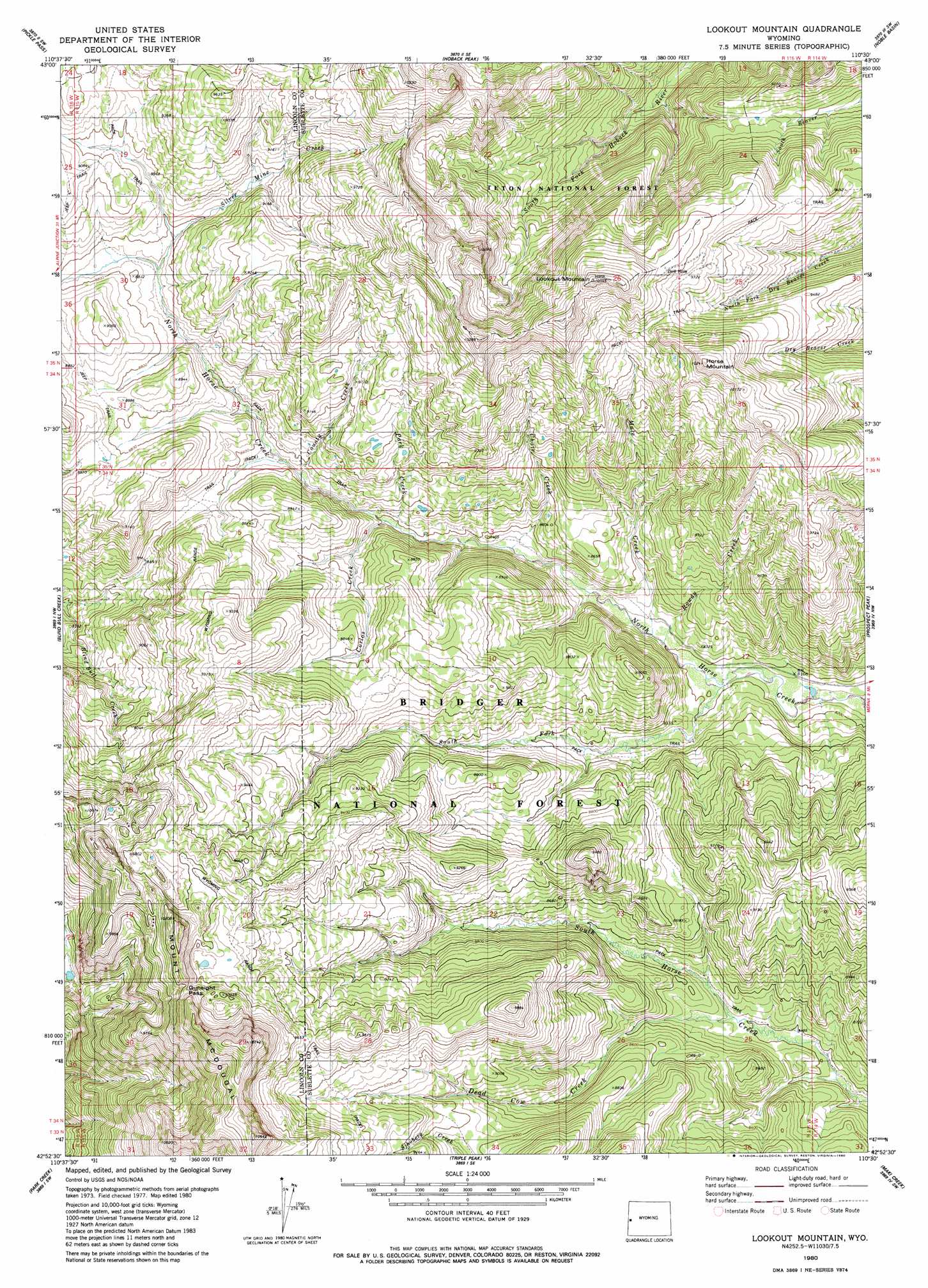
USGS Topo Quad 42110h5 - 1:24,000 scale
| Topo Map Name: | Lookout Mountain |
| USGS Topo Quad ID: | 42110h5 |
| Print Size: | ca. 21 1/4" wide x 27" high |
| Southeast Coordinates: | 42.875° N latitude / 110.5° W longitude |
| Map Center Coordinates: | 42.9375° N latitude / 110.5625° W longitude |
| U.S. State: | WY |
| Filename: | o42110h5.jpg |
| Download Map JPG Image: | Lookout Mountain topo map 1:24,000 scale |
| Map Type: | Topographic |
| Topo Series: | 7.5´ |
| Map Scale: | 1:24,000 |
| Source of Map Images: | United States Geological Survey (USGS) |
| Alternate Map Versions: |
Lookout Mountain WY 1980, updated 1980 Download PDF Buy paper map Lookout Mountain WY 1980, updated 1980 Download PDF Buy paper map Lookout Mountain WY 2012 Download PDF Buy paper map Lookout Mountain WY 2015 Download PDF Buy paper map |
| FStopo: | US Forest Service topo Lookout Mountain is available: Download FStopo PDF Download FStopo TIF |
1:24,000 Topo Quads surrounding Lookout Mountain
Pine Creek |
Bailey Lake |
Clause Peak |
Bondurant |
Raspberry Ridge |
Deer Creek |
Pickle Pass |
Hoback Peak |
Noble Basin |
Kismet Peak |
Man Peak |
Blind Bull Creek |
Lookout Mountain |
Prospect Peak |
Merna Butte |
Rock Lake Peak |
Park Creek |
Triple Peak |
Maki Creek |
Halfway |
Red Top Mountain |
Box Canyon Creek |
Mount Schidler |
Red Castle Creek |
Meadow Canyon |
> Back to 42110e1 at 1:100,000 scale
> Back to 42110a1 at 1:250,000 scale
> Back to U.S. Topo Maps home
Lookout Mountain topo map: Gazetteer
Lookout Mountain: Gaps
Beartrap Junction elevation 2741m 8992′Gunsight Pass elevation 3054m 10019′
Lookout Mountain: Mines
Horse Creek Mine elevation 2821m 9255′Lookout Mountain: Streams
Chair Creek elevation 2549m 8362′Corlos Creek elevation 2577m 8454′
County Creek elevation 2622m 8602′
Dead Cow Creek elevation 2512m 8241′
Mule Creek elevation 2528m 8293′
Park Creek elevation 2559m 8395′
Rowdy Creek elevation 2528m 8293′
Silver Mine Creek elevation 2689m 8822′
South Fork North Horse Creek elevation 2507m 8225′
Lookout Mountain: Summits
Horse Mountain elevation 3088m 10131′Lookout Mountain elevation 3138m 10295′
Lookout Mountain digital topo map on disk
Buy this Lookout Mountain topo map showing relief, roads, GPS coordinates and other geographical features, as a high-resolution digital map file on DVD: