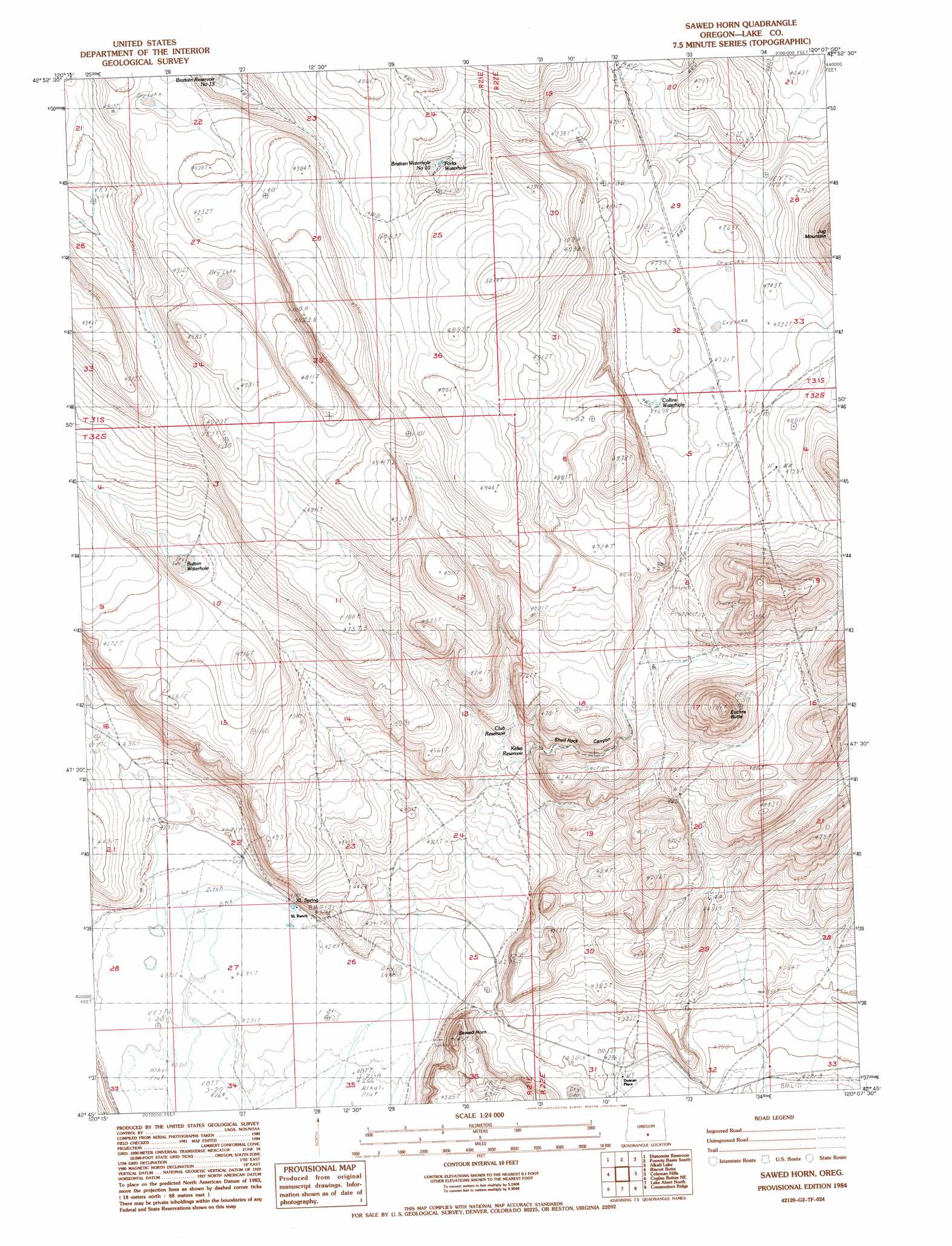
Sawed Horn Topo Map Oregon
To zoom in, hover over the map of Sawed Horn
USGS Topo Quad 42120g2 - 1:24,000 scale
| Topo Map Name: | Sawed Horn |
| USGS Topo Quad ID: | 42120g2 |
| Print Size: | ca. 21 1/4" wide x 27" high |
| Southeast Coordinates: | 42.75° N latitude / 120.125° W longitude |
| Map Center Coordinates: | 42.8125° N latitude / 120.1875° W longitude |
| U.S. State: | OR |
| Filename: | o42120g2.jpg |
| Download Map JPG Image: | Sawed Horn topo map 1:24,000 scale |
| Map Type: | Topographic |
| Topo Series: | 7.5´ |
| Map Scale: | 1:24,000 |
| Source of Map Images: | United States Geological Survey (USGS) |
| Alternate Map Versions: |
Sawed Horn OR 1984, updated 1984 Download PDF Buy paper map Sawed Horn OR 2011 Download PDF Buy paper map Sawed Horn OR 2014 Download PDF Buy paper map |
1:24,000 Topo Quads surrounding Sawed Horn
Sheep Rock |
Fire Lake |
Poverty Basin North |
Alkali Buttes |
Venator Canyon |
Bull Lake |
Diatomite Reservoir |
Poverty Basin South |
Alkali Lake |
Juniper Mountain |
Sharp Top |
Biscuit Point |
Sawed Horn |
Coleman Hills |
Sagebrush Knoll |
Coglan Buttes |
Coglan Buttes Ne |
Lake Abert North |
Commodore Ridge |
Rabbit Hills Nw |
Tucker Hill |
Coglan Buttes Se |
Lake Abert South |
Cooper Draw |
Rabbit Hills Sw |
> Back to 42120e1 at 1:100,000 scale
> Back to 42120a1 at 1:250,000 scale
> Back to U.S. Topo Maps home
Sawed Horn topo map: Gazetteer
Sawed Horn: Reservoirs
Brattain Reservoir Number 13 elevation 1460m 4790′Brattain Waterhole Number 10 elevation 1478m 4849′
Button Waterhole elevation 1408m 4619′
Club Reservoir elevation 1371m 4498′
Collins Waterhole elevation 1432m 4698′
Forks Waterhole elevation 1479m 4852′
Kelso Reservoir elevation 1335m 4379′
Sawed Horn: Springs
XL Spring elevation 1308m 4291′Sawed Horn: Summits
Euchre Butte elevation 1572m 5157′Sawed Horn elevation 1372m 4501′
Sawed Horn: Valleys
Shell Rock Canyon elevation 1384m 4540′Sawed Horn digital topo map on disk
Buy this Sawed Horn topo map showing relief, roads, GPS coordinates and other geographical features, as a high-resolution digital map file on DVD: