Coglan Buttes Topo Map Oregon
To zoom in, hover over the map of Coglan Buttes
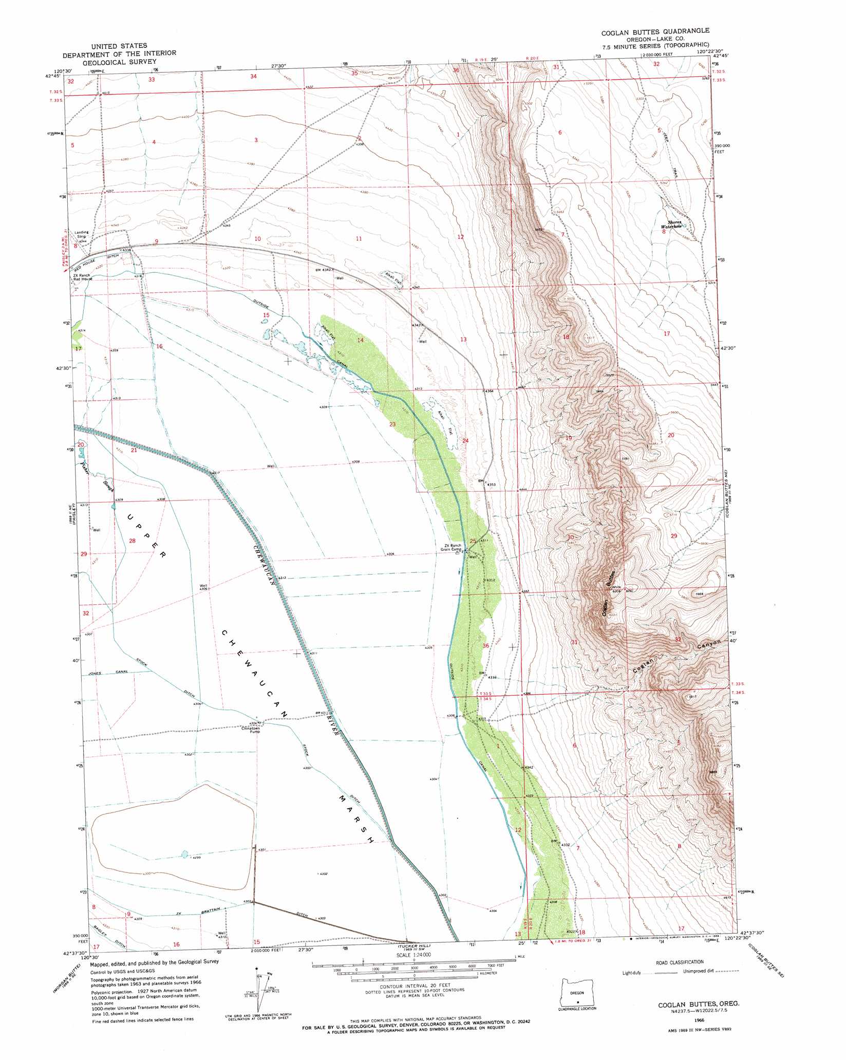
USGS Topo Quad 42120f4 - 1:24,000 scale
| Topo Map Name: | Coglan Buttes |
| USGS Topo Quad ID: | 42120f4 |
| Print Size: | ca. 21 1/4" wide x 27" high |
| Southeast Coordinates: | 42.625° N latitude / 120.375° W longitude |
| Map Center Coordinates: | 42.6875° N latitude / 120.4375° W longitude |
| U.S. State: | OR |
| Filename: | o42120f4.jpg |
| Download Map JPG Image: | Coglan Buttes topo map 1:24,000 scale |
| Map Type: | Topographic |
| Topo Series: | 7.5´ |
| Map Scale: | 1:24,000 |
| Source of Map Images: | United States Geological Survey (USGS) |
| Alternate Map Versions: |
Coglan Buttes OR 1966, updated 1968 Download PDF Buy paper map Coglan Buttes OR 2011 Download PDF Buy paper map Coglan Buttes OR 2014 Download PDF Buy paper map |
1:24,000 Topo Quads surrounding Coglan Buttes
Ana River |
Diablo Peak |
Bull Lake |
Diatomite Reservoir |
Poverty Basin South |
South Of Ana River |
Loco Lake |
Sharp Top |
Biscuit Point |
Sawed Horn |
Slide Mountain |
Paisley |
Coglan Buttes |
Coglan Buttes Ne |
Lake Abert North |
Coffeepot Creek |
Morgan Butte |
Tucker Hill |
Coglan Buttes Se |
Lake Abert South |
Coleman Point |
Shoestring Butte |
Clover Flat |
Valley Falls |
Little Honey Creek |
> Back to 42120e1 at 1:100,000 scale
> Back to 42120a1 at 1:250,000 scale
> Back to U.S. Topo Maps home
Coglan Buttes topo map: Gazetteer
Coglan Buttes: Canals
Outside Canal elevation 1315m 4314′Stock Ditch elevation 1313m 4307′
Coglan Buttes: Flats
Upper Chewaucan Marsh elevation 1313m 4307′Coglan Buttes: Lakes
Shores Waterhole elevation 1613m 5291′Coglan Buttes: Streams
Fisher Slough elevation 1315m 4314′Coglan Buttes: Summits
Coglan Buttes elevation 1893m 6210′Coglan Buttes: Valleys
Coglan Canyon elevation 1380m 4527′Coglan Buttes digital topo map on disk
Buy this Coglan Buttes topo map showing relief, roads, GPS coordinates and other geographical features, as a high-resolution digital map file on DVD: