Pole Butte Topo Map Oregon
To zoom in, hover over the map of Pole Butte
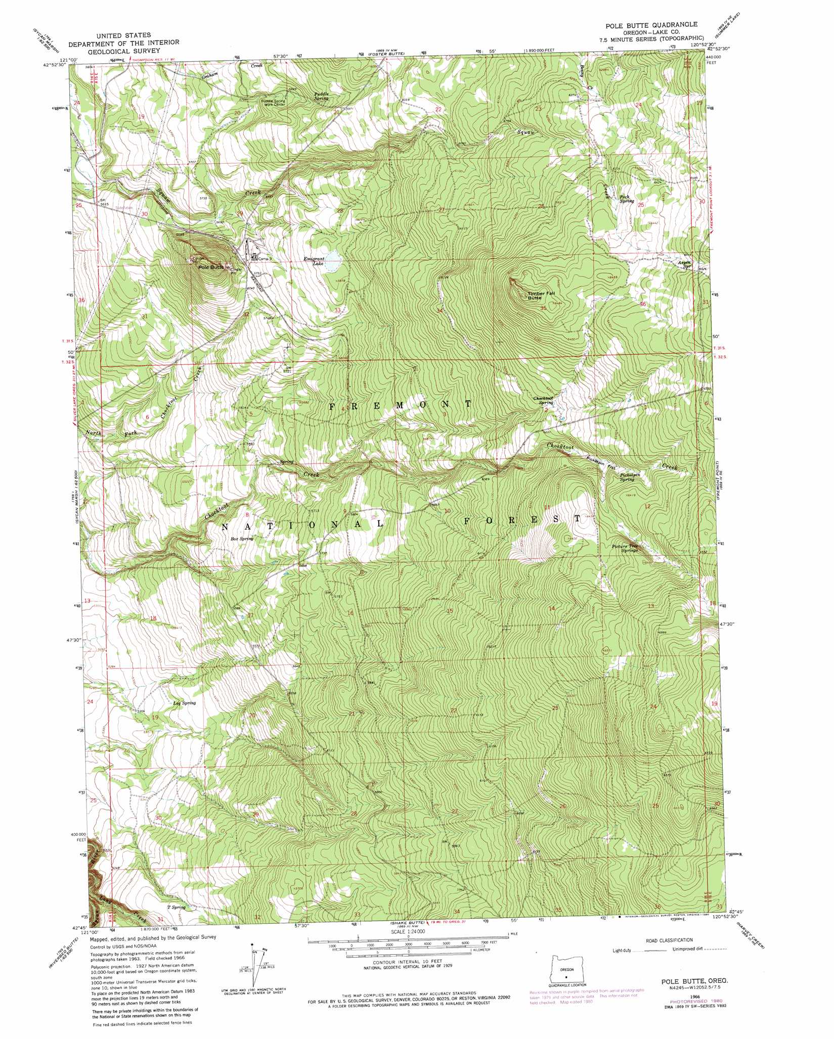
USGS Topo Quad 42120g8 - 1:24,000 scale
| Topo Map Name: | Pole Butte |
| USGS Topo Quad ID: | 42120g8 |
| Print Size: | ca. 21 1/4" wide x 27" high |
| Southeast Coordinates: | 42.75° N latitude / 120.875° W longitude |
| Map Center Coordinates: | 42.8125° N latitude / 120.9375° W longitude |
| U.S. State: | OR |
| Filename: | o42120g8.jpg |
| Download Map JPG Image: | Pole Butte topo map 1:24,000 scale |
| Map Type: | Topographic |
| Topo Series: | 7.5´ |
| Map Scale: | 1:24,000 |
| Source of Map Images: | United States Geological Survey (USGS) |
| Alternate Map Versions: |
Pole Butte OR 1966, updated 1968 Download PDF Buy paper map Pole Butte OR 1966, updated 1980 Download PDF Buy paper map Pole Butte OR 2004, updated 2007 Download PDF Buy paper map Pole Butte OR 2011 Download PDF Buy paper map Pole Butte OR 2014 Download PDF Buy paper map |
| FStopo: | US Forest Service topo Pole Butte is available: Download FStopo PDF Download FStopo TIF |
1:24,000 Topo Quads surrounding Pole Butte
Bridge Creek Draw |
Hager Mountain |
Duncan Reservoir |
Egli Rim |
Sheeplick Draw |
Partin Butte |
Thompson Reservoir |
Foster Butte |
Summer Lake |
Ana River |
Sycan Marsh West |
Sycan Marsh East |
Pole Butte |
Fremont Point |
South Of Ana River |
Riverbed Butte Spring |
Riverbed Butte |
Shake Butte |
Harvey Creek |
Slide Mountain |
Ponina Butte |
Rodeo Butte |
Sandhill Crossing |
Lee Thomas Crossing |
Coffeepot Creek |
> Back to 42120e1 at 1:100,000 scale
> Back to 42120a1 at 1:250,000 scale
> Back to U.S. Topo Maps home
Pole Butte topo map: Gazetteer
Pole Butte: Flats
Lamb Field elevation 1963m 6440′Picketpin Flat elevation 1914m 6279′
Pole Butte: Lakes
Emigrant Lake elevation 1790m 5872′Pole Butte: Springs
Aspen Spring elevation 1985m 6512′Box Spring elevation 1713m 5620′
Chocktoot Spring elevation 1898m 6227′
Log Spring elevation 1629m 5344′
Peck Spring elevation 1941m 6368′
Picketpin Spring elevation 1928m 6325′
Picture Tree Springs elevation 1957m 6420′
Puddle Spring elevation 1803m 5915′
T Spring elevation 1661m 5449′
Pole Butte: Summits
Pole Butte elevation 1819m 5967′Timber Fall Butte elevation 1968m 6456′
Pole Butte digital topo map on disk
Buy this Pole Butte topo map showing relief, roads, GPS coordinates and other geographical features, as a high-resolution digital map file on DVD: