Point Peninsula Topo Map New York
To zoom in, hover over the map of Point Peninsula
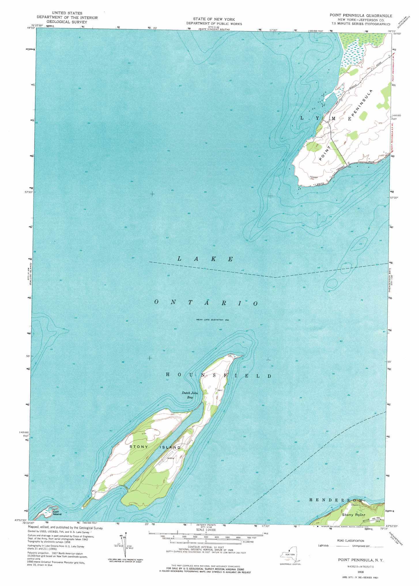
USGS Topo Quad 43076h3 - 1:24,000 scale
| Topo Map Name: | Point Peninsula |
| USGS Topo Quad ID: | 43076h3 |
| Print Size: | ca. 21 1/4" wide x 27" high |
| Southeast Coordinates: | 43.875° N latitude / 76.25° W longitude |
| Map Center Coordinates: | 43.9375° N latitude / 76.3125° W longitude |
| U.S. State: | NY |
| Filename: | o43076h3.jpg |
| Download Map JPG Image: | Point Peninsula topo map 1:24,000 scale |
| Map Type: | Topographic |
| Topo Series: | 7.5´ |
| Map Scale: | 1:24,000 |
| Source of Map Images: | United States Geological Survey (USGS) |
| Alternate Map Versions: |
Point Peninsula NY 1958, updated 1960 Download PDF Buy paper map Point Peninsula NY 1958, updated 1976 Download PDF Buy paper map Point Peninsula NY 2011 Download PDF Buy paper map Point Peninsula NY 2013 Download PDF Buy paper map Point Peninsula NY 2016 Download PDF Buy paper map |
1:24,000 Topo Quads surrounding Point Peninsula
Cape Vincent North |
Saint Lawrence |
Clayton |
||
Cape Vincent South |
Chaumont |
Dexter |
||
Galloo Island |
Point Peninsula |
Henderson Bay |
Sackets Harbor |
|
Stony Point |
Henderson |
Adams |
||
Ellisburg |
Sandy Creek |
> Back to 43076e1 at 1:100,000 scale
> Back to 43076a1 at 1:250,000 scale
> Back to U.S. Topo Maps home
Point Peninsula topo map: Gazetteer
Point Peninsula: Basins
Stony Basin elevation 75m 246′Point Peninsula: Bays
Dels Boat Basin elevation 76m 249′Dutch John Bay elevation 75m 246′
Toad Hole elevation 75m 246′
Point Peninsula: Islands
Calf Island elevation 76m 249′Stony Island elevation 81m 265′
Point Peninsula digital topo map on disk
Buy this Point Peninsula topo map showing relief, roads, GPS coordinates and other geographical features, as a high-resolution digital map file on DVD:
New York, Vermont, Connecticut & Western Massachusetts
Buy digital topo maps: New York, Vermont, Connecticut & Western Massachusetts