Stewartville Topo Map Minnesota
To zoom in, hover over the map of Stewartville
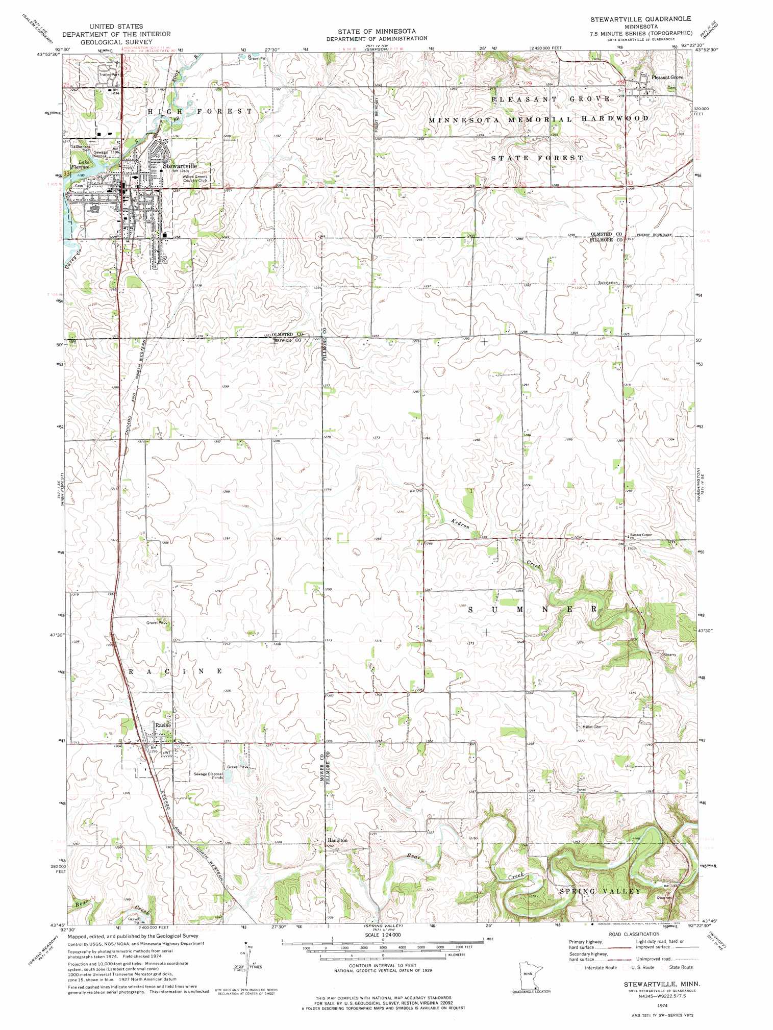
USGS Topo Quad 43092g4 - 1:24,000 scale
| Topo Map Name: | Stewartville |
| USGS Topo Quad ID: | 43092g4 |
| Print Size: | ca. 21 1/4" wide x 27" high |
| Southeast Coordinates: | 43.75° N latitude / 92.375° W longitude |
| Map Center Coordinates: | 43.8125° N latitude / 92.4375° W longitude |
| U.S. State: | MN |
| Filename: | o43092g4.jpg |
| Download Map JPG Image: | Stewartville topo map 1:24,000 scale |
| Map Type: | Topographic |
| Topo Series: | 7.5´ |
| Map Scale: | 1:24,000 |
| Source of Map Images: | United States Geological Survey (USGS) |
| Alternate Map Versions: |
Stewartville MN 1974, updated 1976 Download PDF Buy paper map Stewartville MN 2010 Download PDF Buy paper map Stewartville MN 2013 Download PDF Buy paper map Stewartville MN 2016 Download PDF Buy paper map |
1:24,000 Topo Quads surrounding Stewartville
Byron |
Douglas |
Rochester |
Chester |
Plainview Sw |
Rock Dell |
Salem Corners |
Simpson |
Marion |
Eyota |
High Forest Sw |
High Forest |
Stewartville |
Washington |
Chatfield |
Dexter |
Grand Meadow |
Spring Valley |
Wykoff |
Fountain |
Adams |
Le Roy |
Ostrander |
Cherry Grove |
Greenleafton |
> Back to 43092e1 at 1:100,000 scale
> Back to 43092a1 at 1:250,000 scale
> Back to U.S. Topo Maps home
Stewartville topo map: Gazetteer
Stewartville: Dams
Bear Creek Dam elevation 346m 1135′Stewartville Dam elevation 364m 1194′
Stewartville: Lakes
Lake Florence elevation 365m 1197′Stewartville: Populated Places
Hamilton elevation 384m 1259′Pleasant Grove elevation 393m 1289′
Racine elevation 394m 1292′
Southern Hills Mobile Home Park elevation 381m 1250′
Stewartville elevation 374m 1227′
Stewartville: Post Offices
Hamilton Post Office (historical) elevation 384m 1259′Pleasantgrove Post Office (historical) elevation 393m 1289′
Racine Post Office elevation 394m 1292′
Stewartville Post Office elevation 377m 1236′
Stewartville: Reservoirs
Bear Creek Reservoir elevation 346m 1135′Lake Florence elevation 364m 1194′
Stewartville: Streams
Carey Creek elevation 364m 1194′Stewartville digital topo map on disk
Buy this Stewartville topo map showing relief, roads, GPS coordinates and other geographical features, as a high-resolution digital map file on DVD: