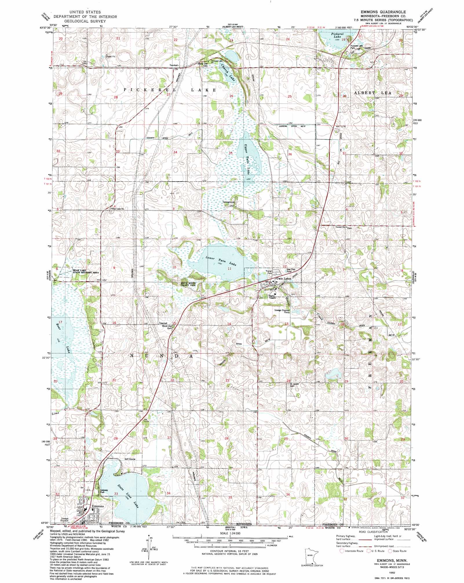
Emmons Topo Map Minnesota
To zoom in, hover over the map of Emmons
USGS Topo Quad 43093e4 - 1:24,000 scale
| Topo Map Name: | Emmons |
| USGS Topo Quad ID: | 43093e4 |
| Print Size: | ca. 21 1/4" wide x 27" high |
| Southeast Coordinates: | 43.5° N latitude / 93.375° W longitude |
| Map Center Coordinates: | 43.5625° N latitude / 93.4375° W longitude |
| U.S. State: | MN |
| Filename: | o43093e4.jpg |
| Download Map JPG Image: | Emmons topo map 1:24,000 scale |
| Map Type: | Topographic |
| Topo Series: | 7.5´ |
| Map Scale: | 1:24,000 |
| Source of Map Images: | United States Geological Survey (USGS) |
| Alternate Map Versions: |
Emmons MN 1982, updated 1983 Download PDF Buy paper map Emmons MN 2010 Download PDF Buy paper map Emmons MN 2013 Download PDF Buy paper map Emmons MN 2016 Download PDF Buy paper map |
1:24,000 Topo Quads surrounding Emmons
Matawan |
Freeborn |
Hartland |
Ellendale |
Hollandale |
Wells |
Alden |
Albert Lea West |
Albert Lea East |
Hayward |
Kiester |
Conger |
Emmons |
Glenville |
Myrtle |
Vinje |
Lake Mills |
Bristol |
Fertile Ne |
Northwood |
Forest City |
Pilot Knob |
Fertile |
Fertile Se |
Manly |
> Back to 43093e1 at 1:100,000 scale
> Back to 43092a1 at 1:250,000 scale
> Back to U.S. Topo Maps home
Emmons topo map: Gazetteer
Emmons: Canals
Judicial Ditch Number Nine elevation 384m 1259′Emmons: Dams
Bear Lake Dam elevation 378m 1240′Emmons: Lakes
Bear Lake elevation 375m 1230′Church Lake elevation 384m 1259′
Everhart Lake elevation 384m 1259′
Lower Twin Lake elevation 381m 1250′
State Line Lake elevation 384m 1259′
Upper Twin Lake elevation 384m 1259′
Emmons: Parks
Ann and Leo Donahue Wildlife Management Area elevation 384m 1259′Bear Lake State Wildlife Management Area elevation 380m 1246′
Gateway Park elevation 387m 1269′
Pickerel Lake Park elevation 385m 1263′
White Woods County Park elevation 383m 1256′
Emmons: Populated Places
Emmons elevation 393m 1289′Emmons Trailer Court elevation 393m 1289′
Lakeview Mobile Home Park elevation 390m 1279′
Twin Lakes elevation 381m 1250′
Emmons: Post Offices
Emmons Post Office elevation 392m 1286′Twin Lakes Post Office elevation 383m 1256′
Emmons: Reservoirs
Bear Lake elevation 378m 1240′Emmons digital topo map on disk
Buy this Emmons topo map showing relief, roads, GPS coordinates and other geographical features, as a high-resolution digital map file on DVD: