Fertile Se Topo Map Iowa
To zoom in, hover over the map of Fertile Se
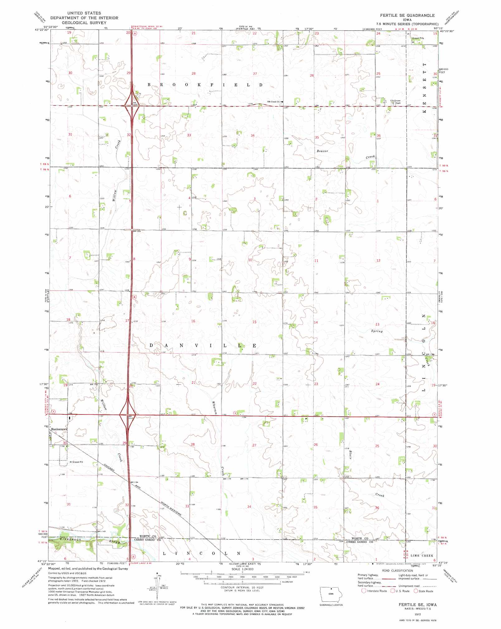
USGS Topo Quad 43093c3 - 1:24,000 scale
| Topo Map Name: | Fertile Se |
| USGS Topo Quad ID: | 43093c3 |
| Print Size: | ca. 21 1/4" wide x 27" high |
| Southeast Coordinates: | 43.25° N latitude / 93.25° W longitude |
| Map Center Coordinates: | 43.3125° N latitude / 93.3125° W longitude |
| U.S. State: | IA |
| Filename: | o43093c3.jpg |
| Download Map JPG Image: | Fertile Se topo map 1:24,000 scale |
| Map Type: | Topographic |
| Topo Series: | 7.5´ |
| Map Scale: | 1:24,000 |
| Source of Map Images: | United States Geological Survey (USGS) |
| Alternate Map Versions: |
Fertile SE IA 1972, updated 1975 Download PDF Buy paper map Fertile SE IA 2010 Download PDF Buy paper map Fertile SE IA 2013 Download PDF Buy paper map Fertile SE IA 2015 Download PDF Buy paper map |
1:24,000 Topo Quads surrounding Fertile Se
Conger |
Emmons |
Glenville |
Myrtle |
London |
Lake Mills |
Bristol |
Fertile Ne |
Northwood |
Carpenter |
Pilot Knob |
Fertile |
Fertile Se |
Manly |
Grafton |
Miller |
Clear Lake West |
Clear Lake East |
Mason City |
Nora Springs |
Garner |
Ventura Heights |
Burchinal |
Hanford |
Mason City Se |
> Back to 43093a1 at 1:100,000 scale
> Back to 43092a1 at 1:250,000 scale
> Back to U.S. Topo Maps home
Fertile Se topo map: Gazetteer
Fertile Se: Crossings
Interchange 203 elevation 363m 1190′Interchange 208 elevation 380m 1246′
Fertile Se: Parks
Willow Creek Wildlife Management Area elevation 355m 1164′Fertile Se: Post Offices
Hirondelle Post Office (historical) elevation 363m 1190′Rock Post Office (historical) elevation 351m 1151′
Fertile Se: Streams
Willow Creek elevation 347m 1138′Fertile Se digital topo map on disk
Buy this Fertile Se topo map showing relief, roads, GPS coordinates and other geographical features, as a high-resolution digital map file on DVD: