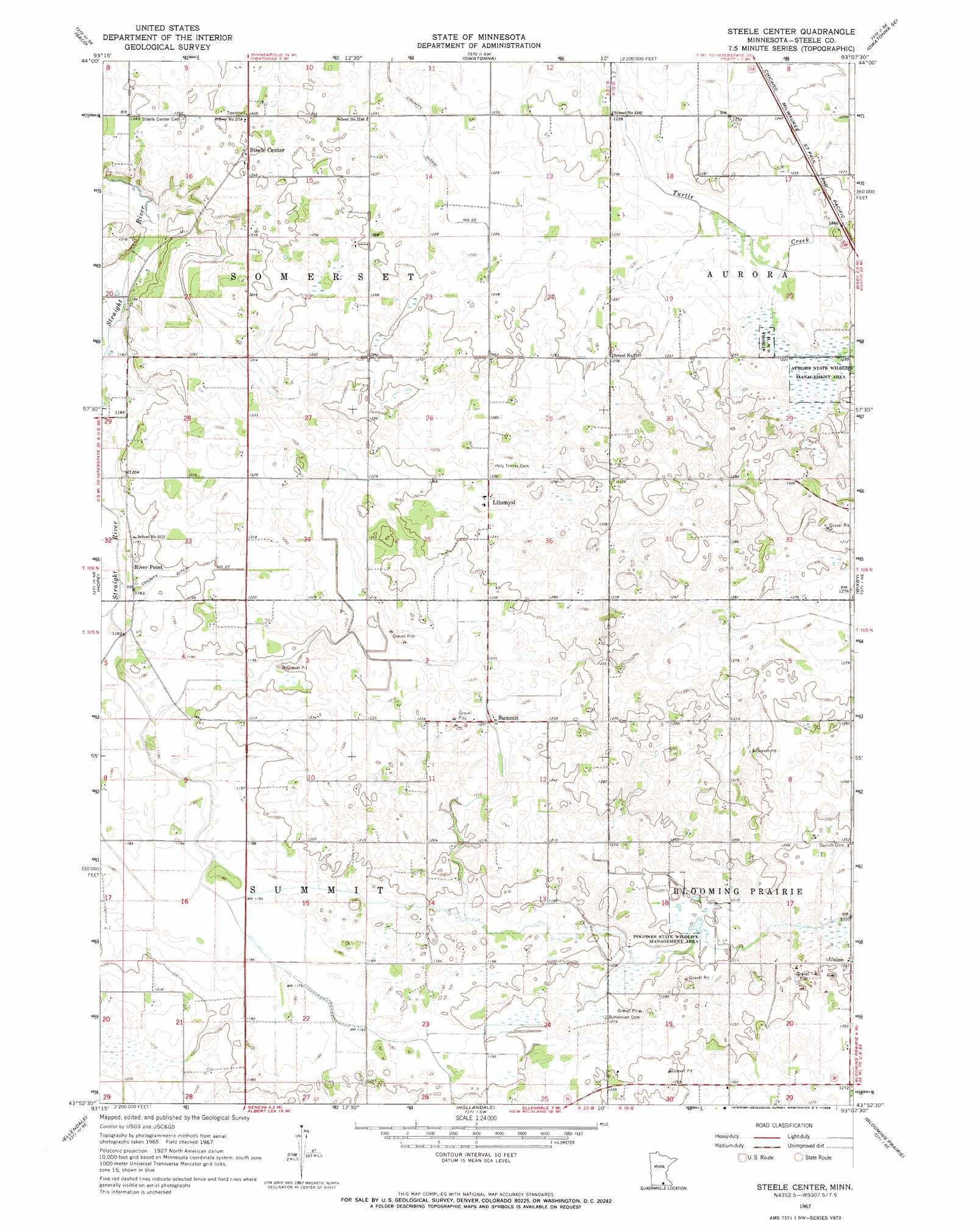
Steele Center Topo Map Minnesota
To zoom in, hover over the map of Steele Center
USGS Topo Quad 43093h2 - 1:24,000 scale
| Topo Map Name: | Steele Center |
| USGS Topo Quad ID: | 43093h2 |
| Print Size: | ca. 21 1/4" wide x 27" high |
| Southeast Coordinates: | 43.875° N latitude / 93.125° W longitude |
| Map Center Coordinates: | 43.9375° N latitude / 93.1875° W longitude |
| U.S. State: | MN |
| Filename: | o43093h2.jpg |
| Download Map JPG Image: | Steele Center topo map 1:24,000 scale |
| Map Type: | Topographic |
| Topo Series: | 7.5´ |
| Map Scale: | 1:24,000 |
| Source of Map Images: | United States Geological Survey (USGS) |
| Alternate Map Versions: |
Steele Center MN 1967, updated 1968 Download PDF Buy paper map Steele Center MN 2010 Download PDF Buy paper map Steele Center MN 2013 Download PDF Buy paper map Steele Center MN 2016 Download PDF Buy paper map |
1:24,000 Topo Quads surrounding Steele Center
Morristown |
Medford West |
Medford East |
Moland |
West Concord |
Meriden |
Saco |
Owatonna |
Owatonna Se |
Claremont |
New Richland |
Hope |
Steele Center |
Bixby |
Hayfield Nw |
Hartland |
Ellendale |
Hollandale |
Blooming Prairie |
Waltham |
Albert Lea West |
Albert Lea East |
Hayward |
Austin West |
Austin East |
> Back to 43093e1 at 1:100,000 scale
> Back to 43092a1 at 1:250,000 scale
> Back to U.S. Topo Maps home
Steele Center topo map: Gazetteer
Steele Center: Canals
County Ditch Number Twentyone elevation 369m 1210′County Ditch Number Twentyseven elevation 363m 1190′
Steele Center: Dams
Donald Anderson Dam elevation 375m 1230′Myron Standke Dam elevation 387m 1269′
Steele Center: Parks
Aurora State Wildlife Management Area elevation 378m 1240′Pogones State Wildlife Management Area elevation 366m 1200′
Steele Center: Populated Places
Litomysl elevation 389m 1276′River Point elevation 360m 1181′
Steele Center elevation 381m 1250′
Summit elevation 372m 1220′
Union elevation 380m 1246′
Steele Center: Post Offices
Riverpoint Post Office (historical) elevation 360m 1181′Steele Center Post Office (historical) elevation 381m 1250′
Steele Center digital topo map on disk
Buy this Steele Center topo map showing relief, roads, GPS coordinates and other geographical features, as a high-resolution digital map file on DVD: