Lennox Topo Map South Dakota
To zoom in, hover over the map of Lennox
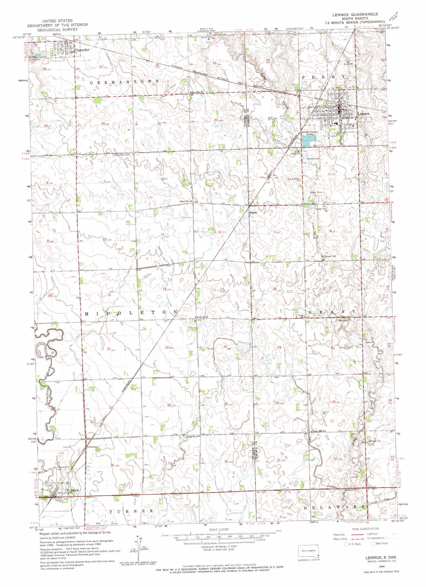
USGS Topo Quad 43096c8 - 1:24,000 scale
| Topo Map Name: | Lennox |
| USGS Topo Quad ID: | 43096c8 |
| Print Size: | ca. 21 1/4" wide x 27" high |
| Southeast Coordinates: | 43.25° N latitude / 96.875° W longitude |
| Map Center Coordinates: | 43.3125° N latitude / 96.9375° W longitude |
| U.S. State: | SD |
| Filename: | o43096c8.jpg |
| Download Map JPG Image: | Lennox topo map 1:24,000 scale |
| Map Type: | Topographic |
| Topo Series: | 7.5´ |
| Map Scale: | 1:24,000 |
| Source of Map Images: | United States Geological Survey (USGS) |
| Alternate Map Versions: |
Lennox SD 1964, updated 1966 Download PDF Buy paper map Lennox SD 2012 Download PDF Buy paper map Lennox SD 2015 Download PDF Buy paper map |
1:24,000 Topo Quads surrounding Lennox
East Vermillion Lake |
Grass Lake |
Hartford South |
Sioux Falls West |
Sioux Falls East |
Parker |
Parker Ne |
Lennox Nw |
Tea |
Harrisburg |
Parker Sw |
Hurley |
Lennox |
Worthing |
Canton Sw |
Center Point |
Viborg |
Beresford Nw |
Beresford Ne |
Alcester Nw |
Irene |
Wakonda |
Centerville |
Beresford |
Alcester |
> Back to 43096a1 at 1:100,000 scale
> Back to 43096a1 at 1:250,000 scale
> Back to U.S. Topo Maps home
Lennox topo map: Gazetteer
Lennox: Populated Places
Chancellor elevation 415m 1361′Davis elevation 381m 1250′
Lennox elevation 411m 1348′
Naomi elevation 404m 1325′
Lennox digital topo map on disk
Buy this Lennox topo map showing relief, roads, GPS coordinates and other geographical features, as a high-resolution digital map file on DVD:
Eastern North Dakota & Eastern South Dakota
Buy digital topo maps: Eastern North Dakota & Eastern South Dakota