Presho 4 Ne Topo Map South Dakota
To zoom in, hover over the map of Presho 4 Ne
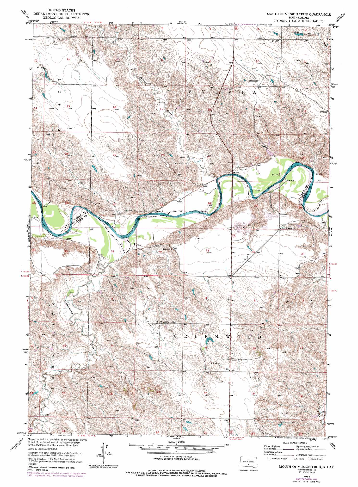
USGS Topo Quad 43100f1 - 1:24,000 scale
| Topo Map Name: | Presho 4 Ne |
| USGS Topo Quad ID: | 43100f1 |
| Print Size: | ca. 21 1/4" wide x 27" high |
| Southeast Coordinates: | 43.625° N latitude / 100° W longitude |
| Map Center Coordinates: | 43.6875° N latitude / 100.0625° W longitude |
| U.S. State: | SD |
| Filename: | o43100f1.jpg |
| Download Map JPG Image: | Presho 4 Ne topo map 1:24,000 scale |
| Map Type: | Topographic |
| Topo Series: | 7.5´ |
| Map Scale: | 1:24,000 |
| Source of Map Images: | United States Geological Survey (USGS) |
| Alternate Map Versions: |
Presho 4 NE SD 1951, updated 1953 Download PDF Buy paper map Mouth of Mission Creek SD 1951, updated 1994 Download PDF Buy paper map Mouth of Mission Creek SD 2012 Download PDF Buy paper map Mouth of Mission Creek SD 2015 Download PDF Buy paper map |
1:24,000 Topo Quads surrounding Presho 4 Ne
Vivian |
Presho Nw |
Presho |
Brakke Dam |
Kennebec |
Vivian Se |
Presho Sw |
Presho Se |
Kennebec Sw |
Kennebec Se |
Badnation |
Presho 4 Nw |
Presho 4 Ne |
Ideal Nw |
Ideal Ne |
Badnation Se |
Two Nation Creek |
Presho 4 Se |
Ideal |
King Dam |
Mosher |
Carter |
Witten |
Miller Hill |
Winner North |
> Back to 43100e1 at 1:100,000 scale
> Back to 43100a1 at 1:250,000 scale
> Back to U.S. Topo Maps home
Presho 4 Ne topo map: Gazetteer
Presho 4 Ne: Dams
Alfred Hutchinson Dam elevation 516m 1692′Archie Millard Number 1 Dam elevation 548m 1797′
Earl Burtz Number 1 Dam elevation 570m 1870′
Earl Burtz Number 2 Dam elevation 513m 1683′
Floyd Sletto Dam elevation 499m 1637′
Presho 4 Ne: Streams
Cottonwood Creek elevation 485m 1591′Mission Creek elevation 477m 1564′
Presho 4 Ne digital topo map on disk
Buy this Presho 4 Ne topo map showing relief, roads, GPS coordinates and other geographical features, as a high-resolution digital map file on DVD:
Eastern North Dakota & Eastern South Dakota
Buy digital topo maps: Eastern North Dakota & Eastern South Dakota