East Of Scotchman Lake Topo Map South Dakota
To zoom in, hover over the map of East Of Scotchman Lake
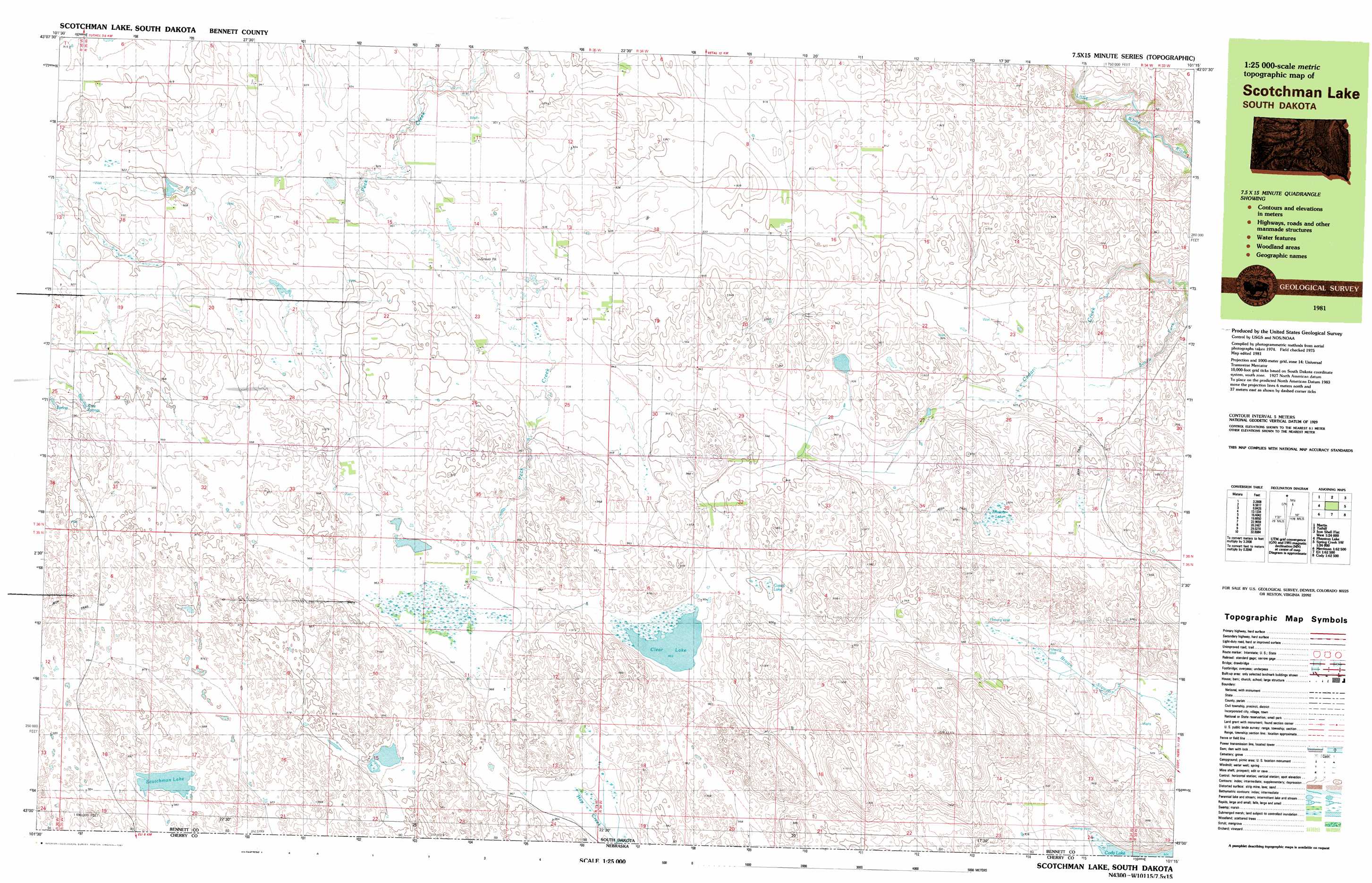
USGS Topo Quad 43101a3 - 1:25,000 scale
| Topo Map Name: | East Of Scotchman Lake |
| USGS Topo Quad ID: | 43101a3 |
| Print Size: | ca. 39" wide x 24" high |
| Southeast Coordinates: | 43° N latitude / 101.25° W longitude |
| Map Center Coordinates: | 43.0625° N latitude / 101.375° W longitude |
| U.S. State: | SD |
| Filename: | k43101a3.jpg |
| Download Map JPG Image: | East Of Scotchman Lake topo map 1:25,000 scale |
| Map Type: | Topographic |
| Topo Series: | 7.5´x15´ |
| Map Scale: | 1:25,000 |
| Source of Map Images: | United States Geological Survey (USGS) |
| Alternate Map Versions: |
Scotchman Lake SD 1981, updated 1981 Download PDF Buy paper map |
1:24,000 Topo Quads surrounding East Of Scotchman Lake
Patricia |
Blackpipe |
Eagle Mans Butte |
Parmelee |
|
Deadmans Lake |
Harrington |
Iron Shell Flat West |
Iron Shell Flat East |
|
Phantom Lake |
East Of Scotchman Lake |
Spring Creek Sw |
Spring Creek |
|
Merriman Ne |
Eli |
Cody West |
Cody East |
Nenzel |
Merriman Se |
Eli Sw |
Eli Se |
Spring Canyon |
Cody Se |
> Back to 43101a1 at 1:100,000 scale
> Back to 43100a1 at 1:250,000 scale
> Back to U.S. Topo Maps home
East Of Scotchman Lake topo map: Gazetteer
East Of Scotchman Lake: Lakes
Clear Lake elevation 953m 3126′Scotchman Lake elevation 978m 3208′
East Of Scotchman Lake: Springs
Rose Springs elevation 975m 3198′East Of Scotchman Lake: Streams
South Fork of Cedar Creek elevation 885m 2903′East Of Scotchman Lake: Swamps
Muskrat Lake elevation 940m 3083′East Of Scotchman Lake digital topo map on disk
Buy this East Of Scotchman Lake topo map showing relief, roads, GPS coordinates and other geographical features, as a high-resolution digital map file on DVD:
Eastern North Dakota & Eastern South Dakota
Buy digital topo maps: Eastern North Dakota & Eastern South Dakota