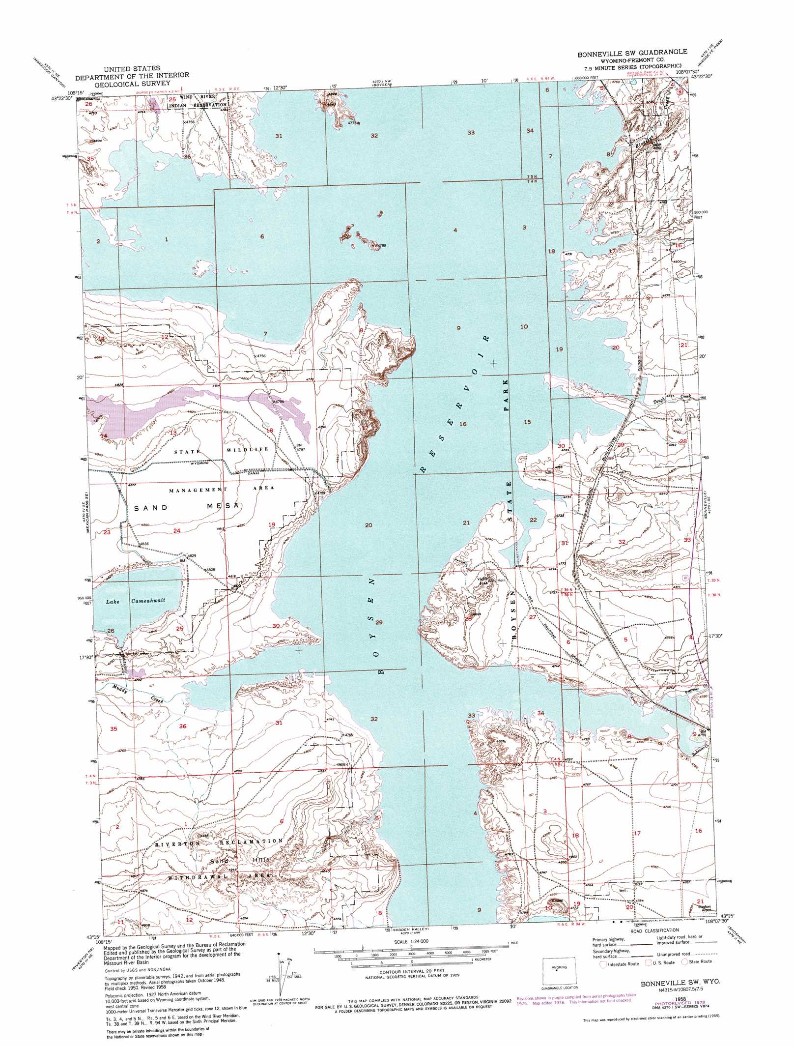
Bonneville Sw Topo Map Wyoming
To zoom in, hover over the map of Bonneville Sw
USGS Topo Quad 43108c2 - 1:24,000 scale
| Topo Map Name: | Bonneville Sw |
| USGS Topo Quad ID: | 43108c2 |
| Print Size: | ca. 21 1/4" wide x 27" high |
| Southeast Coordinates: | 43.25° N latitude / 108.125° W longitude |
| Map Center Coordinates: | 43.3125° N latitude / 108.1875° W longitude |
| U.S. State: | WY |
| Filename: | o43108c2.jpg |
| Download Map JPG Image: | Bonneville Sw topo map 1:24,000 scale |
| Map Type: | Topographic |
| Topo Series: | 7.5´ |
| Map Scale: | 1:24,000 |
| Source of Map Images: | United States Geological Survey (USGS) |
| Alternate Map Versions: |
Bonneville SW WY 1950, updated 1952 Download PDF Buy paper map Bonneville SW WY 1950, updated 1955 Download PDF Buy paper map Bonneville SW WY 1958, updated 1959 Download PDF Buy paper map Bonneville SW WY 1958, updated 1977 Download PDF Buy paper map Bonneville SW WY 1958, updated 1980 Download PDF Buy paper map Bonneville SW WY 2012 Download PDF Buy paper map Bonneville SW WY 2015 Download PDF Buy paper map |
1:24,000 Topo Quads surrounding Bonneville Sw
Potato Butte |
Nostrum Mountain |
Wedding Of The Waters |
Devil Slide |
Blue Hill |
Mexican Pass |
Morrison Canyon |
Boysen |
Birdseye Pass |
Guffy Peak |
Mexican Pass Sw |
Mexican Pass Se |
Bonneville Sw |
Bonneville |
Picard Ranch |
Lost Wells Butte |
Riverton Ne |
Hidden Valley |
Shoshoni |
Ocla Draw |
Riverton West |
Riverton East |
Indian Butte |
Fuller Reservoir |
Haybarn Hill |
> Back to 43108a1 at 1:100,000 scale
> Back to 43108a1 at 1:250,000 scale
> Back to U.S. Topo Maps home
Bonneville Sw topo map: Gazetteer
Bonneville Sw: Dams
Sand Mesa Number 1 Dam elevation 1482m 4862′Sand Mesa Number 2 Dam elevation 1464m 4803′
Bonneville Sw: Mines
Prong Horn Number Fourteen Mine elevation 1452m 4763′Bonneville Sw: Ranges
Sand Hills elevation 1502m 4927′Bonneville Sw: Reservoirs
Sand Mesa Number 1 Reservoir elevation 1482m 4862′Sand Mesa Number 2 Reservoir elevation 1464m 4803′
Bonneville Sw: Streams
Badwater Creek elevation 1441m 4727′Birdseye Creek elevation 1441m 4727′
Muddy Creek elevation 1441m 4727′
Reservoir Creek elevation 1441m 4727′
Tough Creek elevation 1441m 4727′
Bonneville Sw digital topo map on disk
Buy this Bonneville Sw topo map showing relief, roads, GPS coordinates and other geographical features, as a high-resolution digital map file on DVD: