Milk Creek Topo Map Wyoming
To zoom in, hover over the map of Milk Creek
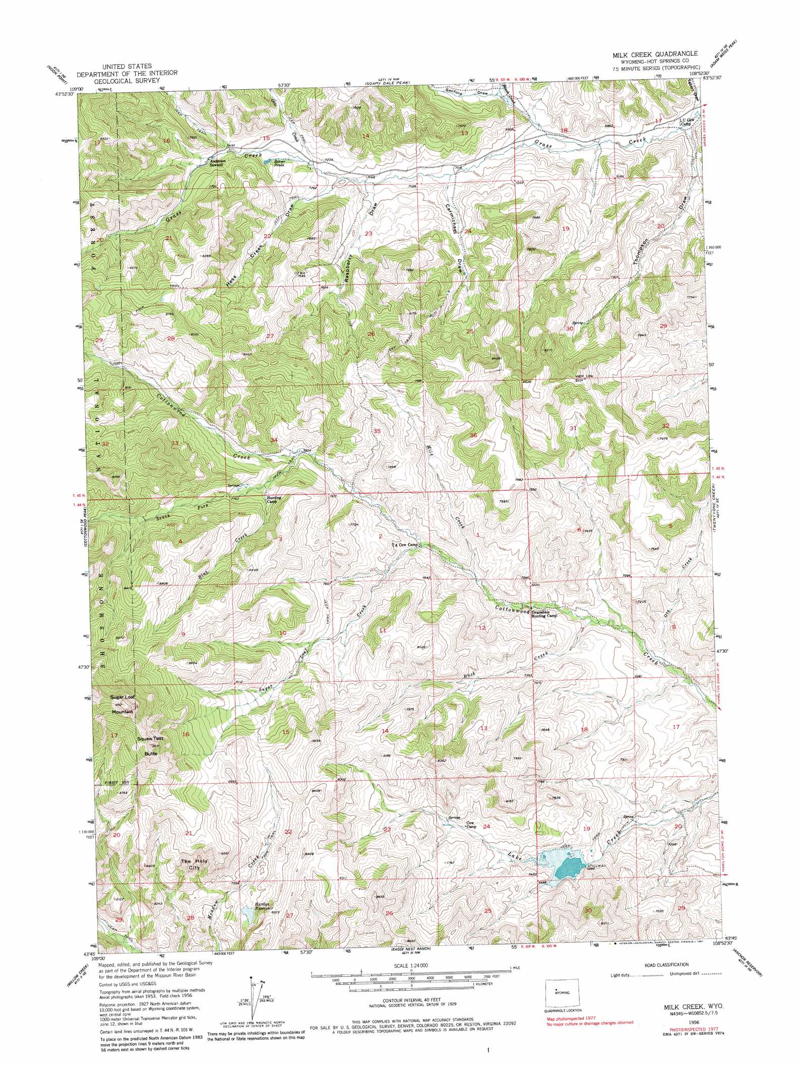
USGS Topo Quad 43108g8 - 1:24,000 scale
| Topo Map Name: | Milk Creek |
| USGS Topo Quad ID: | 43108g8 |
| Print Size: | ca. 21 1/4" wide x 27" high |
| Southeast Coordinates: | 43.75° N latitude / 108.875° W longitude |
| Map Center Coordinates: | 43.8125° N latitude / 108.9375° W longitude |
| U.S. State: | WY |
| Filename: | o43108g8.jpg |
| Download Map JPG Image: | Milk Creek topo map 1:24,000 scale |
| Map Type: | Topographic |
| Topo Series: | 7.5´ |
| Map Scale: | 1:24,000 |
| Source of Map Images: | United States Geological Survey (USGS) |
| Alternate Map Versions: |
Milk Creek WY 1956, updated 1958 Download PDF Buy paper map Milk Creek WY 1956, updated 1967 Download PDF Buy paper map Milk Creek WY 1956, updated 1981 Download PDF Buy paper map Milk Creek WY 1991, updated 1997 Download PDF Buy paper map Milk Creek WY 2012 Download PDF Buy paper map Milk Creek WY 2015 Download PDF Buy paper map |
| FStopo: | US Forest Service topo Milk Creek is available: Download FStopo PDF Download FStopo TIF |
1:24,000 Topo Quads surrounding Milk Creek
Pitchfork |
Sunshine Reservoir |
Iron Creek |
Little Buffalo Basin |
Hillberry Rim |
Dick Creek Lakes |
Noon Point |
Soapy Dale Peak |
Adam Weiss Peak |
Grass Creek |
Twin Peaks |
Cottonwood Peak |
Milk Creek |
Twentyone Creek |
Crater Sink |
Monument Peak |
Willow Creek |
Eagle Nest Ranch |
Anchor Reservoir |
Embar |
Johnson Draw |
Circle Ridge |
Antelope Ridge |
Bargee |
Sheep Ridge |
> Back to 43108e1 at 1:100,000 scale
> Back to 43108a1 at 1:250,000 scale
> Back to U.S. Topo Maps home
Milk Creek topo map: Gazetteer
Milk Creek: Dams
Lake Creek Dam elevation 2281m 7483′Milk Creek: Lakes
Twin Lakes elevation 2592m 8503′Milk Creek: Pillars
The Holy City elevation 2533m 8310′Milk Creek: Reservoirs
Hardys Reservoir elevation 2406m 7893′Lake Creek Reservoir elevation 2281m 7483′
Milk Creek: Streams
Blue Creek elevation 2339m 7673′Buck Creek elevation 2108m 6916′
Milk Creek elevation 2167m 7109′
Ota Creek elevation 2076m 6811′
Otto Creek elevation 2205m 7234′
Roach Creek elevation 2126m 6975′
South Fork Cottonwood Creek elevation 2294m 7526′
Sugar Loaf Creek elevation 2222m 7290′
Milk Creek: Summits
Squaw Teat Butte elevation 2842m 9324′Sugar Loaf Mountain elevation 2938m 9639′
Milk Creek: Valleys
Carmichael Draw elevation 2140m 7020′Hess Creek Draw elevation 2186m 7171′
Raspberry Draw elevation 2171m 7122′
Sanford Draw elevation 2082m 6830′
Sanford Draw elevation 2082m 6830′
Thompson Draw elevation 2052m 6732′
Milk Creek digital topo map on disk
Buy this Milk Creek topo map showing relief, roads, GPS coordinates and other geographical features, as a high-resolution digital map file on DVD: