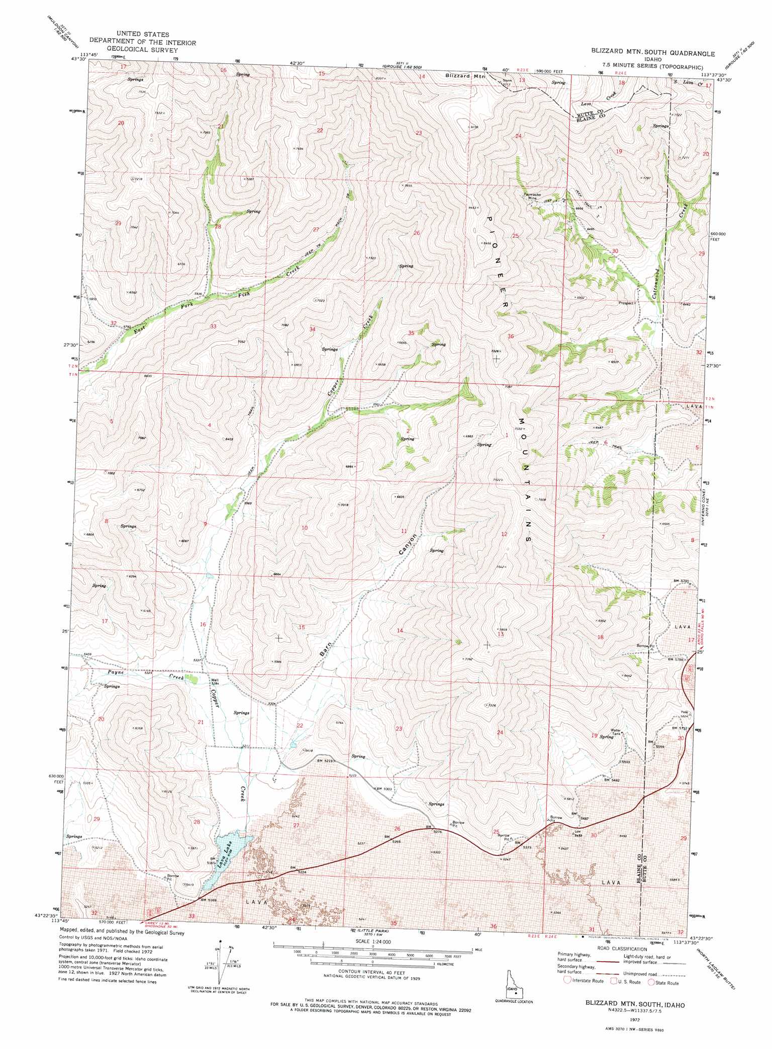
Blizzard Mountain South Topo Map Idaho
To zoom in, hover over the map of Blizzard Mountain South
USGS Topo Quad 43113d6 - 1:24,000 scale
| Topo Map Name: | Blizzard Mountain South |
| USGS Topo Quad ID: | 43113d6 |
| Print Size: | ca. 21 1/4" wide x 27" high |
| Southeast Coordinates: | 43.375° N latitude / 113.625° W longitude |
| Map Center Coordinates: | 43.4375° N latitude / 113.6875° W longitude |
| U.S. State: | ID |
| Filename: | o43113d6.jpg |
| Download Map JPG Image: | Blizzard Mountain South topo map 1:24,000 scale |
| Map Type: | Topographic |
| Topo Series: | 7.5´ |
| Map Scale: | 1:24,000 |
| Source of Map Images: | United States Geological Survey (USGS) |
| Alternate Map Versions: |
Blizzard Mtn South ID 1972, updated 1976 Download PDF Buy paper map Blizzard Mountain South ID 2010 Download PDF Buy paper map Blizzard Mountain South ID 2013 Download PDF Buy paper map |
1:24,000 Topo Quads surrounding Blizzard Mountain South
Star Hope Mine |
Smiley Mountain |
Miller Peak |
Grouse |
Appendicitis Hill |
Muldoon |
Trail Creek |
Blizzard Mountain North |
Champagne Creek |
Nichols Reservoir |
Lake Hills |
Fish Creek Reservoir |
Blizzard Mountain South |
Inferno Cone |
The Watchman |
Carey |
Paddelford Flat |
Little Park |
North Laidlaw Butte |
Fissure Butte |
Pagari Well |
Wagon Butte |
Laidlaw Butte |
Bear Den Butte |
Bear Park West |
> Back to 43113a1 at 1:100,000 scale
> Back to 43112a1 at 1:250,000 scale
> Back to U.S. Topo Maps home
Blizzard Mountain South topo map: Gazetteer
Blizzard Mountain South: Lakes
Lava Lake elevation 1573m 5160′Blizzard Mountain South: Mines
Paymaster Mine elevation 2176m 7139′Blizzard Mountain South: Streams
Copper Creek elevation 1574m 5164′Cottonwood Creek elevation 1793m 5882′
Blizzard Mountain South: Valleys
Barn Canyon elevation 1602m 5255′Blizzard Mountain South digital topo map on disk
Buy this Blizzard Mountain South topo map showing relief, roads, GPS coordinates and other geographical features, as a high-resolution digital map file on DVD: