Mahogany Gap Topo Map Oregon
To zoom in, hover over the map of Mahogany Gap
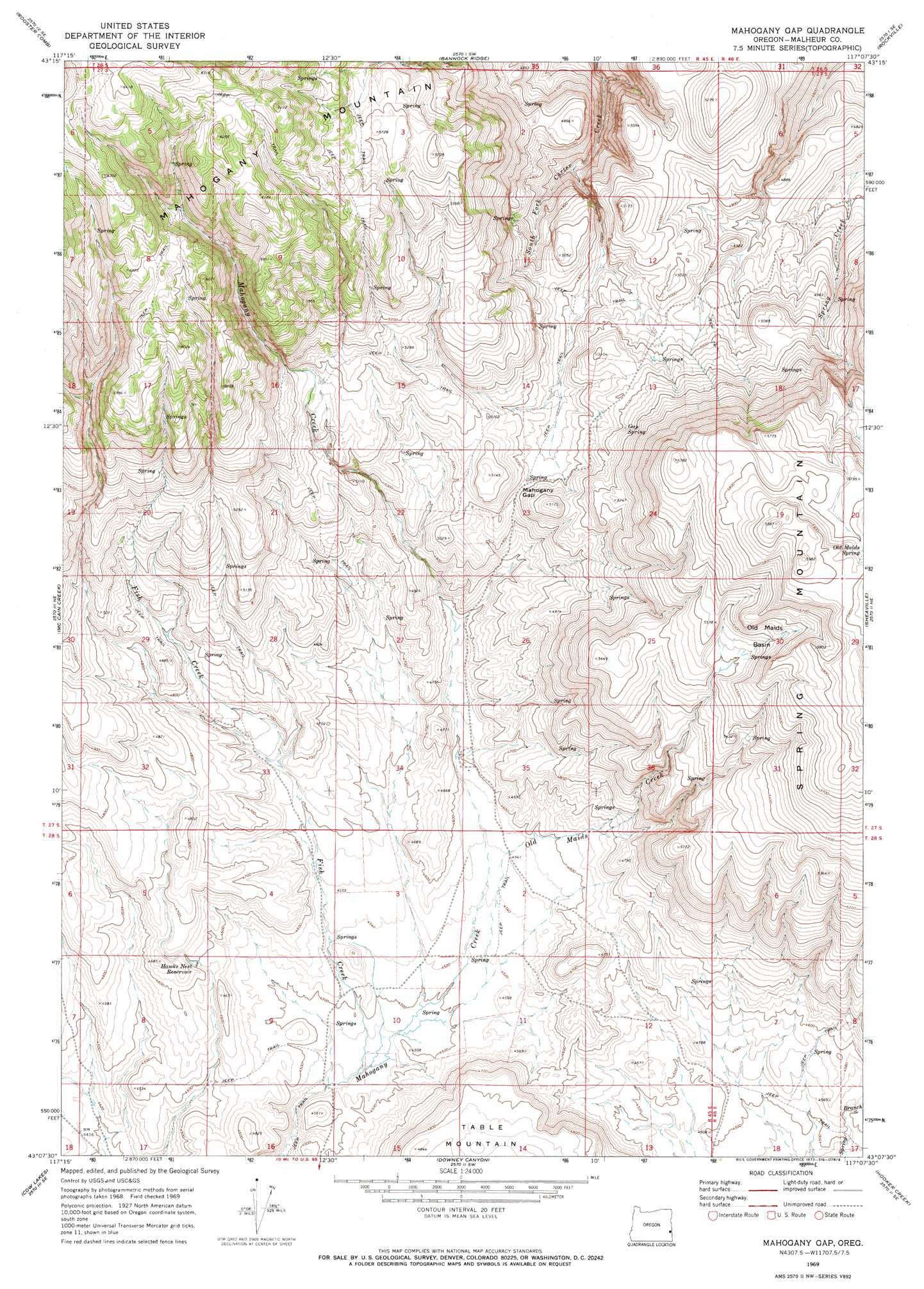
USGS Topo Quad 43117b2 - 1:24,000 scale
| Topo Map Name: | Mahogany Gap |
| USGS Topo Quad ID: | 43117b2 |
| Print Size: | ca. 21 1/4" wide x 27" high |
| Southeast Coordinates: | 43.125° N latitude / 117.125° W longitude |
| Map Center Coordinates: | 43.1875° N latitude / 117.1875° W longitude |
| U.S. State: | OR |
| Filename: | o43117b2.jpg |
| Download Map JPG Image: | Mahogany Gap topo map 1:24,000 scale |
| Map Type: | Topographic |
| Topo Series: | 7.5´ |
| Map Scale: | 1:24,000 |
| Source of Map Images: | United States Geological Survey (USGS) |
| Alternate Map Versions: |
Mahogany Gap OR 1969, updated 1973 Download PDF Buy paper map Mahogany Gap OR 2011 Download PDF Buy paper map Mahogany Gap OR 2014 Download PDF Buy paper map |
1:24,000 Topo Quads surrounding Mahogany Gap
Quartz Mountain Basin |
Pelican Point |
Three Fingers Rock |
Pole Creek Top |
Jump Creek Canyon |
Diamond Butte |
Rooster Comb |
Bannock Ridge |
Rockville |
Piute Butte |
Jordan Craters North |
Mccain Creek |
Mahogany Gap |
Sheaville |
Captain Butte |
Jordan Craters South |
Cow Lakes |
Downey Canyon |
Hooker Creek |
Swisher Mountain |
Threemile Hill |
Danner |
Antelope Reservoir |
Jordan Valley |
Stonehouse Creek |
> Back to 43117a1 at 1:100,000 scale
> Back to 43116a1 at 1:250,000 scale
> Back to U.S. Topo Maps home
Mahogany Gap topo map: Gazetteer
Mahogany Gap: Basins
Old Maids Basin elevation 1647m 5403′Mahogany Gap: Gaps
Mahogany Gap elevation 1524m 5000′Mahogany Gap: Reservoirs
Hawks Nest Reservoir elevation 1400m 4593′Mahogany Gap: Ridges
Spring Mountain elevation 1796m 5892′Mahogany Gap: Springs
Gap Spring elevation 1569m 5147′Ninemeyer Spring elevation 1385m 4543′
Old Maids Spring elevation 1771m 5810′
Mahogany Gap: Streams
Fish Creek elevation 1360m 4461′Old Maids Creek elevation 1366m 4481′
Mahogany Gap digital topo map on disk
Buy this Mahogany Gap topo map showing relief, roads, GPS coordinates and other geographical features, as a high-resolution digital map file on DVD: