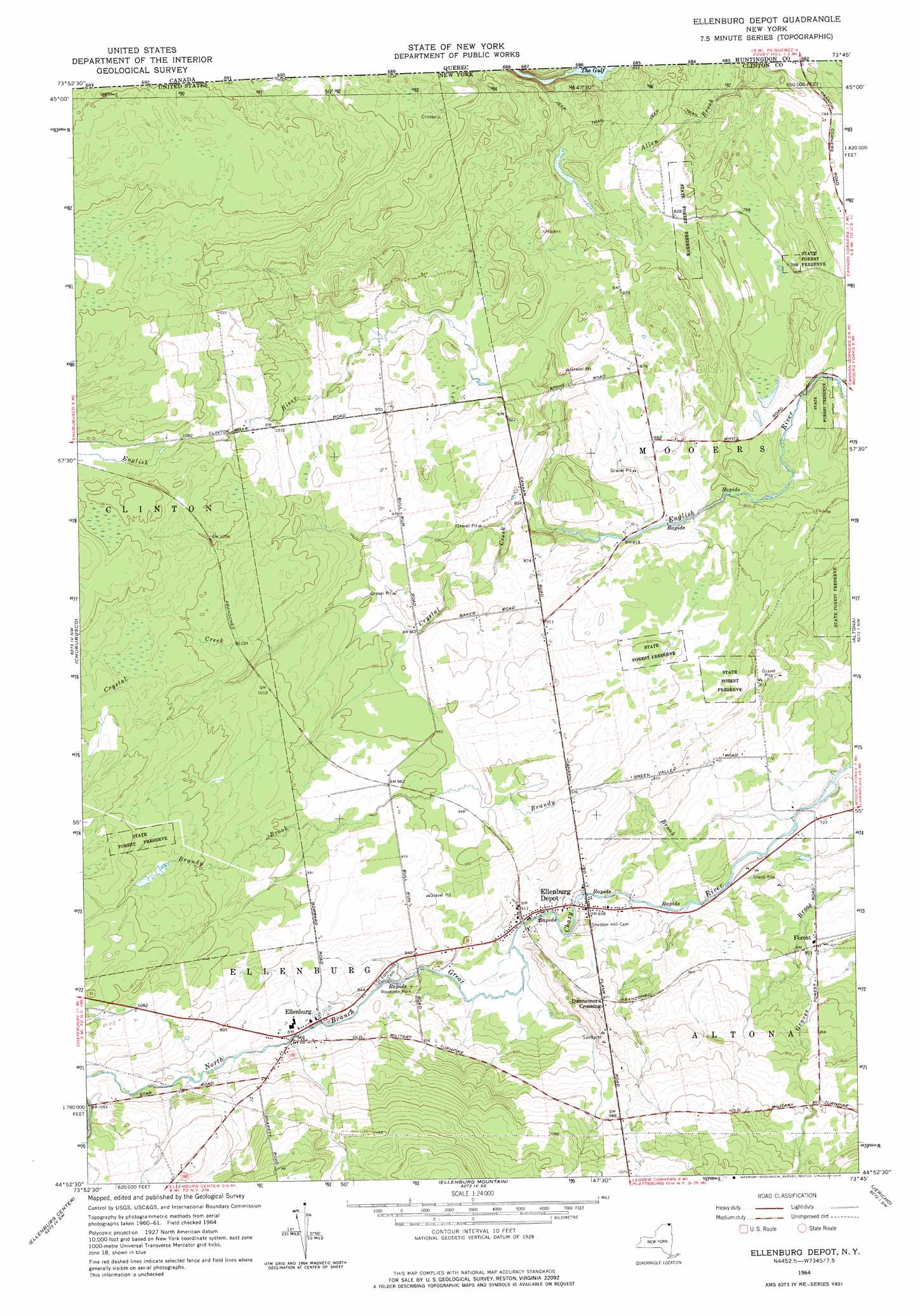
Ellenburg Depot Topo Map New York
To zoom in, hover over the map of Ellenburg Depot
USGS Topo Quad 44073h7 - 1:24,000 scale
| Topo Map Name: | Ellenburg Depot |
| USGS Topo Quad ID: | 44073h7 |
| Print Size: | ca. 21 1/4" wide x 27" high |
| Southeast Coordinates: | 44.875° N latitude / 73.75° W longitude |
| Map Center Coordinates: | 44.9375° N latitude / 73.8125° W longitude |
| U.S. State: | NY |
| Filename: | o44073h7.jpg |
| Download Map JPG Image: | Ellenburg Depot topo map 1:24,000 scale |
| Map Type: | Topographic |
| Topo Series: | 7.5´ |
| Map Scale: | 1:24,000 |
| Source of Map Images: | United States Geological Survey (USGS) |
| Alternate Map Versions: |
Ellenburg Depot NY 1964, updated 1966 Download PDF Buy paper map Ellenburg Depot NY 1964, updated 1976 Download PDF Buy paper map Ellenburg Depot NY 2010 Download PDF Buy paper map Ellenburg Depot NY 2013 Download PDF Buy paper map Ellenburg Depot NY 2016 Download PDF Buy paper map |
1:24,000 Topo Quads surrounding Ellenburg Depot
Chateaugay |
Churubusco |
Ellenburg Depot |
Altona |
Mooers |
Brainardsville |
Ellenburg Center |
Ellenburg Mountain |
Jericho |
West Chazy |
Ragged Lake |
Lyon Mountain |
Moffitsville |
Dannemora |
Morrisonville |
> Back to 44073e1 at 1:100,000 scale
> Back to 44072a1 at 1:250,000 scale
> Back to U.S. Topo Maps home
Ellenburg Depot topo map: Gazetteer
Ellenburg Depot: Populated Places
Dannemora Crossing elevation 266m 872′Ellenburg elevation 293m 961′
Ellenburg Depot elevation 266m 872′
Forest elevation 241m 790′
Ellenburg Depot: Streams
Brandy Brook elevation 213m 698′Crystal Creek elevation 246m 807′
Ellenburg Depot digital topo map on disk
Buy this Ellenburg Depot topo map showing relief, roads, GPS coordinates and other geographical features, as a high-resolution digital map file on DVD:
New York, Vermont, Connecticut & Western Massachusetts
Buy digital topo maps: New York, Vermont, Connecticut & Western Massachusetts