Glen Arbor Topo Map Michigan
To zoom in, hover over the map of Glen Arbor
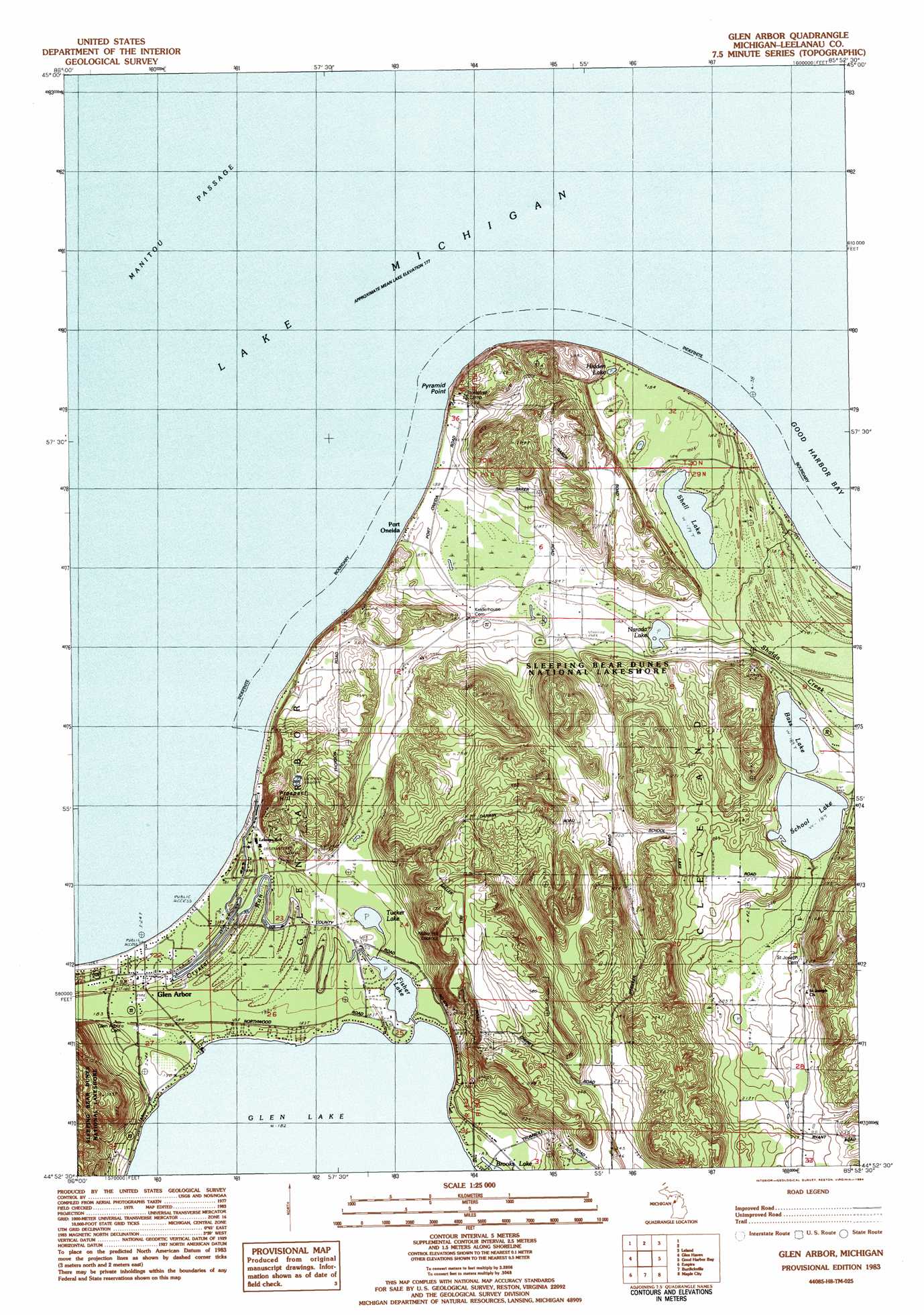
USGS Topo Quad 44085h8 - 1:25,000 scale
| Topo Map Name: | Glen Arbor |
| USGS Topo Quad ID: | 44085h8 |
| Print Size: | ca. 21 1/4" wide x 27" high |
| Southeast Coordinates: | 44.875° N latitude / 85.875° W longitude |
| Map Center Coordinates: | 44.9375° N latitude / 85.9375° W longitude |
| U.S. State: | MI |
| Filename: | l44085h8.jpg |
| Download Map JPG Image: | Glen Arbor topo map 1:25,000 scale |
| Map Type: | Topographic |
| Topo Series: | 7.5´ |
| Map Scale: | 1:25,000 |
| Source of Map Images: | United States Geological Survey (USGS) |
| Alternate Map Versions: |
Glen Arbor MI 1983, updated 1984 Download PDF Buy paper map |
1:24,000 Topo Quads surrounding Glen Arbor
Northport Nw |
||||
South Manitou Island |
North Manitou Island |
Leland |
Gills Pier |
|
Glen Haven |
Glen Arbor |
Good Harbor Bay |
Suttons Bay |
|
Empire |
Burdickville |
Maple City |
Traverse City Sw |
|
Frankfort |
Beulah |
Platte River |
Lake Ann |
Grawn |
> Back to 44085e1 at 1:100,000 scale
> Back to 44084a1 at 1:250,000 scale
> Back to U.S. Topo Maps home
Glen Arbor topo map: Gazetteer
Glen Arbor: Bars
Pyramid Point Shoal elevation 177m 580′Glen Arbor: Capes
Pyramid Point elevation 202m 662′Glen Arbor: Lakes
Bass Lake elevation 188m 616′Fisher Lake elevation 181m 593′
Hatt Pond elevation 180m 590′
Hidden Lake elevation 180m 590′
Narada Lake elevation 178m 583′
School Lake elevation 188m 616′
Shell Lake elevation 178m 583′
Tucker Lake elevation 181m 593′
Glen Arbor: Populated Places
Glen Arbor elevation 180m 590′Leelanau Schools elevation 181m 593′
Port Oneida elevation 190m 623′
Glen Arbor: Post Offices
Glen Arbor Post Office (historical) elevation 180m 590′Miller Hill Post Office (historical) elevation 314m 1030′
North Unity Post Office (historical) elevation 179m 587′
Port Oneida Post Office (historical) elevation 190m 623′
Glen Arbor: Streams
Crystal River elevation 180m 590′Shalda Creek elevation 177m 580′
Glen Arbor: Summits
Prospect Hill elevation 263m 862′Glen Arbor digital topo map on disk
Buy this Glen Arbor topo map showing relief, roads, GPS coordinates and other geographical features, as a high-resolution digital map file on DVD: