Suttons Bay Topo Map Michigan
To zoom in, hover over the map of Suttons Bay
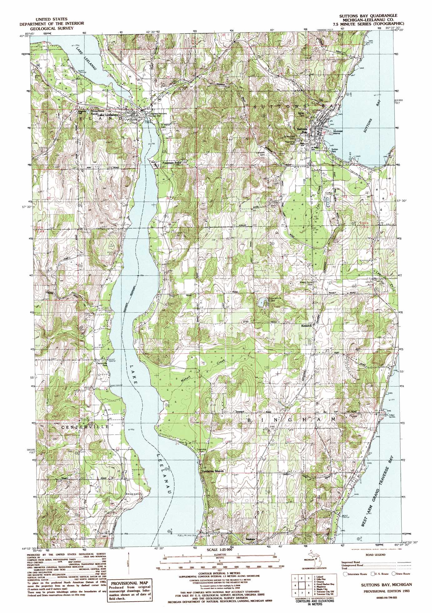
USGS Topo Quad 44085h6 - 1:25,000 scale
| Topo Map Name: | Suttons Bay |
| USGS Topo Quad ID: | 44085h6 |
| Print Size: | ca. 21 1/4" wide x 27" high |
| Southeast Coordinates: | 44.875° N latitude / 85.625° W longitude |
| Map Center Coordinates: | 44.9375° N latitude / 85.6875° W longitude |
| U.S. State: | MI |
| Filename: | l44085h6.jpg |
| Download Map JPG Image: | Suttons Bay topo map 1:25,000 scale |
| Map Type: | Topographic |
| Topo Series: | 7.5´ |
| Map Scale: | 1:25,000 |
| Source of Map Images: | United States Geological Survey (USGS) |
| Alternate Map Versions: |
Suttons Bay MI 1983, updated 1984 Download PDF Buy paper map |
1:24,000 Topo Quads surrounding Suttons Bay
Northport Nw |
Northport |
|||
North Manitou Island |
Leland |
Gills Pier |
Omena |
|
Glen Arbor |
Good Harbor Bay |
Suttons Bay |
Mapleton |
Elk Rapids |
Burdickville |
Maple City |
Traverse City Sw |
Traverse City Se |
Williamsburg |
Platte River |
Lake Ann |
Grawn |
Mayfield |
Jacks Landing |
> Back to 44085e1 at 1:100,000 scale
> Back to 44084a1 at 1:250,000 scale
> Back to U.S. Topo Maps home
Suttons Bay topo map: Gazetteer
Suttons Bay: Bays
Suttons Bay elevation 177m 580′Suttons Bay: Lakes
Lake Leelanau elevation 179m 587′Lawrence Lake elevation 197m 646′
Provemont Pond elevation 198m 649′
Suttons Bay: Parks
Bingham District Number Five Schoolhouse Historical Marker elevation 221m 725′Bingham Township Park elevation 183m 600′
Centerville Park elevation 180m 590′
Sutton Park elevation 179m 587′
Suttons Bay: Populated Places
Bingham elevation 220m 721′Fountain Point elevation 187m 613′
Keswick elevation 225m 738′
Lake Leelanau elevation 188m 616′
Leelanau Shores elevation 188m 616′
Suttons Bay elevation 182m 597′
Suttons Bay: Post Offices
Bingham Post Office (historical) elevation 219m 718′Keswick Post Office (historical) elevation 225m 738′
Lake Leelanau Post Office elevation 186m 610′
Suttons Bay Post Office elevation 181m 593′
Suttons Bay: Streams
Leo Creek elevation 179m 587′Merbert Creek elevation 180m 590′
Suttons Bay digital topo map on disk
Buy this Suttons Bay topo map showing relief, roads, GPS coordinates and other geographical features, as a high-resolution digital map file on DVD: