Oshkosh Ne Topo Map Wisconsin
To zoom in, hover over the map of Oshkosh Ne
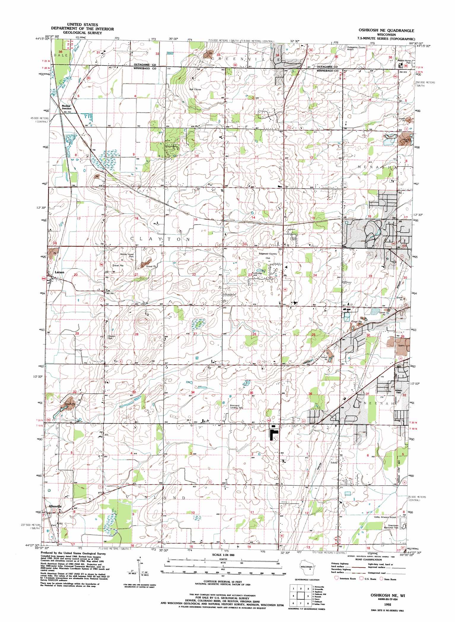
USGS Topo Quad 44088b5 - 1:24,000 scale
| Topo Map Name: | Oshkosh Ne |
| USGS Topo Quad ID: | 44088b5 |
| Print Size: | ca. 21 1/4" wide x 27" high |
| Southeast Coordinates: | 44.125° N latitude / 88.5° W longitude |
| Map Center Coordinates: | 44.1875° N latitude / 88.5625° W longitude |
| U.S. State: | WI |
| Filename: | o44088b5.jpg |
| Download Map JPG Image: | Oshkosh Ne topo map 1:24,000 scale |
| Map Type: | Topographic |
| Topo Series: | 7.5´ |
| Map Scale: | 1:24,000 |
| Source of Map Images: | United States Geological Survey (USGS) |
| Alternate Map Versions: |
Oshkosh NE WI 1961, updated 1966 Download PDF Buy paper map Oshkosh NE WI 1961, updated 1977 Download PDF Buy paper map Oshkosh NE WI 1961, updated 1986 Download PDF Buy paper map Oshkosh NE WI 1992, updated 1996 Download PDF Buy paper map Oshkosh NE WI 2010 Download PDF Buy paper map Oshkosh NE WI 2013 Download PDF Buy paper map Oshkosh NE WI 2016 Download PDF Buy paper map |
1:24,000 Topo Quads surrounding Oshkosh Ne
Northport |
New London |
Shiocton |
Black Creek |
Freedom |
Readfield |
Hortonville |
Greenville |
Appleton |
Kaukauna |
Lake Poygan |
Oshkosh Nw |
Oshkosh Ne |
Neenah |
Sherwood |
Eureka |
Omro |
Oshkosh |
Indian Point |
Stockbridge |
Rush Lake |
Pickett |
Van Dyne |
Fahrney Point |
Brothertown |
> Back to 44088a1 at 1:100,000 scale
> Back to 44088a1 at 1:250,000 scale
> Back to U.S. Topo Maps home
Oshkosh Ne topo map: Gazetteer
Oshkosh Ne: Airports
Brennand Airport elevation 258m 846′Oshkosh Ne: Parks
Oshkosh-Larsen Trail Prairies State Natural Area elevation 242m 793′Oshkosh Ne: Populated Places
Allenville elevation 249m 816′Larsen elevation 235m 770′
Medina Junction elevation 232m 761′
Oshkosh Ne digital topo map on disk
Buy this Oshkosh Ne topo map showing relief, roads, GPS coordinates and other geographical features, as a high-resolution digital map file on DVD: