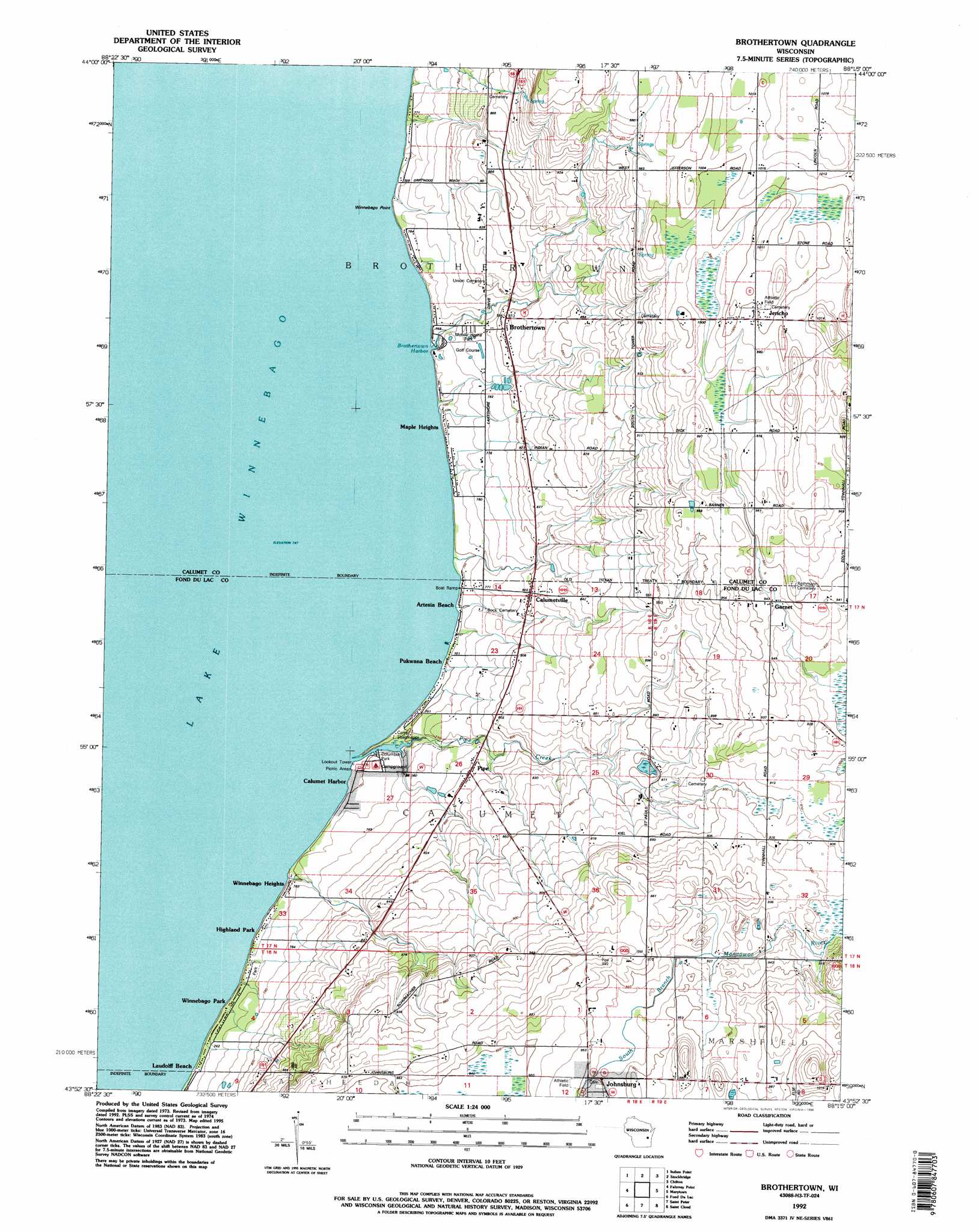
Brothertown Topo Map Wisconsin
To zoom in, hover over the map of Brothertown
USGS Topo Quad 43088h3 - 1:24,000 scale
| Topo Map Name: | Brothertown |
| USGS Topo Quad ID: | 43088h3 |
| Print Size: | ca. 21 1/4" wide x 27" high |
| Southeast Coordinates: | 43.875° N latitude / 88.25° W longitude |
| Map Center Coordinates: | 43.9375° N latitude / 88.3125° W longitude |
| U.S. State: | WI |
| Filename: | o43088h3.jpg |
| Download Map JPG Image: | Brothertown topo map 1:24,000 scale |
| Map Type: | Topographic |
| Topo Series: | 7.5´ |
| Map Scale: | 1:24,000 |
| Source of Map Images: | United States Geological Survey (USGS) |
| Alternate Map Versions: |
Brothertown WI 1974, updated 1978 Download PDF Buy paper map Brothertown WI 1992, updated 1996 Download PDF Buy paper map Brothertown WI 2011 Download PDF Buy paper map Brothertown WI 2013 Download PDF Buy paper map Brothertown WI 2015 Download PDF Buy paper map |
1:24,000 Topo Quads surrounding Brothertown
Oshkosh Ne |
Neenah |
Sherwood |
Hilbert |
Brillion |
Oshkosh |
Indian Point |
Stockbridge |
Chilton |
Potter |
Van Dyne |
Fahrney Point |
Brothertown |
Marytown |
Kiel |
Eldorado |
Fond Du Lac |
Saint Peter |
Saint Cloud |
Elkhart Lake |
Oakfield |
Byron |
Eden |
Dundee |
Cascade |
> Back to 43088e1 at 1:100,000 scale
> Back to 43088a1 at 1:250,000 scale
> Back to U.S. Topo Maps home
Brothertown topo map: Gazetteer
Brothertown: Bays
Brothertown Harbor elevation 228m 748′Brothertown: Capes
Winnebago Point elevation 229m 751′Brothertown: Parks
Columbia Park elevation 229m 751′Brothertown: Populated Places
Artesia Beach elevation 229m 751′Brothertown elevation 246m 807′
Calumet Harbor elevation 229m 751′
Calumetville elevation 244m 800′
Garnet elevation 287m 941′
Highland Park elevation 233m 764′
Jericho elevation 304m 997′
Johnsburg elevation 288m 944′
Laudolff Beach elevation 231m 757′
Maple Heights elevation 233m 764′
Pipe elevation 245m 803′
Pukwana Beach elevation 229m 751′
Winnebago Heights elevation 233m 764′
Winnebago Park elevation 232m 761′
Brothertown: Streams
Pipe Creek elevation 228m 748′Brothertown digital topo map on disk
Buy this Brothertown topo map showing relief, roads, GPS coordinates and other geographical features, as a high-resolution digital map file on DVD: