Abrams Topo Map Wisconsin
To zoom in, hover over the map of Abrams
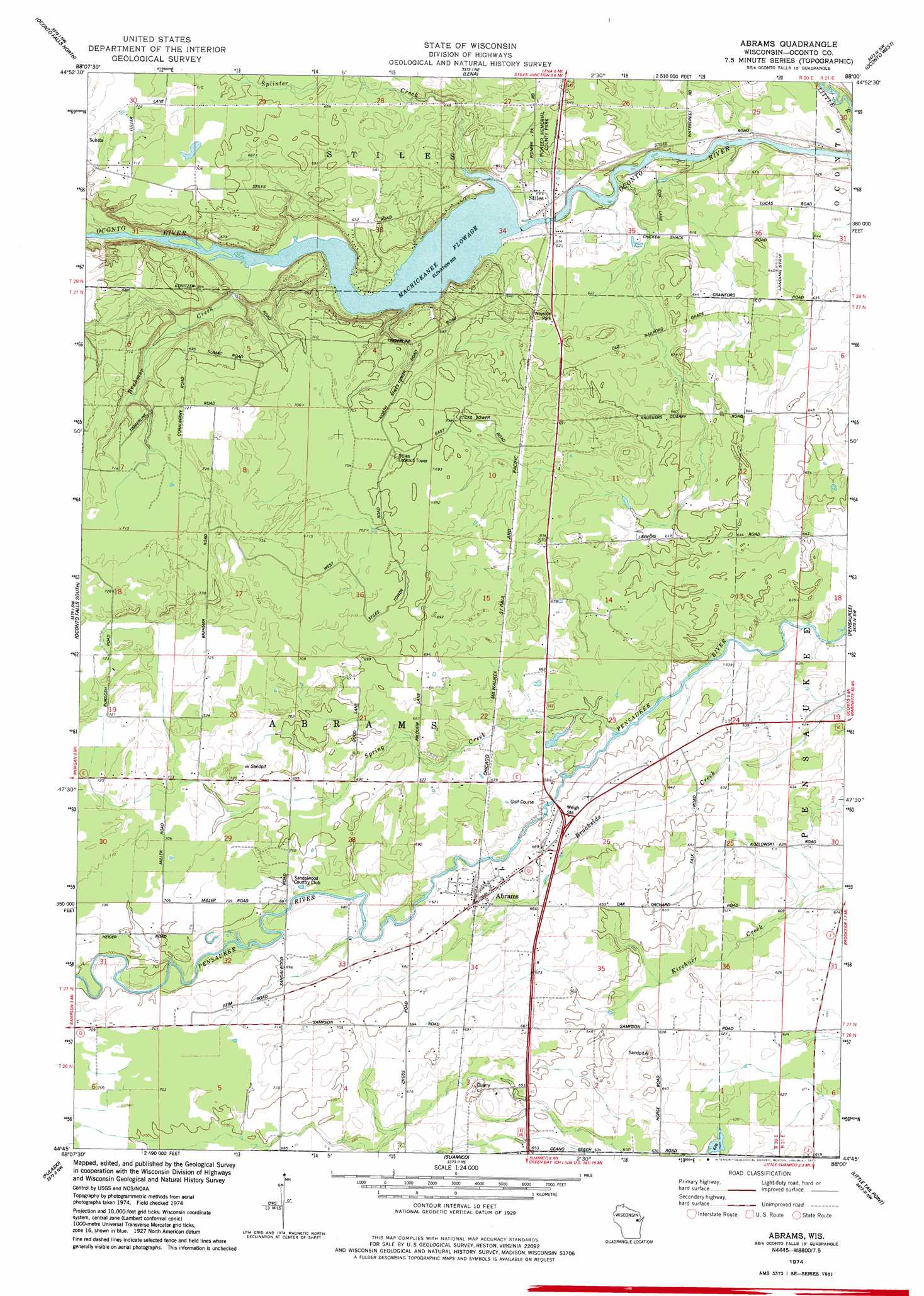
USGS Topo Quad 44088g1 - 1:24,000 scale
| Topo Map Name: | Abrams |
| USGS Topo Quad ID: | 44088g1 |
| Print Size: | ca. 21 1/4" wide x 27" high |
| Southeast Coordinates: | 44.75° N latitude / 88° W longitude |
| Map Center Coordinates: | 44.8125° N latitude / 88.0625° W longitude |
| U.S. State: | WI |
| Filename: | o44088g1.jpg |
| Download Map JPG Image: | Abrams topo map 1:24,000 scale |
| Map Type: | Topographic |
| Topo Series: | 7.5´ |
| Map Scale: | 1:24,000 |
| Source of Map Images: | United States Geological Survey (USGS) |
| Alternate Map Versions: |
Abrams WI 1974, updated 1977 Download PDF Buy paper map Abrams WI 2010 Download PDF Buy paper map Abrams WI 2013 Download PDF Buy paper map Abrams WI 2016 Download PDF Buy paper map |
1:24,000 Topo Quads surrounding Abrams
Hickory Corners |
Kelly Lake |
Coleman |
Porterfiled Sw |
Harmony |
Gillett |
Oconto Falls North |
Lena |
Oconto West |
Oconto East |
Krakow |
Oconto Falls South |
Abrams |
Pensaukee |
Oconto Se |
Zachow |
Pulaski |
Suamico |
Little Tail Point |
Dyckesville |
Seymour |
Oneida North |
Green Bay West |
Green Bay East |
New Franken |
> Back to 44088e1 at 1:100,000 scale
> Back to 44088a1 at 1:250,000 scale
> Back to U.S. Topo Maps home
Abrams topo map: Gazetteer
Abrams: Dams
Stiles 2WP550 Dam elevation 192m 629′Abrams: Parks
Pioneer Memorial County Park elevation 199m 652′Abrams: Populated Places
Abrams elevation 207m 679′Stiles elevation 186m 610′
Abrams: Reservoirs
Machickanee Flowage elevation 185m 606′Machickanee Flowage 770 elevation 192m 629′
Abrams: Streams
Brehmer Creek elevation 190m 623′Splinter Creek elevation 190m 623′
Spring Creek elevation 194m 636′
Abrams digital topo map on disk
Buy this Abrams topo map showing relief, roads, GPS coordinates and other geographical features, as a high-resolution digital map file on DVD: