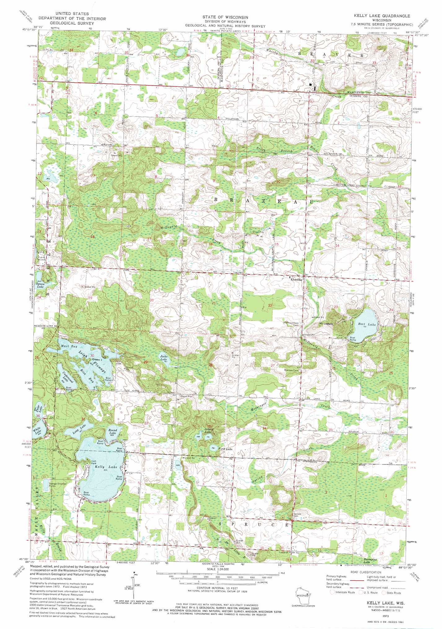
Kelly Lake Topo Map Wisconsin
To zoom in, hover over the map of Kelly Lake
USGS Topo Quad 45088a2 - 1:24,000 scale
| Topo Map Name: | Kelly Lake |
| USGS Topo Quad ID: | 45088a2 |
| Print Size: | ca. 21 1/4" wide x 27" high |
| Southeast Coordinates: | 45° N latitude / 88.125° W longitude |
| Map Center Coordinates: | 45.0625° N latitude / 88.1875° W longitude |
| U.S. State: | WI |
| Filename: | o45088a2.jpg |
| Download Map JPG Image: | Kelly Lake topo map 1:24,000 scale |
| Map Type: | Topographic |
| Topo Series: | 7.5´ |
| Map Scale: | 1:24,000 |
| Source of Map Images: | United States Geological Survey (USGS) |
| Alternate Map Versions: |
Kelly Lake WI 1973, updated 1977 Download PDF Buy paper map Kelly Lake WI 2010 Download PDF Buy paper map Kelly Lake WI 2013 Download PDF Buy paper map Kelly Lake WI 2015 Download PDF Buy paper map |
1:24,000 Topo Quads surrounding Kelly Lake
Wheeler Lake |
Thunder Mountain |
High Falls Reservoir |
Mount Tom |
Wausaukee South |
Mountain |
Shay Lake |
White Potato Lake |
Crivitz |
Loomis |
Breed |
Hickory Corners |
Kelly Lake |
Coleman |
Porterfiled Sw |
Berry Lake |
Gillett |
Oconto Falls North |
Lena |
Oconto West |
Cecil |
Krakow |
Oconto Falls South |
Abrams |
Pensaukee |
> Back to 45088a1 at 1:100,000 scale
> Back to 45088a1 at 1:250,000 scale
> Back to U.S. Topo Maps home
Kelly Lake topo map: Gazetteer
Kelly Lake: Airports
Buds Landing Airport elevation 259m 849′Frievalt Airport elevation 255m 836′
Funk Field elevation 253m 830′
Tachick Field elevation 260m 853′
Kelly Lake: Bays
Marl Bay elevation 253m 830′Rice Bay elevation 253m 830′
Kelly Lake: Dams
Kelly Lake Waterways 2WP 168 Dam elevation 257m 843′Kelly Lake: Islands
Green Island elevation 255m 836′Kelly Lake: Lakes
First Lake elevation 240m 787′Jocko Lake elevation 232m 761′
Kelly Lake elevation 251m 823′
Leigh Flowage elevation 253m 830′
Long Lake elevation 252m 826′
Pecor Lake elevation 254m 833′
Rost Lake elevation 241m 790′
Round Lake elevation 252m 826′
Second Lake elevation 243m 797′
Squaw Lake elevation 259m 849′
Underwood Lake elevation 254m 833′
White Lake elevation 254m 833′
Kelly Lake: Parks
Holt Park elevation 256m 839′Kelly Lake: Populated Places
Klondike elevation 241m 790′Kelly Lake: Reservoirs
Leigh Flowage 10 elevation 257m 843′Kelly Lake: Streams
Spring Creek elevation 221m 725′Kelly Lake: Summits
Mount LeBett elevation 296m 971′Kelly Lake digital topo map on disk
Buy this Kelly Lake topo map showing relief, roads, GPS coordinates and other geographical features, as a high-resolution digital map file on DVD: