Philip Se Topo Map South Dakota
To zoom in, hover over the map of Philip Se
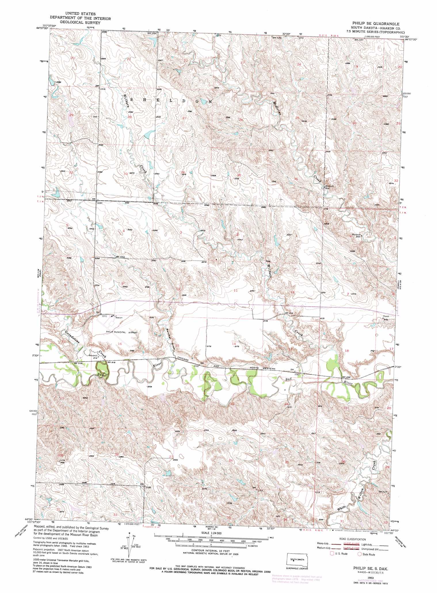
USGS Topo Quad 44101a5 - 1:24,000 scale
| Topo Map Name: | Philip Se |
| USGS Topo Quad ID: | 44101a5 |
| Print Size: | ca. 21 1/4" wide x 27" high |
| Southeast Coordinates: | 44° N latitude / 101.5° W longitude |
| Map Center Coordinates: | 44.0625° N latitude / 101.5625° W longitude |
| U.S. State: | SD |
| Filename: | o44101a5.jpg |
| Download Map JPG Image: | Philip Se topo map 1:24,000 scale |
| Map Type: | Topographic |
| Topo Series: | 7.5´ |
| Map Scale: | 1:24,000 |
| Source of Map Images: | United States Geological Survey (USGS) |
| Alternate Map Versions: |
Philip SE SD 1953, updated 1955 Download PDF Buy paper map Philip SE SD 1953, updated 1980 Download PDF Buy paper map Philip SE SD 2012 Download PDF Buy paper map Philip SE SD 2015 Download PDF Buy paper map |
1:24,000 Topo Quads surrounding Philip Se
Hilland |
Elbon |
Tornado Ranch |
Mule Creek |
Pheba 2 Se |
Grindstone Butte |
Elevenmile Corner |
Lucerne |
Powell Nw |
Ottumwa |
Bowen Ranch |
Philip |
Philip Se |
Powell |
Nowlin |
Cottonwood Ne |
Philip Junction |
Kadoka Ne |
Belvidere Nw |
Belvidere Ne |
Cottonwood Se |
Weta |
Kadoka |
Belvidere Sw |
Belvidere |
> Back to 44101a1 at 1:100,000 scale
> Back to 44100a1 at 1:250,000 scale
> Back to U.S. Topo Maps home
Philip Se topo map: Gazetteer
Philip Se: Airports
Philip Municipal Airport elevation 670m 2198′Philip Se: Streams
Grindstone Creek elevation 640m 2099′Wilburn Creek elevation 625m 2050′
Philip Se: Valleys
Belcher Draw elevation 641m 2103′Philip Se digital topo map on disk
Buy this Philip Se topo map showing relief, roads, GPS coordinates and other geographical features, as a high-resolution digital map file on DVD:
Eastern North Dakota & Eastern South Dakota
Buy digital topo maps: Eastern North Dakota & Eastern South Dakota