Powell Topo Map South Dakota
To zoom in, hover over the map of Powell
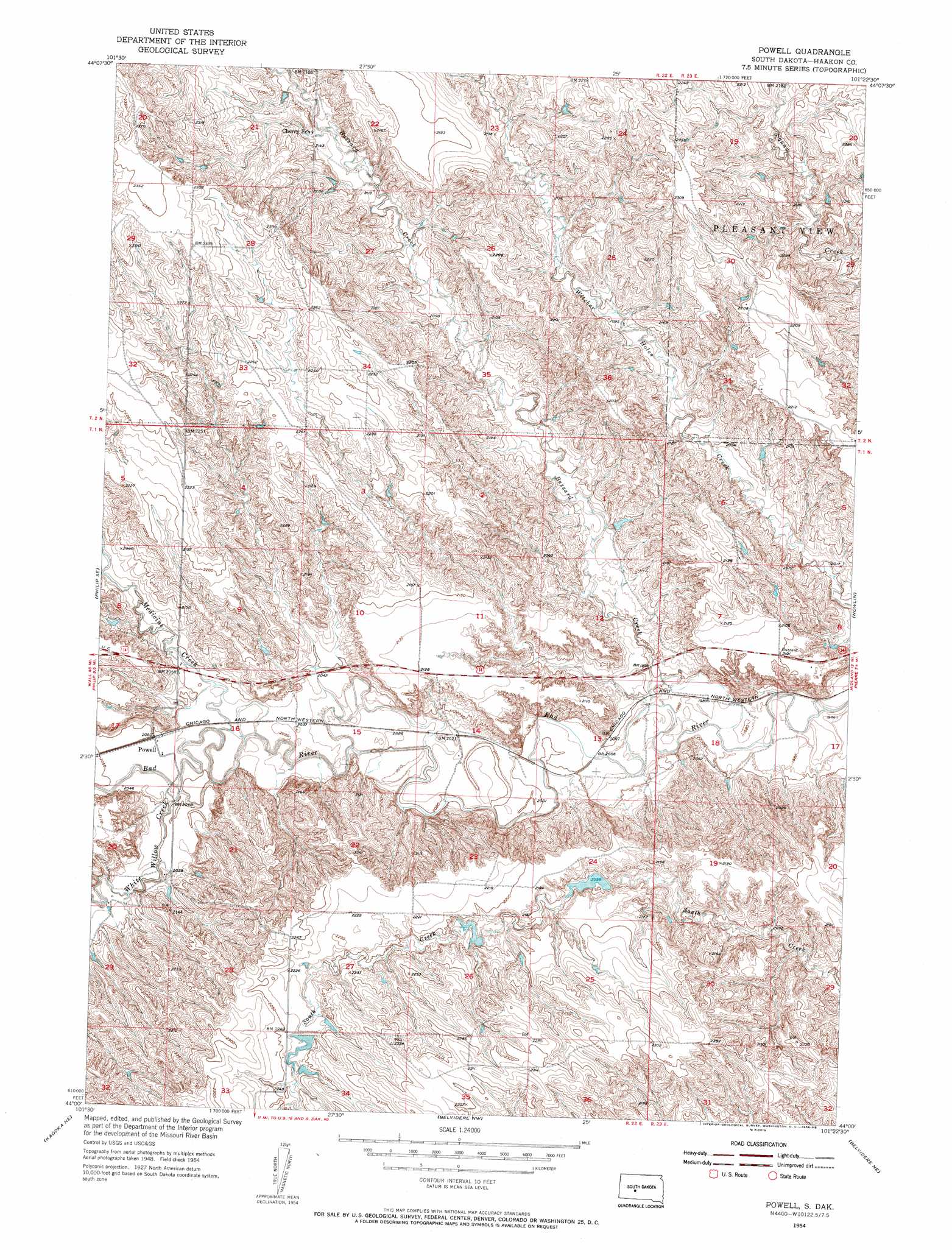
USGS Topo Quad 44101a4 - 1:24,000 scale
| Topo Map Name: | Powell |
| USGS Topo Quad ID: | 44101a4 |
| Print Size: | ca. 21 1/4" wide x 27" high |
| Southeast Coordinates: | 44° N latitude / 101.375° W longitude |
| Map Center Coordinates: | 44.0625° N latitude / 101.4375° W longitude |
| U.S. State: | SD |
| Filename: | o44101a4.jpg |
| Download Map JPG Image: | Powell topo map 1:24,000 scale |
| Map Type: | Topographic |
| Topo Series: | 7.5´ |
| Map Scale: | 1:24,000 |
| Source of Map Images: | United States Geological Survey (USGS) |
| Alternate Map Versions: |
Powell SD 1954, updated 1956 Download PDF Buy paper map Powell SD 2012 Download PDF Buy paper map Powell SD 2015 Download PDF Buy paper map |
1:24,000 Topo Quads surrounding Powell
Elbon |
Tornado Ranch |
Mule Creek |
Pheba 2 Se |
May Ranch |
Elevenmile Corner |
Lucerne |
Powell Nw |
Ottumwa |
Midland Nw |
Philip |
Philip Se |
Powell |
Nowlin |
Midland |
Philip Junction |
Kadoka Ne |
Belvidere Nw |
Belvidere Ne |
Stamford Nw |
Weta |
Kadoka |
Belvidere Sw |
Belvidere |
Stamford Sw |
> Back to 44101a1 at 1:100,000 scale
> Back to 44100a1 at 1:250,000 scale
> Back to U.S. Topo Maps home
Powell topo map: Gazetteer
Powell: Populated Places
Powell elevation 625m 2050′Powell: Streams
Buzzard Creek elevation 604m 1981′Medicine Creek elevation 621m 2037′
White Willow Creek elevation 623m 2043′
Powell digital topo map on disk
Buy this Powell topo map showing relief, roads, GPS coordinates and other geographical features, as a high-resolution digital map file on DVD:
Eastern North Dakota & Eastern South Dakota
Buy digital topo maps: Eastern North Dakota & Eastern South Dakota