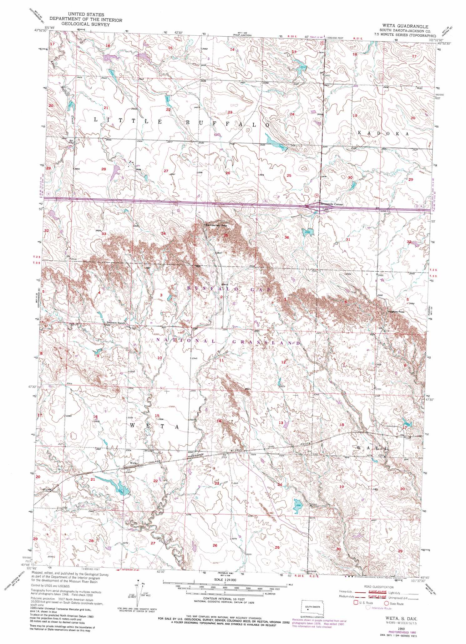
Weta Topo Map South Dakota
To zoom in, hover over the map of Weta
USGS Topo Quad 43101g6 - 1:24,000 scale
| Topo Map Name: | Weta |
| USGS Topo Quad ID: | 43101g6 |
| Print Size: | ca. 21 1/4" wide x 27" high |
| Southeast Coordinates: | 43.75° N latitude / 101.625° W longitude |
| Map Center Coordinates: | 43.8125° N latitude / 101.6875° W longitude |
| U.S. State: | SD |
| Filename: | o43101g6.jpg |
| Download Map JPG Image: | Weta topo map 1:24,000 scale |
| Map Type: | Topographic |
| Topo Series: | 7.5´ |
| Map Scale: | 1:24,000 |
| Source of Map Images: | United States Geological Survey (USGS) |
| Alternate Map Versions: |
Weta SD 1950, updated 1952 Download PDF Buy paper map Weta SD 1950, updated 1980 Download PDF Buy paper map Weta SD 2012 Download PDF Buy paper map Weta SD 2015 Download PDF Buy paper map |
| FStopo: | US Forest Service topo Weta is available: Download FStopo PDF Download FStopo TIF |
1:24,000 Topo Quads surrounding Weta
Grindstone Sw |
Bowen Ranch |
Philip |
Philip Se |
Powell |
Cottonwood |
Cottonwood Ne |
Philip Junction |
Kadoka Ne |
Belvidere Nw |
Cottonwood Sw |
Cottonwood Se |
Weta |
Kadoka |
Belvidere Sw |
Interior |
School Section Butte |
Wanblee Nw |
Wanblee Ne |
Pass Creek Nw |
Potato Creek |
Interior Se |
Wanblee |
Broken Leg Dam |
> Back to 43101e1 at 1:100,000 scale
> Back to 43100a1 at 1:250,000 scale
> Back to U.S. Topo Maps home
Weta topo map: Gazetteer
Weta: Dams
Boocke Number 2 Dam elevation 765m 2509′Dave Peterson Number 3 Dam elevation 747m 2450′
Dave Peterson Number 4 Dam elevation 756m 2480′
Pat Stout Number 1 Dam elevation 741m 2431′
Roy Stout Number 1 Dam elevation 738m 2421′
Roy Stout Number 2 Dam elevation 744m 2440′
Weller Number 1 Dam elevation 735m 2411′
Weta: Gaps
Chamberlain Pass elevation 758m 2486′Hughes Pass elevation 749m 2457′
Weta: Populated Places
Sevenmile Corner elevation 758m 2486′Weta elevation 702m 2303′
Weta: Reservoirs
Boocke Reservoir elevation 765m 2509′Weta digital topo map on disk
Buy this Weta topo map showing relief, roads, GPS coordinates and other geographical features, as a high-resolution digital map file on DVD:
Eastern North Dakota & Eastern South Dakota
Buy digital topo maps: Eastern North Dakota & Eastern South Dakota