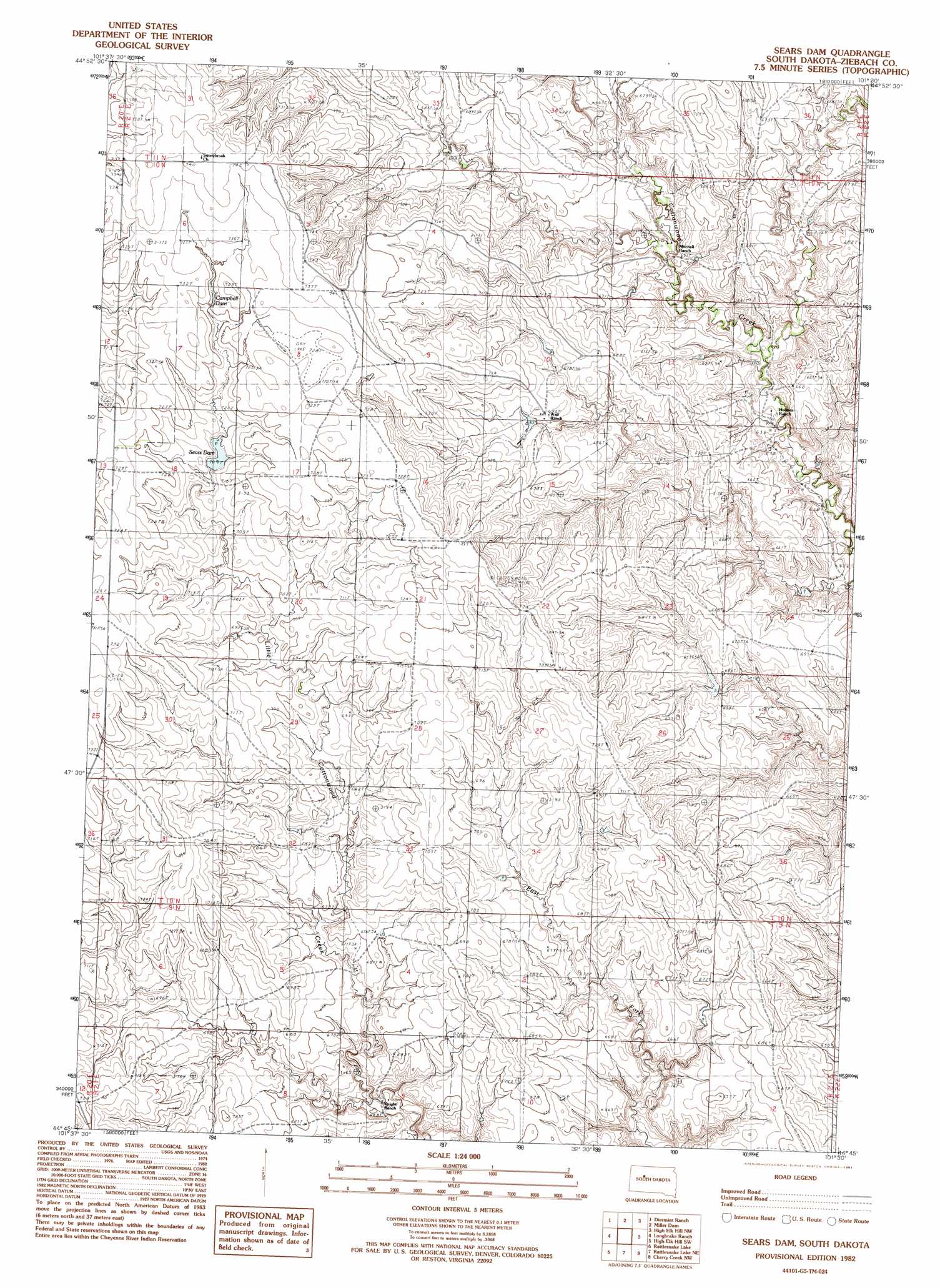
Sears Dam Topo Map South Dakota
To zoom in, hover over the map of Sears Dam
USGS Topo Quad 44101g5 - 1:24,000 scale
| Topo Map Name: | Sears Dam |
| USGS Topo Quad ID: | 44101g5 |
| Print Size: | ca. 21 1/4" wide x 27" high |
| Southeast Coordinates: | 44.75° N latitude / 101.5° W longitude |
| Map Center Coordinates: | 44.8125° N latitude / 101.5625° W longitude |
| U.S. State: | SD |
| Filename: | o44101g5.jpg |
| Download Map JPG Image: | Sears Dam topo map 1:24,000 scale |
| Map Type: | Topographic |
| Topo Series: | 7.5´ |
| Map Scale: | 1:24,000 |
| Source of Map Images: | United States Geological Survey (USGS) |
| Alternate Map Versions: |
Sears Dam SD 1982, updated 1983 Download PDF Buy paper map Sears Dam SD 2012 Download PDF Buy paper map Sears Dam SD 2015 Download PDF Buy paper map |
1:24,000 Topo Quads surrounding Sears Dam
Red Elm |
Dupree |
Lantry |
Lantry Se |
|
Bull Creek 2 Ne |
Diermier Ranch |
Miller Dam |
High Elk Hill Nw |
High Elk Hill |
Red Scaffold |
Longbrake Ranch |
Sears Dam |
High Elk Hill Sw |
High Elk Hill Se |
Bridger Ne |
Rattlesnake Lake |
Rattlesnake Lake Ne |
Cherry Creek Nw |
Carlin Flat |
Bridger Se |
Rattlesnake Lake Sw |
Rattlesnake Lake Se |
Cherry Creek |
Kirley |
> Back to 44101e1 at 1:100,000 scale
> Back to 44100a1 at 1:250,000 scale
> Back to U.S. Topo Maps home
Sears Dam topo map: Gazetteer
Sears Dam: Dams
C Bennett Dam elevation 689m 2260′R Fields Number 4 Dam elevation 710m 2329′
R Fields Number 5 Dam elevation 726m 2381′
W Holmes Number 1 Dam elevation 663m 2175′
W Holmes Number 2 Dam elevation 627m 2057′
Sears Dam: Reservoirs
Campbell Dam elevation 726m 2381′Sears Dam elevation 710m 2329′
Sears Dam digital topo map on disk
Buy this Sears Dam topo map showing relief, roads, GPS coordinates and other geographical features, as a high-resolution digital map file on DVD:
Eastern North Dakota & Eastern South Dakota
Buy digital topo maps: Eastern North Dakota & Eastern South Dakota