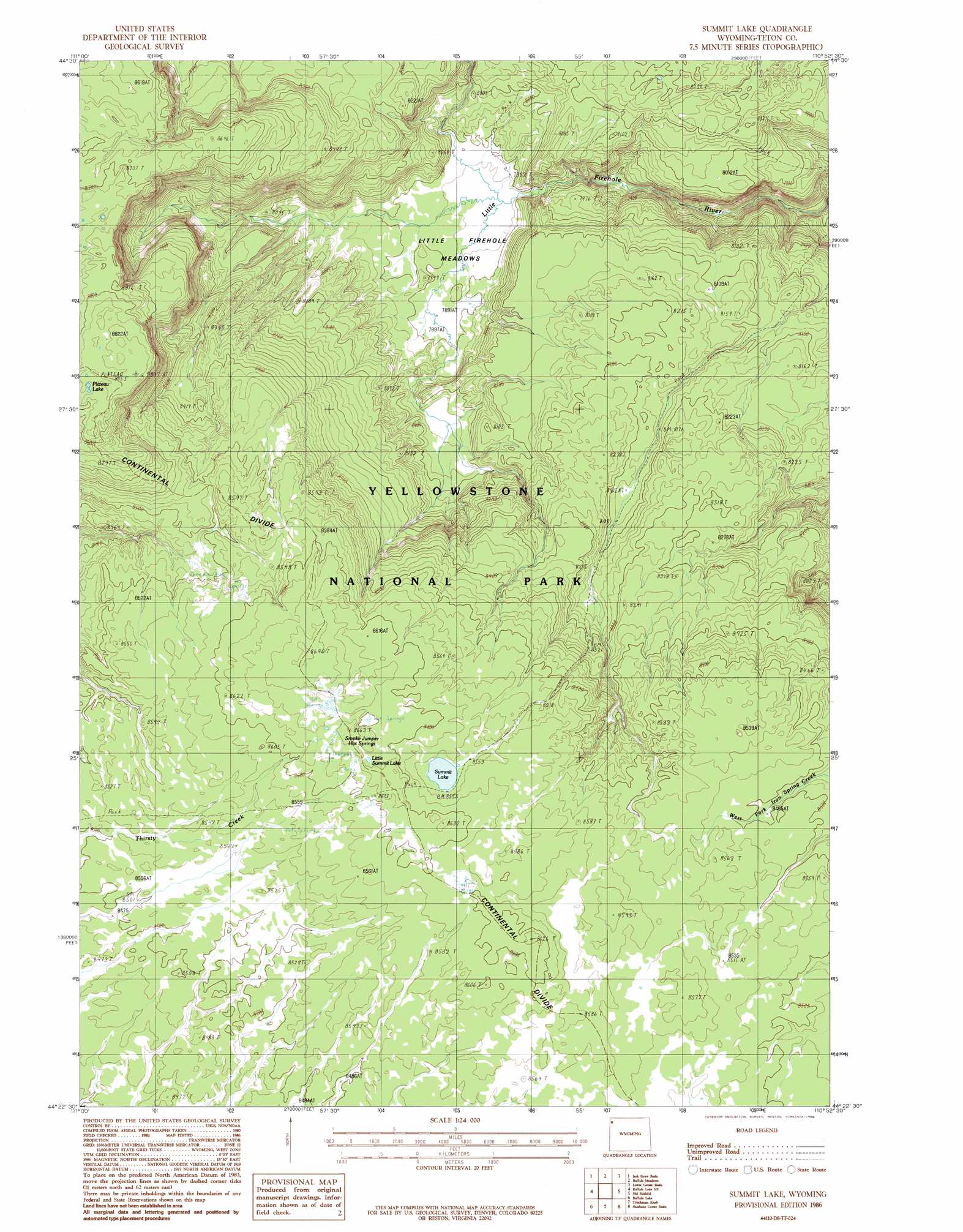
Summit Lake Topo Map Wyoming
To zoom in, hover over the map of Summit Lake
USGS Topo Quad 44110d8 - 1:24,000 scale
| Topo Map Name: | Summit Lake |
| USGS Topo Quad ID: | 44110d8 |
| Print Size: | ca. 21 1/4" wide x 27" high |
| Southeast Coordinates: | 44.375° N latitude / 110.875° W longitude |
| Map Center Coordinates: | 44.4375° N latitude / 110.9375° W longitude |
| U.S. State: | WY |
| Filename: | o44110d8.jpg |
| Download Map JPG Image: | Summit Lake topo map 1:24,000 scale |
| Map Type: | Topographic |
| Topo Series: | 7.5´ |
| Map Scale: | 1:24,000 |
| Source of Map Images: | United States Geological Survey (USGS) |
| Alternate Map Versions: |
Summit Lake WY 1986, updated 1986 Download PDF Buy paper map Summit Lake WY 2012 Download PDF Buy paper map Summit Lake WY 2015 Download PDF Buy paper map |
1:24,000 Topo Quads surrounding Summit Lake
Madison Arm |
West Yellowstone |
Mount Jackson |
Madison Junction |
Norris Junction |
Reas Pass |
Jack Straw Basin |
Buffalo Meadows |
Lower Geyser Basin |
Mary Lake |
Latham Spring |
Buffalo Lake Ne |
Summit Lake |
Old Faithful |
Craig Pass |
Big Grassy |
Buffalo Lake |
Trischman Knob |
Shoshone Geyser Basin |
Lewis Falls |
Warm River Butte |
Bechler Falls |
Cave Falls |
Grassy Lake Reservoir |
Lewis Canyon |
> Back to 44110a1 at 1:100,000 scale
> Back to 44110a1 at 1:250,000 scale
> Back to U.S. Topo Maps home
Summit Lake topo map: Gazetteer
Summit Lake: Flats
Little Firehole Meadows elevation 2418m 7933′Summit Lake: Lakes
Little Summit Lake elevation 2628m 8622′Plateau Lake elevation 2690m 8825′
Summit Lake elevation 2606m 8549′
Summit Lake: Springs
Smoke Jumper Hot Springs elevation 2629m 8625′Summit Lake Hot Springs elevation 2619m 8592′
Summit Lake: Trails
Summit Lake Trail elevation 2494m 8182′Summit Lake digital topo map on disk
Buy this Summit Lake topo map showing relief, roads, GPS coordinates and other geographical features, as a high-resolution digital map file on DVD: